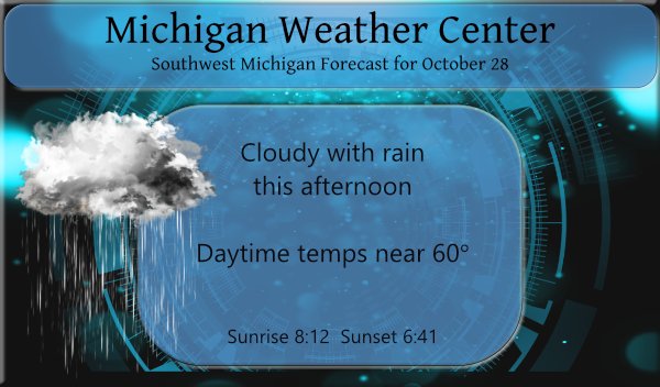
After a couple of days of sunny dry weather, the rain will move back in later today. I am not seeing the two-inch totals we saw on Monday, perhaps a quarter to half-inch will fall from this system.
Yesterday we had a high temp of 52° and the low was 29.7°.
I am not sure I am going to stick my neck out on a winter forecast this year except to say we may actually have a winter this year, I guess we will see. Most of the snow is contained at and north of the 60th parallel (N) today with the exception of the mountains out west.
Forecast Discussion
- Wet pattern arrives later this afternoon and lasts through Friday

The large area of low pressure centered in Southwest MO is forecast
to slow down as it tracks up the OH Valley.  The moisture gradually
deepens through the day today with the DGZ moistening up this
afternoon.  By the late afternoon into the evening hours the rain
will be arriving from the southwest as the column completely
saturates.  This system does not pull away til Friday night so we
will feature rain until then.  The rain will be of varying intensity
and could stop at times because the DGZ will not be saturated the
whole time.  The northern zones will be furthest away from this
system.  Thus places like Harrison and Ludington will see the least
amount of rainfall. The models are generally on the same page with
this scenario.  QPF output from the models generally supports a
half inch or less for the region...but there is some spread amongst
the models.  We still believe the Jackson area will see the most
given its proximity to the low and also some moisture feeding off of
Lake Erie into that region.

- Dry weather returns for the weekend

The atmosphere dries out this Saturday  as the storm system pulls
away and subsidence moves in.  We will be seeing some sun as well
especially Saturday.  A cold front moves in from the northwest
on Sunday.  At this time this front looks disorganized and it is
likely to be a dry frontal passage.  It does open the door for
the onset of a cooling pattern as the winds shift to the northwest
behind this feature by Sunday evening.

- Cooling down next week with a risk for mixed precipitation

Models are showing a deepening low over Ontario and Quebec Monday
into Tuesday.  While the low level low is shown to be in Quebec,
the upper level part of this system will be over Ontario.  This will
act to keep the cold air funneling down into the Great Lakes Region
through much of the week.  It does look like we will be seeing some
lake effect precipitation at times...especially as we go through mid
week.  Surface temperatures are likely to be above freezing for
much of the period so any impacts look limited at this time.
A mid to upper level wave will likely be crossing from CA into
the Central/Southern Plains for early to mid week.  It remains to be
seen how strong/weak this system will be as models have a lot of
spread with this system, including the timing. It will need to be
monitored closely as it will have the potential to tap some Gulf
moisture and arctic air sinking south out of the Canadian
Prairies.
Grass mowed today. It was really nice out. I am hoping the leaves fall off the trees before the snow comes. Hoping to go for a ride to see the Fall colors this weekend.
Cut the grass it now looks great! Nice and green. And as I have stated before most of the leaves are still on the trees. There are some falling today but no where near where we should be for this late in October. It is now 62 here and there is some sun.
Slim
Beautiful day today. Almost don’t even need a jacket. Ground is still soggy but I can’t put off mowing any longer. Starting to look like a hay field.
Yup. Suns been out here, very mild 60 degrees, and heading out to mow yet again. We are heading into a green November this year.
What? More rain? How could it be? The wet Fall keeps rocking and rolling!
Shhhhh some cant handle that lol…get the umbrella ready …InDY
Winter?…cold, windy, ice, snow. Same thing, every year :/
Sounds great!
Big time cold front coming Sunday we may have high temperatures 10 15 degres below normal next week get the wimter gear out here comes Winter wooo wooo ….InDY …
After 6 nights in the row with lows no warmer than 41 and most nights in the low to mid 30’s the overnight low here was a milder 50 the official overnight low looks to have been 49 at GRR. There was a period of drizzle/mist here last night. At this time it is cloudy and 51 here. The mean for October is now down to 57.9 that is still a departure of +5.7.
Slim