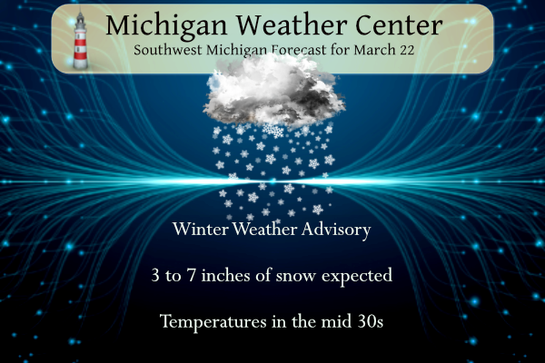
...WINTER WEATHER ADVISORY REMAINS IN EFFECT UNTIL MIDNIGHT EDT
TONIGHT...

* WHAT...Snow expected. Total snow accumulations of 3 to 7
  inches.

* WHERE...Portions of central, south central, southwest and west
  central Michigan.

* WHEN...Until midnight EDT tonight.

Occasional snow is expected today that will lead to travel impacts. The snow will be heavy at times. The snow will taper off early this evening. A swath of 4 or more inches is looking likely in the Grand Rapids to Alma region.
NWS Forecast
Weather History
1938: Temperatures soar into the 80s during one of the warmest March days in Lower Michigan. Grand Rapids ties their record high for the month at 82 degrees and Lansing sets a record for the date of 81 degrees.
On March 22, 2012, an unprecedented spring heatwave, and quite possibly the most anomalous weather event in over 130 years of record-keeping in Michigan, came to a close. The high temperature of 86 was the warmest March temperature ever in Detroit, beating by two degrees the record of 84 degrees set the day before. Highs of 84 and 75 in Flint and Saginaw fell short of the all-time March records set the day before. However, the 84-degree high in Flint still tied for the second warmest March temperature on record (Flint also reached 84 degrees on March 20, 2012, and March 22, 1938).
Altogether, SE Michigan shattered all significant records for March warmth. Detroit set 6 records in 8 days, including tying or breaking the monthly record twice. Flint set 8 records in 9 days, including tying or breaking the monthly record three times. Saginaw set 6 records in 8 days, which also included tying or breaking the monthly record two times.
The heat wave also included 10 consecutive days (March 14-23) of 70 degrees or higher in Detroit. This has never happened in March. In fact, it has never even happened in April. The closest competition is a span of 9 days late in the month of April over 125 years ago, in 1886.
Also on March 22, 1938, the daytime temperature soared to 82 degrees in Saginaw county, which ties for the third-highest maximum temperature recorded in Saginaw in the month of March.
1888: Chicago’s morning low dips to one degree below zero, the latest sub-zero Fahrenheit reading in the city’s history. This record still stands today.
1893: The first tornado was recorded in Oklahoma City, Oklahoma, on this date. It destroyed 14 buildings and injured four people as it passed through the center of town. There was minor damage to the Weather Bureau office, which was located at Grand and Robinson in south Oklahoma City.
1920: A spectacular display of the “Northern Lights” was visible as far south as Bradenton FL, El Paso, TX and Fresno, CA. At Detroit MI, the display was described “so brilliant as to blot out all-stars below the first magnitude.”
Forecast Discussion
- Snow Today and Tonight

 Bottom line upfront: We have expanded the Winter Weather Advisory
to include all of our forecast area. The counties along the I-94
corridor have been included due to the snow amounts and impacts
for the morning commute. The advisory for those counties will end
by 2 PM. Have adjusted snow amounts based on the track of the
incoming precipitation and on the latest CAMS. The trend of the a
more southern shift of the snow bands continues. This is reflected
in less snow expected along the US 10 corridor and the inclusion
of the I 94 corridor in the advisory.

 The event is coming into focus though some questions on amount
and timing remain. The overnight radar showed that as this snow
system moved through Minnesota, Iowa and Wisconsin it had
continued lightning strikes overnight. Latest CAMS seem to be
accounting for this with the increased instability should allow
for stronger southern snow bands. Latest obs have shown reductions
in visibility near South Haven and Holland airport to drop below
a mile. Temperatures have dropped to below freezing and this
should continue through sunrise. Temperatures should warm as the
day continues, especially through Southern Michigan given the Warm
air a lot that is feeding the isentropic lift of this system.
However, temperatures should hover right around freezing. So with
reduced visibility and snow falling on roadways give yourself
extra time as the morning commute could become hazardous.

 There remains some questions on the intensity of this system
along the I-94 corridor. The impacts will be relatively brief
especially as temperatures will be marginal this afternoon.
However, given the instability, the moisture through the
dendritic growth zone and the potential for strong snow rates this
morning, there is a high probability for impacts through the
morning commute. As the initial bands move eastward these impacts
will wain so the advisory for the I-94 corridor will end by 2 PM.
However, for the north the boundary due to the "warm" air
advection will allow for persistent, and at time intense snow
showers to continue through the afternoon and evening and should
effect the evening commute as well as the commute this morning.
Highest snowfall amounts should be along and just to the north of
the I-96 corridor and east of the US 131. While there will be
snowfall this morning, the highest rates and snow amounts for that
area will be this afternoon into the early evening. Areas north
of the line from Muskegon to Alma will receive snow, however due
to the shift of the boundary there will be less of a dendritic
growth zone, so amounts will be reduced. Snow should linger into
this evening but will slowly taper off late Friday evening into
early Saturday morning. Temperatures will rebound slightly but
highs will remain in the low to mid 30s with a blustery north wind
continuing through Saturday.


- Very Cold Saturday Night

High pressure will be centered over Lower MI Saturday night.  With
mainly clear skies and cold temperatures to start the night along
with snow on the ground, good radiational cooling is expected.
Temperatures will likely fall quickly after sunset with teens
looking likely for much of the area by midnight. However models are
starting to show an area of mid level clouds moving in after
midnight.  This is expected to keep the temperatures from falling
lower than the teens.  Ensemble temperature plots show a slight
trend upward, but min temperature values are likely to end up in the
teens.


- Warming up with Showers Monday Night into Tuesday, Windy

Warm and moist air advection strengthens Monday into Monday night.
PWAT values climb to above normal levels, and approach an inch in
southern counties.  A coupled upper jet arrives later Monday night
into Tuesday.  This will support deeper lift leading to numerous
showers. LI`s at 850 mb do make a run towards negative values Monday
night.  This supports an increased risk for a few storms.  I will
not add it to the forecast at this time, as the potential is still
low. Ensemble mean rainfall amounts from the models suggest a half
inch is likely to occur for most locations.  Also, there has been a
trend toward a later arrival of the deeper moisture and lift in the
models so Tuesday may end up being the wettest period.

As for temperatures, good agreement amongst the models for max
temperatures to reach 50 degrees in the GRR area.  Ensemble mean
temperatures support these values.  925 mb temps are progged to
approach 10 deg C.  With slight mixing, we should easily reach the
50 degree mark.   Normals for this time of the year are in the upper
40`s.

A 50 knot low level jet moves in later Monday into Monday night. The
will support increasing winds.  Ensemble gust values from the GFS
and ECMWF show values topping 30 knots for GRR.  If deeper mixing
occurs, we could go even higher.  Thus conditions are likely to
become windy.
What a storm! Incredible snowfall totals for late March! I have a question – is winter weather done yet? Get ready for lows in the teens tonight! Incredible!
Freeways starting to slicken up now that the sun is setting here in Ionia County including Interstate 96. Drive carefully out there!
Hey Rocky, what a snow event!
The RDB gets another bingo. Incredible!
This was a great late March snowstorm! Tomorrow should be e great day to get outside and play in the snow! Maybe winter is not over? Who would have thought?
Definitely picked up more snow than I was expecting. Much of the accumulation actually happened this afternoon… still need to go out and measure
So far the official snowfall at the airport is 5.5 inches and counting! The RDB model had another bullseye! The most accurate model on the market does it again!! WOW!
6.5 inches on my deck out at thee yardofbricks ne GR!! Get the snow shovel out let’s go!! INDY
Snow shovel? I have already used my snowblower today! It was AWESOME baby! Possible skiing or snowshoeing tomorrow! What a storm!
Yesterday was another double digit below normal temp day and now a 6 inch snowstorm! Is winter weather done yet?
I am in the yellow bullseye forecasted. I just measured a tad over 5”. But it’s 31f and some appears to be melting, so I suspect more had fallen than that. I am happy this cooler weather has dampened the budding flowers on my fruit trees. Hopefully the pattern holds.
I would guess that received at least 6 inches of snow! Enjoy!
What a storm and it just keeps coming and coming! Rock n roll baby! Is winter weather over yet? Just thought I would check! WOW!!!!
Still getting moderate snowfall and now here in MBY I am now at just under 5″ of snow on the ground.
Slim
Wow!
We have picked up 4.5 inches of snow so far and it still pilling up!
Just took a snowfall measurement and while I don’t know how much has fallen there is now 3″ of snow on my snow board. That is the most snowfall since February 15th depending on the snowfall totals this could be the 2nd most snow for this winter season. Getting light to moderate snowfall at this time.
Slim
Wow! The snow is really starting to pile up! Incredible storm!
WINTER STORM ALERT! The RDB model gives the GGR area 5 to 8 inches of SNOW! Rock n roll will never die! Just think, the warm weather fanatics declared winter weather was over weeks and months ago! What a joke! They have lost all credibility! Who wouldn’t want a major snowstorm in March?
Breaking winter weather alert >>>>>>What a storm! A major snowstorm In late March. Get outside and enjoy winter! I will be using my snowblower later! Already about 2 inches and piling up very fast! WOW! WOW! WOW! WOWEEEEEEE!!!!!!!!!!
It’s our first accumulating snow in 36 days. Local mets said we could get three or so inches here, but you don’t need to go very far to the north for significantly more snow. Will I dust off the shovel for just the 3rd time this winter? Probably not. The snow won’t stick around for very long.
Here in MBY there is now 1” of snow on the ground. This is the 1st time there has been one inch or more on the ground here since February 20th The overnight low in MBY was 25 and at the current time it is 27 with light snow falling.
Slim
The official H/L yesterday at Grand Rapids was 35/29 there was no rain or snowfall. The sun was out 60% of the possible time. For today the average H/L is 47/29 the record high of 85 was set in 2012 and the record low of 6 was set in 1906. The wettest was in 1955 with 0.79” that fell as 4.1” of snow. The most snowfall of 6.3” fell in 1965 and the most snow on the ground was in 1965 with 11” Last year the H/L was 49/40 and there was 0.04” of rain fall.
Slim