While yesterday was a record snowfall for Grand Rapids it more likely than not will not be remember by most people. That was not the case on St Patrick’s day 1973 in the Bay City area.
Every now and then there is a storm that stays burned into your mind and you can remember the day and events for the rest of your life. For many here in the NW area of Grand Rapids it might be the May 1998 derecho (it’s one of mine) some of my other lifetime weather events are September 1st 1960 derecho in Bay City. The blizzards of 1967 and 1978 the 1976 ice storm and.
THE BLIZZARD AND FLOOD OF 1973. The March 17th storm started in the pre-dawn hours of March of 17th That March saw March have some very nice and mild late winter early spring weather with days in the 50’s and 60’s So when the storm started there was no snow on the ground and the water in Saginaw Bay was ice free.
My wife who I was dating at the time lived on Killarney Beach Road and I lived in the city of Bay City at that time. We went out of the night of the 16th and I took her home around 1 AM and it was not snowing at that time but it was windy with a strong NE wind. I went home and went to bed. It was just getting light out when I was awoken by the sound of thunder and lightning (a lot of thunder and lightning) and the sound of the wind. I looked out the window and all you could see was snow. During that thunder snow, thunderstorm visibilities were less than two hundred feet at best. Around 9 am my current wife called me and said that they were evacuating people down the road closer to the bay. (Killarney Beach Road runs right along the bay and there are beach front houses out there) and that there was water coming in from the bay and the waves where crashing into the houses there. My wife lived in from the Bay about a half mile and closer to the Bay City State Park. And was told by the sheriff department that their house should be ok. She asked me if I thought I could make it over to her house at the time I did not know. I turned on the TV and the radio. And to my surprise the water was not only hitting the houses by the bay but the water was being pushed up the Saginaw river and there was flooding going on right in the city of Bay City. The water did not get to where I lived but the snow sure did. In fact, Bay City had over 22” of snow and drifts up to 4 feet. Here is a short story on the events and the front page of the Bay City Times.
http://www.mybaycity.com/scripts/p3_v2/P3V3-0200.cfm?P3_ArticleID=8917
The water did not get to where my wife was living at that time and while I was not able to get to her house that day the next day (Sunday) I was able to get close enough to walk to her house. There was snow and water everywhere! It was the only time in my lifetime when I seen a blizzard and flood at the same time. That storm was a big east side of the state storm with Saginaw getting 21.3” Jackson getting 19” Flint getting 13.7” Here in Grand Rapids that storm in 1973 only dropped 8.5” so while a big late season storm not the event places on the east side of the state got.
Here is a more on the storm in Jackson
http://www.mlive.com/news/jackson/index.ssf/2015/03/peek_through_time_who_remember.html
A new record snowfall record for the date was set yesterday at Grand Rapids with 6.5” There is now 6” of snow on the ground. At some point there was a reported 1% of sunshine. For today the record H/L is 48/29 the record high of 74 was set in 1907 and 2021 the record low of 4 was set in 1983. The most snowfall of 8.4” fell in 1956 the wettest was in 1897 with 1.38” that fell as 4.0” of snow. The most snow on the ground was 14” in 1965. Last year the H/L was 48/36 and there was 0.04” of rainfall.
DISCUSSION
ISSUED AT 233 AM EDT SAT MAR 23 2024
– WINTER RETURNS FOR THE WEEKEND
IN THE WAKE OF THE WINTER STORM COLD NORTHERLY WINDS WILL CONTINUE
THROUGH MOST OF THE WEEKEND. LIGHT SNOW CONTINUES TO FALL EARLY
THIS MORNING AS A SECONDARY FRONT MOVES THROUGH THE REGION SPURRED
ON BY THE COLD NORTHERLY FLOW. HOWEVER, GIVEN THAT IT IS A VERY
COLD AIR MASS WITH LITTLE MOISTURE PRESENT, EXPECT ONLY FLURRIES.
OTHERWISE COLD AND DRY FLOW WILL CONTINUE TODAY INTO SUNDAY. WITH
850MB TEMPS OF -12 AND CLEARING SKIES EXPECT HIGHS TO STRUGGLE
MOVING INTO THE MID 30S AND OVERNIGHT LOWS INTO SUNDAY BEING IN
THE TEENS.
TEMPERATURES WILL REBOUND A LITTLE INTO SUNDAY WITH WARM AIR
ADVECTION THROUGHOUT THE DAY. AS A WEAK SYSTEM BUILDS INTO THE
AREA SUNDAY NIGHT THERE WILL BE A CHANCE FOR LIGHT SNOW WITH ONLY
LIGHT, IF ANY, ACCUMULATIONS EXPECTED MAINLY ALONG THE US 10
CORRIDOR.
– WARM, WINDY AND SHOWERY MONDAY INTO TUESDAY
A STRENGTHENING SOUTHERLY LOW LEVEL JET LIFTS UP INTO THE CWA MONDAY
INTO TUESDAY. THE ASSOCIATED WARM AIR ADVECTION WILL SUPPORT WELL
ABOVE NORMAL TEMPERATURES FOR THE REGION. ENSEMBLE 2M TEMPERATURES
PLOTS FROM THE MODELS SHOW VALUES REACHING INTO THE 50’S FOR BOTH
MONDAY AND TUESDAY. TRENDS SUGGEST SLIGHTLY WARMER TEMPERATURES FOR
MONDAY WITH INCREASING NUMBERS OF MEMBERS SHOWING VALUES MAKING A
RUN A 60 DEGREES FOR SOUTHERN PARTS OF THE CWA.
THE LOW LEVEL JET ALSO ADVECTS IN A VERY MOIST AIRMASS FROM THE
GULF. ENSEMBLE PWAT VALUES SUGGEST VALUES WILL TOP 0.80 INCHES
WHICH IS WELL ABOVE NORMAL FOR THIS TIME OF THE YEAR. MID LEVEL
HEIGHTS FALL HERE IN MI MONDAY NIGHT INTO TUESDAY AS A WAVE TRACKS
NORTH NORTHEASTWARD THROUGH THE PLAINS AND TAKES ON A NEGATIVE TILT
BY TUESDAY. THE ASSOCIATED SURFACE COLD FRONT PUSHES THROUGH MI ON
TUESDAY. THIS FEATURE WILL TAP INTO THE MOISTURE IN PLACE LEADING
TO WIDESPREAD SHOWERS. ENSEMBLE MEAN 24 HR QPF VALUES ARE STILL
RUNNING AROUND A HALF INCH, BUT THERE IS A DECENT AMOUNT OF SPREAD
AMONGST THE MEMBERS IN ALL THE MODELS. THUS WE WILL NEED TO MONITOR
TRENDS, HOWEVER HYDRO IMPACTS APPEAR UNLIKELY AT THIS TIME.
THAT LOW LEVEL JET WILL CAUSE THE SURFACE WINDS TO INCREASE
CONSIDERABLY ON MONDAY. ENSEMBLE GUST VALUES ARE SUPPORTING VALUES
REACHING INTO THE 30 MPH RANGE AND THE GFS IS SHOWING A RISK FOR 40
MPH GUSTS. WE ALREADY HAVE HIGHER GUSTS IN THE FORECAST AND WILL
MAINTAIN THOSE VALUES.
Detailed Forecast For Grand Rapids
Today
Mostly sunny, with a high near 36. North wind 6 to 10 mph.
Tonight
Partly cloudy, with a low around 19. North northwest wind around 6 mph becoming light and variable.
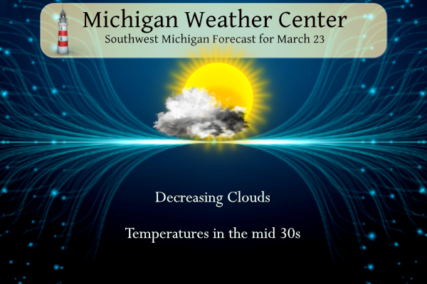
Sunday
Increasing clouds, with a high near 40. East southeast wind 7 to 13 mph.
Sunday Night
Cloudy, with a low around 31. Breezy, with an east southeast wind 15 to 20 mph, with gusts as high as 31 mph.
Monday
A 40 percent chance of showers, mainly after 2pm. Mostly cloudy, with a high near 58. Breezy, with a south southeast wind 18 to 20 mph, with gusts as high as 30 mph.
Monday Night
Showers, mainly after 2am. Low around 47. Breezy. Chance of precipitation is 90%.
Tuesday
Showers. High near 56. Breezy. Chance of precipitation is 90%.
Tuesday Night
Showers likely, mainly before 8pm. Mostly cloudy, with a low around 33.
Wednesday
Partly sunny, with a high near 40.
Wednesday Night
Partly cloudy, with a low around 28.
Thursday
Mostly sunny, with a high near 46.
Thursday Night
Partly cloudy, with a low around 31.
Friday
Partly sunny, with a high near 55.
The snowfall totals ended exactly as the RDB predicted! WOW!!
Let me describe the winter conditions and the scenery on the trails today! Great, Fantastic, Gorgeous, Spectacular, Unbelievable, Incredible, Breathtaking, Beautiful, Splendid, Heaven on Earth and Exhilarating! Plenty of snow in the woods to play in! Let’s squeeze out another snowstorm this season! ROCK n ROLL will never die!
I measured right around 6” last evening when the snow ended. Pretty good late March dumping of snow.
One other note – forget about golf this weekend and enjoy WINTER!!!!!!!!!!!!!!!!
It looks great outside! I am getting ready to go on an epic March snowshoe hike! Who would have thought! I love it and let’s see if we can squeeze out one more snowstorm, yet this season!!! Wouldn’t that be rocking!
Nice write up, Slim. I don’t believe I had heard of that storm. I can see why it was a memorable one for you and Mrs Slim.
That storm dropped 7.5″ at Grand Rapids, 8.0″ at Alpena, 8.4″ at Detroit, 12.6″ at Lansing, 12.6″ 21.6″ at Saginaw and just over 22″ at Bay City.
Slim
Impressive amounts! I was a wee lad – too young to remember that. 😃
What a great winter storm yesterday! Just think some said winter was over long ago! Delusional! Yesterday saw a RECORD daily snowfall total and we are now ABOVE Average for monthly SNOWFALL! Wow just wow, WOW!!!!