[columns] [span6]
[/span6][span6]
[/span6][/columns]
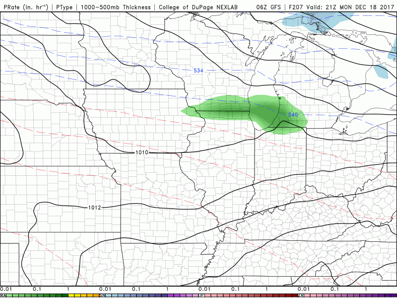
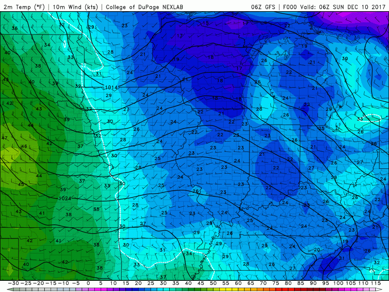
Above are the GFS models which show our temperatures bouncing all over the place from now through Christmas. The first is the precipitation model from the 19th to the 26th showing a mixed bag with the possibility of rain and snow through the period. The temperature map show the cooler air denoted in the blues and the greens and yellows warmer.
I think it will be hard to keep a cover of snow on the ground with the exception of the ski resorts who will have a large base made and areas from Gaylord to the north. We will be entering a period of the Arctic flow retreating and a zonal flow returning with the pattern going back and forth through the period.
The mean snow accumulation for SW Michigan from the various models I have been looking show around 13 inches through the 26th and the mean precipitation of about 1.5 inches – mean is the arithmetic average of a set of data (numbers), or the middle point between its two extremes.
So, our forecast will be quite a range of temperatures and precipitation, rain and snow. Will there be snow on the ground for Christmas? The models have been flopping back and forth so much over the past week it makes one want to scream in indignation being a MET and trying to decipher long rang forecasts. I am thinking maybe a couple inches may be on the ground Christmas – nothing major at this point, but, with all long range models this could change.
Today: Snow showers, mainly after 9am. High near 31. Southwest wind 9 to 13 mph. Chance of precipitation is 90%. Total daytime snow accumulation of less than one inch possible.
Tonight: A chance of snow showers before 1am, then a slight chance of flurries after 1am. Mostly cloudy, with a low around 23. Northwest wind 5 to 9 mph becoming light and variable after midnight. Chance of precipitation is 50%.
Monday: Snow showers. High near 31. South wind 6 to 11 mph. Chance of precipitation is 90%. New snow accumulation of around 2 inches.
Monday Night: Snow showers. Low around 23. West wind 6 to 11 mph becoming north northwest 12 to 17 mph after midnight. Winds could gust as high as 30 mph. Chance of precipitation is 80%. New snow accumulation of around 2 inches.
Tuesday: Snow showers likely, mainly after 1pm. Mostly cloudy, with a high near 23. Northwest wind around 16 mph, with gusts as high as 25 mph. Chance of precipitation is 60%. New snow accumulation of around an inch possible.
Tuesday Night: A 40 percent chance of snow showers, mainly before 1am. Mostly cloudy, with a low around 12.
Wednesday: A 30 percent chance of snow showers, mainly after 1pm. Mostly cloudy, with a high near 23.
Wednesday Night: Snow showers likely, mainly after 1am. Mostly cloudy, with a low around 15.
Thursday: A chance of snow showers. Mostly cloudy, with a high near 30.
Thursday Night: A chance of snow showers. Mostly cloudy, with a low around 21.
Friday: A chance of snow showers. Mostly cloudy, with a high near 31.
Friday Night: A chance of snow showers. Mostly cloudy, with a low around 25.
Saturday: Mostly cloudy, with a high near 39.
Snow should develop across the area by midday Monday bringing 1 to 3 inches by evening. The passage of an arctic front early Tuesday morning will result in a significant lake effect snow event near US-31. There will likely be blowing and drifting snow and wind chills across the area will be near zero.
Monday MOanin….Tune…..”I HEAR YA MOAN”!!!!
https://m.youtube.com/watch?v=30sZXy6Lho8
I’m OUTTA My Head on Monday….MOANIN…….
http://www.weather.gov/images/grr/10Dec2017%20Winter%20Weather%20Monday.png
Looking good!
http://www.weather.gov/images/erh/gis/LP_state_Snow.png
Is this total new snow that falls or total snow on the ground?
These maps show expected snowfall over a 2 or 2-1/2 day period!
Where do you find these maps at, Rocky? I have looked for them on the NOAA office pages, but can’t find them.
I don’t remember how I feel upon these maps however here is the link that you can save.
http://www.weather.gov/images/erh/gis/LP_state_Snow.png
try this:
http://www.weather.gov/images/erh/gis/LP_state_snow.png
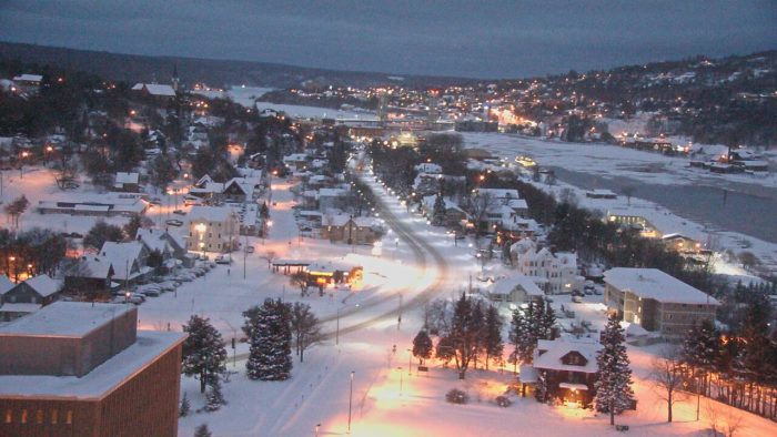
With all these dark gloomy days there is one bright spot. Starting yesterday, we are now gaining daylight at night! Friday was our earliest sunset of the year, so now it’s back to staying light a tad longer each day! Of course we continue to lose daylight in the morning till about the second week of January, but I much prefer extra light in the evening. Enjoy!
LIKE……. 🙂
Great news! I really don’t like that it gets dark out so early.
Do you know that the last time Grand Rapids officially reached 0° was way back on March 3rd 2015 and the last sub zero low was on February 28th 2015 so Grand Rapids has now gone two winters without reaching 0° or below. The coldest it officially got last winter was +2° on January 6th and the coldest in 2015/16 was +1 on February 16th 2016. The longest Grand Rapids has ever gone with out reaching 0° or below was 3 years in 1937, 1938 and 1939.
Slim
We are now have 9 days in the record books for December 2107. At this time Grand Rapids is +3.0° for the month (that will fall over the next week) The warmest it has been this month so far is 61° on the 4th and the coldest so far for the month is 19° on the 8th So far this month Grand Rapids has officially recorded 4.7” of snow fall (parts of the metro area have seen much more here at my house I am at 6.3” for the month) the biggest snow fall so far was the official 2.8”… Read more »
Chances of a white Christmas? Well in our area the chances are around 70% But in the last 7 years there have been 4 with out snow and 3 with snow.
Slim
Climatology for today December 10th At Grand Rapids, MI
The 30 year average H/L at Grand Rapids is 36/25°
The Record high is 62° and the recorded coldest maximum is 14° is 1995
The record low is +5 set in 1977 and the warmest minimum is 45° in 1911
The most precip 2.13” fell in 1971
The most snow 7.2” fell in 2009 and the most on the ground at 7 AM 9” in 1962 and 1958
Last year the H/L was 24/20 4.5” of snow fell and the there was 3” on the ground at 7 AM
Slim
My prediction for a white Christmas is nearly 100%! Count in it! We will be having a great winter for outdoor sports!
I’m skeptical. The ground is still warm and the snow is slowly melting from below. Several days in the upper 30s next week will unfortunately wither away at it. 🙁 This whole “Arctic blast” has been pretty unimpressive to me.
I’m Seeing Possible upper 50’s for Temps. Around Here Just A Few Days From Christmas….SO or HENCE You Could Be 100 percent WRONG Again. RDB….