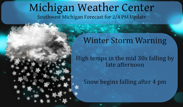
Here is our p.m. update – many areas have been upgraded to a winter storm warning (pink area):

...WINTER STORM WARNING REMAINS IN EFFECT FROM 4 PM THIS
AFTERNOON TO 7 PM EST FRIDAY...

* WHAT...Heavy snow expected. Total snow accumulations of 4 to
  10 inches. Winds gusting as high as 40 mph.

* WHERE...Leelanau, Benzie, Grand Traverse, Wexford and Manistee
  Counties.

* WHEN...From 4 PM this afternoon to 7 PM EST Friday.
...WINTER STORM WARNING REMAINS IN EFFECT UNTIL 7 PM EST FRIDAY...

* WHAT...Heavy snow and blowing snow expected. Total snow
  accumulations of 6 to 9 inches. Winds gusting to 40 mph.

* WHERE...Mason, Lake, Oceana, Newaygo and Muskegon counties.

* WHEN...From 4 PM this afternoon to 7 PM EST Friday.
...WINTER STORM WARNING IN EFFECT UNTIL 7 PM EST FRIDAY...

* WHAT...Heavy snow expected. Total snow accumulations of 5 to 8
  inches. Winds gusting to 40 mph.

* WHERE...Ottawa, Kent and Allegan counties.

* WHEN...Until 7 PM EST Friday.
Forecast Discussion:
- Snow this evening with rapidly falling temperatures

Burst of warm advection snow will rapidly move northeast this
evening with accumulations of a quick inch or two following by a
period of light snow and the arctic front passage overnight. Then
we transition to lake effect snow showers and blowing snow by
daybreak and through the afternoon.

Temperatures expected to be around freezing this evening and the
evening commute will see some roads with a coating of slushy snow.
Icy spots are expected to develop overnight as temperatures drop
into the teens after midnight. Snow showers developing during the
Friday morning commute will combine with the icy patches to make
for some hazardous travel conditions.

- Arctic cold and lake effect snow showers through next week

West-southwest winds of 30 to 35 knots through the boundary layer
on Friday will carry snow showers well inland and temperatures
stuck in the teens will mean blowing snow with hazardous travel
conditions due to inability of salt to melt snow along with
rapidly fluctuating visibility and drifting of snow, especially on
north- south roads.

Lake effect snow showers continue through the weekend but
inversion heights of 5 kft along with the DGZ lowering to the
surface will limit excessive amounts.

Synoptic enhancement of the snow showers is expected on Saturday
night as a clipper moves through and again on Monday or Tuesday.
No big storms expected through the middle of next week, but lake
effect snows should add up to several inches across the western
half of Lower Michigan. No relaxation of the arctic air through
the week with 850 mb temps at or below minus 20C most of the time.
Current conditions in my area getting hammered with lake effect snow …INDY
What a storm!
Winter storm warning has been updated to 6-11 inches of snow now n the Winter storm area … Crazzy …INDY
I was just outside with the dog and it is still snowing pretty good. I noticed though how the sky looks. It has all these puffy looking white clouds. I wonder if these are like the ones you see when we have thunderstorms sometimes.
.UPDATE… Issued at 859 PM EST Thu Feb 4 2021 Impressive burst of snow now pivoting north of the Grand Rapids to Muskegon area. There were some lightning strikes within this area of snow earlier this evening. Multiple locations reported snow rates of an inch per hour and Muskegon had an observation with 2 inches in an hour. The cold front in northwest IN was advancing quickly east northeast. The winds will pick up to 35 to 45 mph and the temperature will fall sharply behind this front. Scattered power outages are likely to occur. Based on the latest run… Read more »
We are getting pounded with snow! There are a bunch of schools closed already!
Just over 2 inches of snow off to a good start in my area ….INDY
Bring it! These snow maps are out of this world!
http://wxcaster.com/gis-gfs-snow-overlays2.php?STATIONID=GRR
Really?
Wow just wow ….INDY
Granted…MI level cold is on the way. As usual, it feels as though it’s time to significantly lower our snowfall “expectations”, wishes”…
It is snowing very heavy here. Roads are deteriorating fast. Lots of white outs. I ran my daughter with her car to get a problem fixed and it wasn’t snowing. We went back about 4:30 and it took me longer to get to her house. Drive safe out there. Go slow.
Getting moderate to heavy snow falling at this time. While it is 33 it is staying on the old snow road and driveway. At this time it is well under a inch but it has only been snow less then half a hour.
Slim
Wild is picking up and it’s snowing very hard in my area just the beginning….INDY
I 80 is closed to due blizzard conditions In Iowa that’s coming this way stay tuned…INDY
There was a report of a big accident on I-80 so that may be the reason why it was closed.
Slim
Ricky amazing numbers for this weekend .. Loving this back loaded Winter!! INDY
Winter is about ready to get reeved up and we still have 7 weeks of winter left! Incredible!
I’ve been waiting 2 years for an arctic outbreak. Here we go! Looks like driving conditions will deteriorate fast based on webcams road the west, be careful driving
It is here and Indy is correct, this
may end up like the Groundhog Day storm a few years back!
Yea. Random memory from bills blog, I remember Bill S. made a joke about Fixxer (was that his name?) about having to shovel his driveway with a toothbrush after the groundhogs day blizzard. Whenever I think of that storm I always think of Bill’s joke haha
Lol ..Loved Bills Blog yes Fixxer was just as bad as the warm weather fanatics on here lol….INDY
I wonder what old Fixxer is up to. He was a hoot.
Snow has started here, light to moderate.
Blizzard conditions coming …Let’s go to a blizzard warning why not I can already feel a bite in the cold air outside reminds me of the ground hog day blizzard feeling I had!! something big is definitely brewing ….INDY ..
Ahhh…the old Winter Storm Warning jinx! I was waiting for that!
Get ready to be hammered with snow, cold and wind! Rock n roll will never die!
I’ll be hammered, but probably not til Saturday!
Sounds great!
Well, well well, it is nice to see the NWS come around and agree with the RDB model! I have no idea why they did not issue a Winter Storm Watch yesterday but at least they came around eventually! Parts of Kent County are in the 12 to 18 inch range by Sunday morning and the point forecast for GR shows 10 to 12 inches by Sunday morning! Who would have thought? Absolutely INCREDIBLE!
Take care while traveling tonight.