Winter has returned with a vengeance with cold air rushing in from Canada we will see our coldest air of the season thus far. We added another three inches of snow to our winter total here in Otsego bringing us to 22.2 inches for the season. Unless we have the snowstorm of the century we still won’t come close to our ‘normals’ this year.
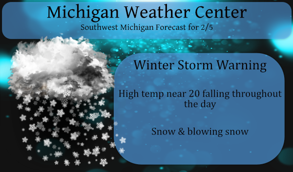
The winter storm warning continues until 7 pm this evening though it may be extended with the expectation of a flare-up of snow showers late this afternoon into the overnight hours.

Forecast Discussion:
- A lull in the snow mid day, then a flareup late --

So far, this winter weather event is playing out as expected. The
strong cold front has pushed through the CWA and much colder air
continues to pour into the region. Three to six inches of snow has
already fallen with more to come. Wind gusts over 50 mph have
been reported along the lake shore with gusts to 45 inland.
Scattered power outages have also occurred. As the low over
northern Lake Michigan moves north toward Superior, the pressure
gradient, and thus the wind, will begin to decrease to the 30-35
mph range by mid morning. We`re looking at gusty winds much of the
day, which means blowing and drifting snow along with hazardous
travel.

The cold air is just now moving over the lake. A look at local
radar reveals the synoptic snow is moving out and the lake effect
is just now beginning as h8 temps around -10c arrive.
Realistically, the lake effect will continue into Saturday at
least. Wind flow from 250 degrees will mean much of the CWA will
see snow showers. There is another wave that rotates through the
upper trough this afternoon and that will result in a flareup of
snow from late this afternoon through the evening. Given that the
depth of the DGZ is only 3k ft or so, accumulations will be
limited, but steady. Still thinking we`ll see a quarter to half
inch of snow per hour across the warning area with less in the
advisory area.

We`ll leave the Winter Storm Warning and Winter Weather Advisory
as is for now, but they may need to be extended later today.

-- Cold and snowy through next week --

A steady supply of arctic air will result in temperatures
remaining fairly steady in the teens through Sunday. Another
short wave moving across IL/IN Saturday evening will provide
another couple of inches to most of the CWA; the far north may
only see an inch or so. As the wave moves by, a reinforcing shot
of arctic air will again move in.

If any clearing occurs Sunday night, it would likely be over the
eastern CWA. The ECMWF is hinting at lows in the -5 to -10F range
with wind chills around -20F. Of course, closer to the lake more
clouds would result in warmer temperatures.

Temperatures will climb to near 20 Tuesday ahead of the next wave,
but then decrease into the teens again through the end of the
week.
Out in my area sitting at 11 inches of snow what a storm and on top of that it’s still coming down pretty good can’t make this up …Be safe out there ….INDY
That is also what I now have on the ground.
Slim
The mid and long range still looks promising also! The cpc show a cold month! Incredible!
https://www.pivotalweather.com/model.php?m=gfs&p=snku_acc&rh=2021020518&fh=384&r=conus&dpdt=&mc=
Muskegon, Ottawa and Kent counties are still looking great for snow, snow and more snow!
http://wxcaster.com/gis-snow-overlays2.php?STATIONID=GRR
What a storm, what a cold and snowy pattern and what a back
loaded winter! Face the facts we will be getting pummeled with cold and snow for weeks on end! Bring it!
Remembering a NWS winter forecast of 104 inches…hmmmm
Extremely heavy snow here. Went to walk in the park and it was a white out, maybe 15 foot visibility. Driving in these bands would be incredibly dangerous.
Seems like warning criteria snowfall rates to me?
Winter Storm Warnings dropped. Winter Weather Advisory until noon tomorrow.
Got groceries yesterday. I’m not even going outside until tomorrow, at least. Interestingly, there is maybe an inch of snow on our driveway. The wind has blown most of the snow into the yard.
I had a good 18 to 20″ drift in my driveway. I now have the drive way cleared and waiting for more snow to fall over the next several days. I have at least 5″ of new snow (yesterday and today so far) At this time there is light snow falling and a temperature of 18 here.
Slim
Other then the low snow totals Winter has been rocking hard since Christmas weekend many advisorys snow covered grounds no January thaws or any rain storms no 50’s
just pure winter weather lots of fun winter activitys I must say back loaded Winters is the bomb let it snow though April rock n roll will never die baby ..INDY ..
That is the spirit!
I definitely can see our winter storm warning being extended overnight …No let up in sight …INDY
I just got done snow blowing and it an absolutely AWESOME winter day! I am considering skiing or snowmobiling this weekend! I will need my best cold weather gear!
5.5 inches and counting! According to the NWS we are looking for a flare up late afternoon/evening! Another 2 to 4 inches, then another one Saturday evening/Sunday morning! What a storm! The cold and snow just keeps coming and no change is n sight! Rock n Roll baby!!!
Latest out look from the NWS below normal temps through the 18th of February now great Scott that only means one thing more snow …Back loaded Winters of fun…INDY
I love back loaded winters and who wouldn’t want snow this time of year?
Just measured over 7 inches of new snow in my area can’t make this up and it’s still snowing are we talking 24 hour snowfall record for this date or what?? let it snow let it snow let it snow …INDY
You must be just to my north or south. I have been in between the two main bands for the past few hours.
The latest form the NWS! This is on top of what we already received! It looks awesome!
When factoring what has already fallen, that’s a little less than some of the models you were posting yesterday. But I believe it more since it comes from the NWS.
You are 100% wrong as usual! The GFS was the 5 day snow maps and we will be seeing plenty of snow by Monday/Tuesday!
Nasty pile up on 94 near Mattawan. 20 cars involved. Yikes!
After a high of 31.3 degrees at midnight, we have fallen to 16 with moderate snow falling….
SNOWING VERY HARD IN MY AREA CAN’T EVEN SEE THE WOODS IN THE BACKYARD WOOOO WOOOO LAKE EFFECT SNOW MACHINE IS CRANKIN TODAY ….INDY
Wow just was traveling on a north south road white out conditions happing if you don’t have 4×4 stay home you maybe stuck the snow is piling up out there heavy snow falling in my area stay safe everyone…INDY
What? Snow, cold, wind, low visibility, heavy snow, dangerous roads! Who would have thought?
Hard to get an exact measurement with the wind, but I’d guess around 4-5 inches so far here. Nearby report in Ada had 5 earlier this morning.
Nice lake effect band passing overhead right now. Looks chilly out!
Getting a heavy lake effect snow shower here at this time temperature is now now to 18.
Slim
FINALLY, some real winter weather (not a blizzrd, but I’ll take what I can get :); Looking forward to lots of time outside this next week to take it all in… be safe all of you.
Happy Weatherpersons Day!! Thanks to all of you who are so interested in the weather and share your knowledge with us.
I did several snow fall measurements around the yard and averaged 4″ of new snow and now have 6″ on the ground. The snow has kind of a crunchy fell to it so there is some moisture in it. At the current time light snow is falling with a temperature of 20. All in all not as bad as I thought it would be this morning.
Slim
Good morning, friends. I shoveled a pathway for our little dog this morning. Guessing we received two or three inches. We now have a solid six inches on the ground.
Stay health, safe, and warm.
I have picked up 4 to 5 inches and tons more on the way!