On average July is the warmest month of the year with a average mean of 72.8 at Grand Rapids. On average there is 3.86” of rain fall in July. The daily H/L is rather stable with a H/L of 82.8/60.0 on the 1st and reaches up to 84.3/63.5 around the 20th and then falls to 83.6/63.2 by the 31st The warmest mean temperature in July was 79.7 in 1921. It was 79.2 in 2012, 78.7 in 1916, 78.1 in 1901 and 77.3 in1936. The coldest Julys are 67.1 in 2009, 67.2 in 1992, 68.1 in 1950, 68.2 in 1996 and 68.4 in 2014. Note that more of us have seen one of the coldest Julys than have seen one of the hottest. The all time record high at Grand Rapids is 108 on July 13, 1936 it was also 106 on July 12th that year. A high of 104 was recorded on July 21st 1934 and on July 6, 2012 (here in MBY I recorded 108 on that day in 2012) The record low for July is 41 on July 6, 1983. It has gotten as cold as 42 in 1945 and 43 on several years the last time was on July 2, 2001. The coldest maximum temperature is 58 on July 15, 1987. The warmest minimum was a very warm 82 on July 5, 1982 note the highs were only in the 80’s so it must have been very humid. There was a low of just 81 on July 14, 1995 a low of 78 was recorded on the 13 that same month and highs were 97 on both days. Lows of 79 were record in 1942,1936,1916,1911. Other than that low of 78 in 1995 a low of 78 was recorded in 2013 and 2012.
On average Grand Rapids receives 3.86” of rain fall in July. The wettest July’s are 8.83” in 1992, 8.42” in 1950, 8.07” in 1994, 7.47” in 1912 and 6.41” in 1917. The driest July’s are 0.40” in 1934,0.46” in 1939, 0.54” in 1998, 0.56” in 1951 and 1930. It has been a long time since we have seen a very dry July and we have to go back to the 1990’s for a very wet one.
The official H/L at Grand Rapids yesterday was 89/64 there was no rain fall. There was 36% of possible sunshine. For today the average H/L is 83/62 the record high of 101 was set in 1931 and the record low of 44 was set in 1982. There were 0 HDD’s and 12 CDD’s. The “year” for Heating Degree Days runs from July 1st to June 30th that said the 2022/23 Heating Degree Days ended up at 5946 that is a departure of -460 below the 30-year average of 6406. The heating season of 2022/23 ended up as the 6th warmest in Grand Rapids history. The range runs from 7712 in 1904 to a low of 5253 in 2012.
AREA FORECAST DISCUSSION
NATIONAL WEATHER SERVICE GRAND RAPIDS MI
351 AM EDT SAT JUL 1 2023
LATEST UPDATE…
SHORT TERM/LONG TERM/MARINE
SHORT TERM
(TODAY THROUGH SUNDAY)
ISSUED AT 350 AM EDT SAT JUL 1 2023
MAIN FOCUS OF THE SHORT TERM ARE THE CHANCES FOR SHOWERS AND
THUNDERSTORMS FROM TODAY INTO TOMORROW. THE FIRST ITEM OF CONCERN
WITH REGARD TO CONVECTION ARE THE STORMS WORKING NORTHEAST OUT OF
MISSOURI AND IOWA. IT APPEARS THERE MAY BE ONE OR TWO MCV’S
EMBEDDED WITHIN THE PRECIPITATION SHIELD. THE HRRR BRINGS SOME
PRECIPITATION INTO SOUTHERN LOWER MICHIGAN THIS MORNING WITH THE
HREF FOCUSED A BIT LATER IN THE DAY. EITHER WAY IT APPEARS THIS
FEATURE WILL MAKE SOME INROADS INTO OUR AREA TOWARDS I-94. SURFACE
BASED CAPE VALUES TODAY LOOK TO BE IN EXCESS OF 2,000 J/KG AT MAX
HEATING. GIVEN A FAIRLY NEBULOUS SURFACE PATTERN, THE SHOWERS AND
STORMS WILL BE FOCUSED ON OUTFLOWS AND THE LAKE BREEZE. WE HAVE
CHANCES FOR PRECIPITATION RISING TO 60-70 PERCENT IN PORTIONS OF
THE CWA THIS AFTERNOON. GIVEN THE LACK OF DEEP LAYER SHEAR NOT
EXPECTING SEVERE WEATHER.
TONIGHT…LOW PRESSURE WILL CONSOLIDATE BY SUNDAY MORNING OVER
ILLINOIS WITH A WEAK WARM FRONT EXTENDING TO THE EAST ACROSS
SOUTHERN LOWER MICHIGAN. GIVEN A DIURNAL FADE TO THE PRECIPITATION
AREAL EXTENT AND INTENSITY WILL DECREASE TONIGHT, BUT THE FRONT
WILL PROVIDE A FOCUS THROUGH THE NIGHT. THE HREF WOULD SUGGEST
THAT WE WILL SEE SCATTERED ACTIVITY OCCURRING ALL NIGHT LONG IN
THE SOUTHERN HALF OF THE FORECAST AREA.
ON SUNDAY…LIKELY POPS ARE NOW IN THE FORECAST FOR A SIZABLE
PORTION OF THE FORECAST AREA AS LOW PRESSURE MOVES EAST ACROSS
NORTHERN INDIANA AND OHIO. THE LOW WILL CONTINUE TO PROVIDE A
FOCUS FOR PRECIPITATION DEVELOPMENT AS WILL ITS POSITIVELY TILTED
MID LEVEL SHORTWAVE WORKING THROUGH THE SOUTHERN GREAT LAKES. A
FAIRLY WIDESPREAD RAIN IS NOW EXPECTED ESSENTIALLY NEAR AND SOUTH
OF INTERSTATE 96. SURFACE BASED CAPE VALUES WILL BE HELD DOWN A
BIT BY THE CLOUDS AND PRECIPITATION, MORE ON THE ORDER OF 1,000 TO
2,000 J/KG. SEVERE WEATHER IS NOT ANTICIPATED.
LONG TERM
(SUNDAY NIGHT THROUGH FRIDAY)
ISSUED AT 335 AM EDT SAT JUL 1 2023
LOW PRESSURE WILL BE PULLING AWAY FROM THE CWA SUNDAY NIGHT. THERE
MAY BE A FEW LINGERING SHOWERS BUT DRY CONDITIONS WILL DEVELOP BY
MONDAY MORNING.
THE BEST CHANCE OF RAIN DURING THE NEXT WEEK IS WEDNESDAY INTO
THURSDAY. A COLD FRONT WILL BE MOVING EAST IN THE QUASI ZONAL FLOW
AND WILL GENERATE SHOWERS/STORMS ALONG AND AHEAD OF IT AS IT MOVES
OVER LOWER MI WEDNESDAY. GFS SHOWS A NICE SHORT WAVE ACCOMPANYING IT
WEDNESDAY AFTERNOON. IF THAT CADENCE CONTINUES, THE LIFT WOULD
ARRIVE DURING PEAK HEATING. LI’S ARE ALREADY PROGD NEAR -5C AND
SBCAPE AROUND 1500 J/KG. A 35KT LLJ WILL ADVECT IN HIGH THETA-E AIR
AHEAD OF THE FRONT. ADDITIONALLY, PRECIPITABLE WATER VALUES CLIMB TO
OVER 2 INCHES. THUS, WE COULD SEE SITUATION WHERE STRONG STORMS ARE
POSSIBLE ALONG WITH A HEAVY RAIN THREAT.
A SEASONABLY STRONG HIGH PRESSURE SYSTEM WILL BUILD IN QUICKLY
BEHIND THE FRONT AND KEEP IT MOVING ALONG; PRECIPITATION SHOULD
CLEAR THE CWA BY THURSDAY EVENING.
HIGHS AHEAD OF THE COLD FRONT WILL BE AROUND 90 AND BEHIND THE FRONT
AROUND 80 THURSDAY THROUGH SATURDAY. IT WILL BE REALLY MUGGY DURING
THE FIRST PART OF THE WEEK AS DEWPOINTS CLIMB INTO THE UPPER 60S TO
AROUND 70. BUT AFTER THE FRONT, THEY WILL FALL TO AROUND 50 AND LOW
TEMPERATURES WILL FALL INTO THE 50S THURSDAY NIGHT THROUGH SATURDAY
NIGHT.
Detailed Forecast For Grand Rapids
Today
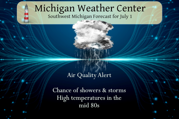
A 50 percent chance of showers and thunderstorms, mainly after 11am. Mostly cloudy, with a high near 86. Calm wind becoming west southwest 5 to 8 mph in the morning.
Tonight
A 30 percent chance of showers and thunderstorms, mainly after 2am. Mostly cloudy, with a low around 67. Light and variable wind.
Sunday
A chance of showers and thunderstorms, then showers likely and possibly a thunderstorm after 2pm. Mostly cloudy, with a high near 81. East northeast wind 3 to 8 mph. Chance of precipitation is 60%. New rainfall amounts between a quarter and half of an inch possible.
Sunday Night
Showers likely and possibly a thunderstorm before 8pm, then a slight chance of showers and thunderstorms between 8pm and 2am. Partly cloudy, with a low around 61. North northwest wind 5 to 9 mph becoming calm after midnight. Chance of precipitation is 60%. New rainfall amounts between a tenth and quarter of an inch, except higher amounts possible in thunderstorms.
Monday
Sunny, with a high near 86. Light west northwest wind increasing to 6 to 11 mph in the morning.
Monday Night
Mostly clear, with a low around 64.
Independence Day
Sunny and hot, with a high near 90.
Tuesday Night
Mostly clear, with a low around 68.
Wow, wow, WOW!!!!!!
Drought? What drought! I have picked u0 over 6 inches of rain in the last week!! Wow, just WOW, WOW! WOW!!!!!!!!!!!
That’s insane. We got 1.7”
3 rounds of thunder and soaking rains this afternoon again we have had some good rains now for the last week im thinking the serious drought in my area is over our grass is so much greener I have to cut it soon …… Hopefully the rain clears away for fireworks tonight downtown GR ….. INDY
I consider mid-May to early October the warm season. So even a “normal” or “cool” month is going to be warm. A good example is this past June. We had 6 90+ days and still ended near average.
It was not humid until the last couple days of the month, and it was cloudy and smoky most of the month, so it didn’t feel as bad as a usual June. But still warm
I had the perfect fire last night it wss so peaceful outside listening to all the fireworks going off in my hood finally my wood pile is getting used again and the ice cold sprites priceless happy 4th of July weekend woo woo!! INDAYS!!
Thanks for all the stats Slim. Looks like the majority of the area ended up above average with Muskegon being the hot spot for June. How many 90 degree days they they end up with?
Muskegon had 7 days of 90 or better. While on the east side of the state Flint did not have any and Detroit and Saginaw had only 1. To the north Alpena had 2, Houghton Lake had 1 Marquette also had 1 and the Sault had none. Might be the 1st time that Muskegon has lead the state in 90° days. That 7 is the most 90 or better at Muskegon in their history.
Slim
55 to a 60 degree water temperature at Muskegon along the lakeshore for July standards pretty cool!! INDY
How is that possible with all the warm weather hype????
Breaking News>>>>>GR has seen below normal temps 3 out of the last 4 months despite the constant warm weather Hype! Who would have thought! Incredible!!!
It won’t count lol….We know the facts though…INDY
Facts baby, facts!!!!
We have made it to July. One of my absolute favorite months of the year. I know I’m going to thoroughly enjoy it.
Fun fact: I have been officially Storm chasing for 11 years. My first ever storm chase was 11 years ago today down at the Michigan/Indiana state line. I was hooked ever since.
What? An average month temperature wise? So the overall cool pattern and even playing up the warmth was bogus? Interesting. It was a great month if only it featured more rain.
Yeah, that kind of shoots holes in the daily posts about an overall cool pattern. And yes more rain would have been nice. I don’t think I’ve ever run the sprinklers as much as I have in May and June.
Facts! 3 of the last 4 months GR has seen below normal temps! Those are the hard cold facts!!!!!
Spring for GR and Lansing were both above average.
Here is a West Michigan summary of June 2023. Grand Rapids mean 68.8 (-0.1) the high for the month was 91 and the low was 47. There was 1.69” of rain fall. There were 6 days of 90 or better. At Lansing the mean was also 68.8 (+0.8) the high for the month 92 the low 44 with 0.89” of rain fall. There were 6 days of 90 or better. At Muskegon the mean was 68.9 (+1.5) the high for the month was 94 and the low was 45 with just 0.58” of rain fall. There were 7 days of… Read more »
An east Michigan summary. Detroit mean 68.6 (-1.3) the high for the month 90 the low for the month 48 there was 3.19” of rain fall. There was just 1 day of 90 or better. At Flint the mean was 65.9 (-1.2) the high for the month 89 the low for the month 39 there was 2.12” of rain fall. Flint did not have a day of 90 or better. At Saginaw the mean was 67.5 the high for the month was 90 and the low was 47 there was 2.03” of rain fall and there was just 1 day… Read more »
There were many days of a dry eastly wind and that caused the west side of the state to be warmer than the east side. Detroit, Flint, Saginaw all had a below average mean temperature. There were just one or no days of 90 or better and there was more rain fall. On the west side of the state Grand Rapids and Holland were near average and Muskegon and Lansing were above average. The east wind and dryness cause the west side of the state to have around 6 days of 90 or better. And Muskegon had the warmest high… Read more »
Im sure we will be told GR doesn’t count butt in all reality chalk up another beloved average month is that 3 in a roll now ?? Lets go for 4 welcome to the hottest month of the year July when air quality days are due to smoke and not heat enjoy INDY PS great information Slim!
The cool pattern is locked in’!!!!!!!