Today we can expect similar conditions as yesterday. This afternoon we could see scattered showers and isolated thunderstorms with locally heavy rainfall. These storms will mostly be near and south of Muskegon and west of US-131. Locations significantly inland of US-131 should stay dry. These storms will be of the popup variety which are slow-moving until they drain themselves. The areas indicated above have a 20% or less chance of rain.
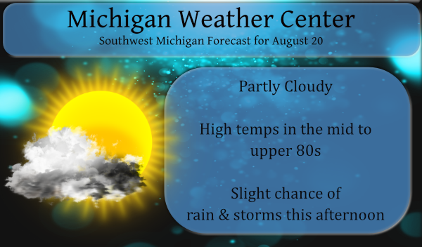
Saturday will be another hot and humid day with temps in the mid to upper 80s with increasing chances of rain and storms overnight into early Sunday morning. Sunday will feature less humidity and more comfortable temps in the low 80s.
We had no rain in Otsego while areas around Allegan County saw some heavy downpours. Yesterday’s high was 86.2° with a 74° dewpoint.
The Long Range outlook is out for September. The guess from the CPC is near normal temps and slightly above-normal precipitation. As we all know with the beginning of Met fall this means a more rapid decline in daylight hours and slowly falling temps. Where did the summer go? Our fall forecast (guess) is for chances of warmer than normal temps and equal chances of above/below normal rainfall. I generally don’t read much into this, after all, they are only guesses based on model predictions.
Today’s sunrise sunset times are 6:54 and 8:36 respectively which gives us 13 hours and 42 minutes of daylight.
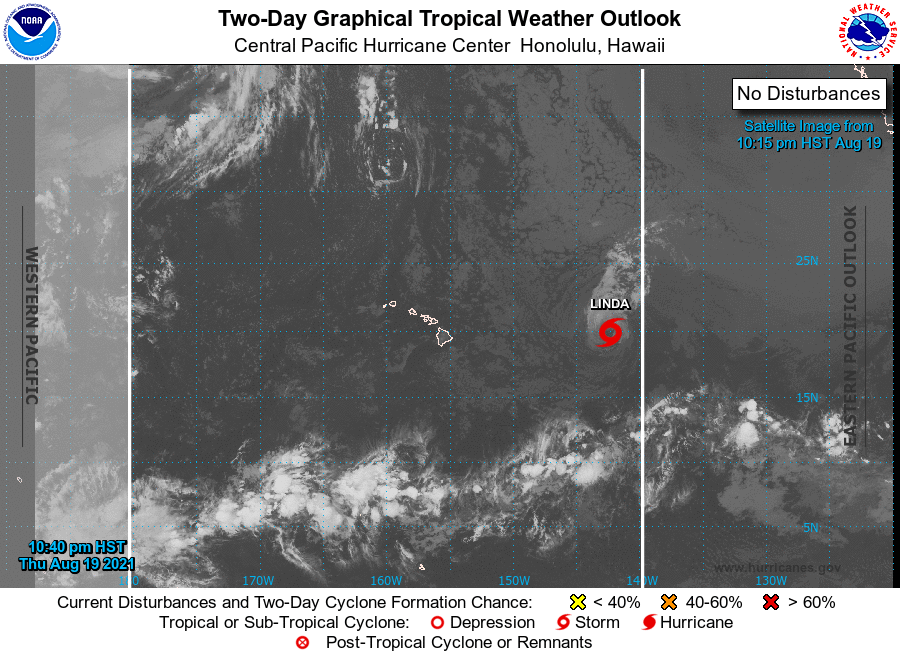
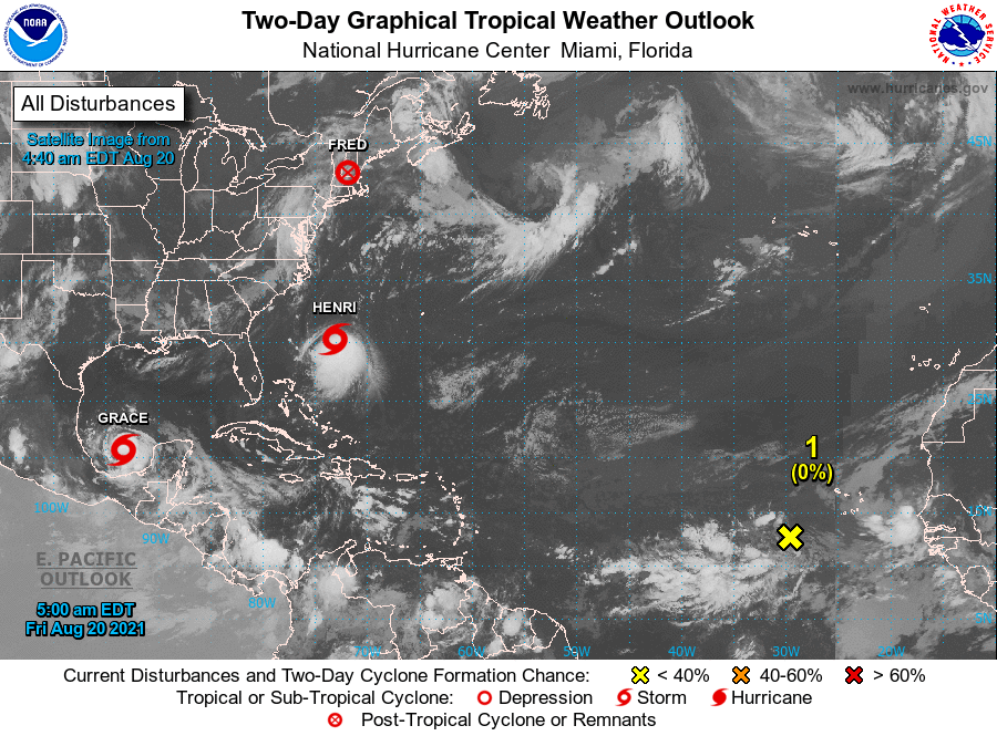
With the hurricane season ramping up here are the current hurricane/tropical storms in the Central Pacific and Atlantic:
[columns] [span6]
[/span6][span6]
[/span6][/columns]
Forecast Discussion
- Lake breeze convection this afternoon

I am thinking, like the last 2 days, we will see isolated lake
breeze storms this afternoon and evening. This time through the
convection will be mostly west of US-131, all the way up through
Mason County in the 3 pm to 9 pm time frame.

Our upper low, that I throught would be out of this area by this
afternoon, is in fact sending and shortwave at us from the
northeast (Central Ontario). It tracks southwest. By mid to late
afternoon there is a fairly sharp curvature in the mid level flow
south of I-96. This in combination with the lake breeze
convergence boundary will kick off isolated showers and
thunderstorms. The 00z HREF shows greater coverage late this
afternoon than the past 2 days. The past 2 days the HREF did a
great job of showing approximately where the convection would be
(correct counties)and the concentration of that convection. It has
30 to 40 pct pops (6 hrs ending at 8 pm) from Muskegon County
south. There is some deep layer shear due to that shortwave but it
is below 30 knots. There will be a fair amount of dry air above
600 mb but the MU cape is near 1500 j/kg. The air will be very
moist to 600 mb. The precipitable water will be near 1.8 inches,
which is on the high side, even for this time of year. I am
thinking slow moving storms with locally heavy rain, mostly MKG to
GRR to AZO to the lake shore. However there will be some storms
north of MKG to LDM too, but the coverage should be less.

Otherwise, for everywhere else, there is the typical patchy fog,
but not as much dense fog as yesterday at this time. That will
burn off quickly with sunrise. It will be another warm and humid
day again. Highs will be in the 85 to 90 range inland of the lake
shore.

Tonight upper ridging finally builds in totally but the frontal
trough gets closer so we will see a little more wind in the
boundary layer after midnight so I do not think we will see as
much fog early Saturday morning.

- Frontal system brings thunderstorms Saturday evening

Saturday should be our warmest day of the week due to deep mixing
as the frontal trough approaches the area. However we have a
large glitch if you want meaningful rain any time soon. Believe it
or not the upper heights rise Saturday night into Sunday. So from
Traverse City, south, we actually have a sharp 300 to 500 mb
ridge building. That is hugely not favorable for convection (to
much warm air aloft due to rising heights). So, while we do have
a surface front coming through the area early Sunday morning and
there is instability with that front there is very little deep
layer shear do to the building upper ridge. Still we do have some
surface convergence and upper divergence, plus there is 1200 to
1500 j/kg of MU cape to work with. Likely there will be some
convection with the front but with that building upper ridge, I
have to believe what is there will not be all that impressive.
One other very unfavorable aspect to meaningful convection is that
the core of the Low level jet will be north of Big Mac Bridge
Saturday evening. So we get speed divergence at low levels, that
is very not helpful for strong convection. Thus we have low chance
pops for this event. Most of the convection should be done by
midnight, what little of it there actually is.


- Overall trend is warmer next week with no cooling

Curiously, if one looked at the trend in the 500 or 300 mb height
fields over the CONUS for this coming week one would see, that for
the past 3 days, each run has higher heights (through Friday of
next week) over the entire CONUS. This is due to the upper ridge
being larger and forcing the polar jet to stay farther north. By
Friday we have a upper ridge from the west coast to the east
coast! However it should be noted that the polar jet, while
farther north than in previous runs, still comes down a touch the
northern board states a good part of next week. An upper trough
tries to develop over the western North America, north of Nevada.
This leads to a wavy frontal system that could mean periods
thunderstorms. At this point I will not say to much more about
the timing of the convection but next week could be wetter for
us than this week has been. It will also be warm since the polar
jet is north of us even so.
There are indications that we will be heading into a La Nina this fall and winter season. And generally in a La Nina fall we tend to be warmer than average at the start and colder at the end. I say colder because by late October and into November we can have some very cold days and nights. If the La Nina becomes a reality this would be the 2nd winter in a row with La Nina conditions. Here in Grand Rapids there have been some very mild (mild temperatures and less snow fall) and there have been some very… Read more »
Well let’s hope for a “three-peat” with a third Winter in a row with mild temps and way below average snow! It has been a long time since our last big Winter storm, and even longer since our last actual blizzard.
It all depends on what one calls a big storm. The last storm of 8 or more inches was December 12th 2016 with 8.9″ That snow stuck around for 16 days. The last storm with 9 or more inches was 9.6″ on November 18th 2014, While a total of 27.4″ fell over a period of just 5 days all that snow was gone in 2 days after the snow stopped. The last one day snow fall of 10″ or more was on February 2, 2011 there was a storm total of 17.2″ That snow stayed around for 17 days.
Slim
Yeah it’s definitely been a while. Guess that’s why some people lose their minds now with 3 or 4 inches. Standards have been lowered over the past several years.
The overnight low here at my house was 67 the official overnight low at GRR was 65. After the big storms of August 11th we now have had 8 days in a row without any rain. At this time it is sunny and 75 here with a dew point of 69.
Slim
Uneventful/boring weather = quiet blog
Should be great weather for the Woodward Dream Cruise.