January 12
1912: Muskegon sets their all-time record low for the month of January at 21 degrees below zero during their coldest month on record.
1918: Record cold is experienced at Lansing with 18 degrees below zero and Grand Rapids at 14 below during one of the coldest winters on record.
2005: On January 12, 2005, dense fog blanketed lower Michigan. Numerous highway accidents near Lansing killed two people and damaged almost 200 vehicles. At least 37 people were injured. One pileup involved 50 vehicles and necessitated the closure of 12 miles of Interstate 96 between Okemos and Webberville.
January 13
1952: Dense fog with visibility near zero leads to a number of auto accidents across southwest Lower Michigan. The fog persists for three days from the 12th to the 14th.
1979: A massive storm dumps heavy snow across southern Lower Michigan. Temperatures in the teens and strong winds lead to heavy drifting of the powdery snow, causing travel to come to a halt. The snow, at times falling at more than an inch an hour, caused power outages due to broken tree limbs. Snow accumulations were up to 3 feet, causing some roofs to collapse. South Haven had 21 inches of new snow added to 24 inches already on the ground. Grand Rapids saw 13.5 inches of snow and 2 to 4 foot drifts with wind gusts between 25 and 35 miles an hour.
January 14
1893: A long siege of arctic cold drops the temperature below zero for 15 out of the first 19 days of January at Lansing. This is the coldest day of the month with a low of 16 below zero.
1932: Grand Rapids is in the midst of a stretch of six days with temperatures above freezing during the warmest January on record.
2005: Two days of heavy rain and high temperatures in the 50s is followed by a stretch of arctic cold, causing massive ice jams to form on the Grand River. The ice jams result in devastating flooding of Robinson Township in Ottawa County. Flooding also occurs on stretches of the Muskegon, Thornapple, Flat and Kalamazoo rivers.
2015: Arctic air and clear skies allow temperatures to drop well below zero. Grand Rapids sets a record low for the second consecutive day with a low of 13 degrees below zero.
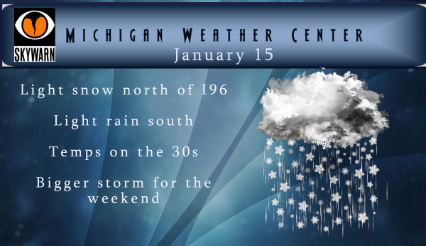
January 15
1972: Muskegon falls to 12 below zero to set a record low. The temperature only rises to 4 below zero on this day, the coldest high temperature on record for the month of January at Muskegon. It is also the coldest high temperature for January at Grand Rapids, where the maximum is three below zero.
1984: Lansing plunges to 25 below zero and Grand Rapids falls to 14 below during a stretch of arctic cold. Temperatures are below zero for eight straight days at Lansing between the 14th and the 21st.
January 16
1949: Temperatures reach record highs in the mid to upper 50s for the second consecutive day across southwest Lower Michigan.
1972: The arctic air holds on for one more morning of record lows as Grand Rapids falls to 16 below zero and Muskegon tumbles to 11 below.
January 17
1952: Temperatures rise to record highs of 61 degrees at Battle Creek, 59 degrees at Lansing and 56 at Grand Rapids.
1982: For the second time in a week, extremely cold arctic air drops temperatures to record low levels. The low of 9 below zero at Muskegon is followed by an afternoon high of 7 above. It is even colder away from Lake Michigan where high temperatures remain below zero during the day. Lansing has a high of 1 below and Battle Creek maxes out at 3 below.
January 18
1857: Extreme cold weather prevails across the eastern United States. In Lower Michigan, a temperature of 28 degrees below zero was reported in Grand Rapids.
1976: Arctic air and deep snow results in record cold across interior Lower Michigan. The temperature plunges to 25 below zero at Lansing and 20 below at Jackson. Along Lake Michigan, clouds and an onshore flow keep lows from falling below zero. The low of 10 above at Muskegon is 35 degrees warmer than the low at Lansing.
1996: A blizzard moving through the Dakotas pulls warm air up over Michigan. Record highs in the upper 50s and lower 60s are followed by a line of heavy rain and severe thunderstorms. At least one weak tornado is spawned by the squall line, which is quickly followed by a blast of arctic air and rain changing to snow. Rapids snowmelt and heavy rains, followed by a quick freeze, leads to many areas of ice jam flooding.
We are once again looking at another storm system for the weekend which could bring snow and rain then lake effect snows. The NWS is calling for several inches of snow, which in my opinion is still too early with the variability of temps across the area and the track of the low. We will keep an eye on it…
The NAM is going crazy!
http://wxcaster.com/gis-snow-overlays2.php?STATIONID=GRR
Looking good for this weekend for accumulating snow. I am soooo missing my snow this year :(. My problem is I do my mom’s yard work and can be very exhausting, therefore having a good solid winter provides me much reprievement. When temps are mild and weeds are growing during the winter…. yikes.. me NO LIKEY 🙂 Glad chat is working now on my end…I haven’t been able to chat or read the larger entries lately.
We only have 47.5 inches more of snow to go to reach the 48 inches by January 25, that Rocky predicted on his instantweather map from a little over a week ago!
Keep those maps coming!! The higher the snow totals on the map means the less snow we actually get!!! Winter Hype Storm, Weekend 2!!! Maybe we’ll get a full inch on snow this time!!
Great maps Rocky keep then coming the warm weather fanatics love them!!! Wild Bill Winter storm watches coming tomorrow ….Let it snow let it snow let it snow….INDY!!
Rock n roll will never die! This storm is building and has a lot of potential! The RDB will weigh in tomorrow evening!
Looks like 7 inches for Grand Rapids!!!
Maybe more with the lake enhancement!
The latest gfs looks great! Stay tuned for the official RDB model forecast!
The nws map is above and here is the gfs! Incredible!
http://wxcaster.com/gis-gfs-snow-overlays2.php?STATIONID=GRR
Love what Bill Steffens Wood tv 8 just said significant inches of snow will fall Saturday night into Sunday with gusty winds blizzard conditions coming ?? INDY!!
And last weekend he called for 10+ inches and we don’t even get 1. Incredible.
Remember what “Hype” gets you.. A fail.. Keep it up and jinx this storm once again. I love it !
The NAM is still trending the right direction!
http://wxcaster.com/gis-snow-overlays2.php?STATIONID=GRR
Wow! INDY
That map has been showing the same thing for like the last 2 weeks! What a joke!
Check this little map out! Incredible!
Lol!!! Said the same exact thing last Friday & Saturday!
Lol!!! Hey Mookie, looks like another short few day cool down then right back above normal according to the latest CPC!! Love these short snowless winters!!!
What happen to all the avatars by everyone’s name??
Winter storm watches have begun in the Midwest now for the storm Michigan is next more breaking winter weather news love it ……INDY
Finally some snow after all this time? I’m ready for a nice short winter.
The lastest EURO MODLE drops the storm 50 miles south now that should be good enough to send mokkiee on vacation and the possibility of snow In Zland finally BREAKING NEWS!!!! Great Scotty …INDY
That sounds incredible!
The NAM is looking good!
http://wxcaster.com/gis-snow-overlays.php?STATIONID=GRR
Let it snow let it snow let it snow …WOW!! INDY!!
Wow the CPC’s 6-10 day and 8-14 day outlooks now show warmer than average temps! What happened to all this cold hype?!
Huh, imagine that. Going by the current line of thinking today, this must be the tropical vortex paying a visit. The drier than average is a welcome sight. We have had enough rain for a while now.
Haha weren’t the two snow fanatics calling for polar vortex for weeks just yesterday? Whoops!
Looks like we are nearing minimum energy in the N. Hemisphere. Interesting how Antarctica stays very cold even through the summer thanks to the plentiful permanent ice. The Arctic, on the other hand, nearly completely warms to near/above freezing by mid-late summer!
https://earth.nullschool.net/#current/wind/surface/level/overlay=temp/orthographic=-78.98,14.81,377
Also notice much of Europe is not entrenched in any deep cold yet either.
Cool!
I love the fact winter weather started in early November this year and may stretch into April! I have been skiing and snowshoeing every weekend but one since early November! Incredible!
LOL
lol maybe hundreds of miles north. Too funny!
Everyone knows there is nothing worse in the winter than rain and freezing rain?
Hello West MI!
http://wxcaster.com/gis-gfs-snow-overlays.php?STATIONID=GRR
This is only through 7 am Saturday and more snow after that!
Interesting, considering our local mets are calling for no accumulating snow. Or is this a “trend” map?
Directly form the nws through 7 am Saturday! Just the facts!
Wishcast
Beauty at its best …INDY
I see there have been a lot of back and forth this morning. Well at this time it looks that it might turn colder and dryer for a while. Note by colder I do not mean record cold just colder then it has been. If and that is a big IF the rest of January was to stay at the current mean of 34.0 this would tie the warmest January in Grand Rapids history and with just 0.9” of snow fall so far it would be in 2nd place. As it is I do not see this year catching up… Read more »
That sounds very familiar and exactly what you said one year ago! We will see if your prediction turns out better, because last year it blew up big time!
Boy I had some thing happen to me that I hope I never have again! After taking my medicine that I take every day I started coughing and then I had a hard time breathing. Of course the first thing that come to you mind is heart attack. As my coughing became worse I started having a odd taste in my mouth and had the urge to throw up. Well I started throwing up and lo be hold I threw up one of my pills. And long with the pill came a lot of blood colored stuff. I woke my… Read more »
Yup, been there – didn’t end up in the ER though. Glad you are OK.
Glad to hear you are ok. Scary stuff.
Getting some steady rain to add to our rain total. So much better than snow. Love it!
working out some security issues – please stand by if the site becomes temporarily unavailable
We are good to go – we now verified a Digi-Cert safe site to browse – you may have to update your link to
https://michigan-weather-center.org
(the s is added to http) – and a padlock – as with other sites, this site is attacked daily from outside sources several thousand times in the past months in fact. I had to go through a bunch of lines of code today to make sure all the outside links I pull in are also safe to include.
Only 45 days left of meteorological winter. I love short winters!
Just hitting Cadliac Michigan heading south snow on the ground far as the eye can see looks like we will be adding on to that this weekend wow ….INDY
Hey Indy keep up the good work! The warm weather fanatics would not admit a polar vortex unless it was below zero for days on end! No doubt highs near 20 degrees is the result of a polar vortex! Rock on!
Temps in the 20’s during our coldest time of the year on average now equals polar vortex?? Wow, really grasping at straws now, looking for any glimmer of hope.
Let’s review the facts! 1. We have more snow to date than last year at this point in time! 2. Last year at this point most people on here were stating we would end up with below normal snowfall. There were a total of two people that said above normal snowfall and those 2 people were 100% correct again! 3. The same thing is happening again this year and some people are predicting GR only seeing 50 inches of snow! 4. The pattern is in the process of switching to cold and snow! 5. We will be getting hammered with… Read more »
#’s 4, 5, and 9 are not facts as they haven’t happened yet, just wishcasting. #6 is simply the opinion of the minority on this blog.
10. Warm weather fanatics love snow and cold! INDY..
BREAKING NEWS POLAR VORTEX WARNING IS IN FULL EFFECT!!! STAY TUNED!!! INDY !!!!
There will be some weakening and stretching of the polar vortex, which will allow cold air to drain southward from Canada in stages during the second half of the month. However, a big breakdown and major shift of the polar vortex, which would allow an extremely cold discharge, is not anticipated
Let’s hope they are wrong, because the polar vortex is my favorite weather event and = tons of lake effect snow!
Seeing highs in the single digits around the end of the month that’s polar enough to me ….INDY
Where are you seeing highs in the single digits?
It’s called the GFS MODLE !! Stay Warm …INDY
I see no major arctic outbreaks at this time. In fact, the CPC now shows us barely in the blue. More of a glancing blow of below average temps.
The snow maps are building for this weekend. Special Note for ANDY>>>>>>>>>this is the GFS depiction, NOT the RDB official prediction! Let’s keep the facts straight this time!
http://wxcaster.com/gis-gfs-snow-overlays2.php?STATIONID=GRR
+1000!! INDY
Breaking…..the GR NWS is going bonkers again. The point forecast for Rockford, MI gives me 12 inches of snow this weekend! Stay tuned for later updates!
25 out of the last 26 days have been above average! January is now +9.4 degrees above average through 14 days. One of the warmest starts to a new year (if not the warmest) we’ve ever seen!
Since Sunday, GR has received a whopping .04″ of ran and .1″ of snow. Dry week so far.
I suspect them numbers will change around the end of the month I hope your on here to share them again … I always was the cherry picker playing basketball in JR high hung out under the net alot waiting for the pass! Lol…INDY
It looks dry after this weekend at the current time.
Not very often we reach mid January and the rainfall total is outpacing the snowfall total by over a 2 to 1 ratio. At least the outlooks are all looking drier than average after this weekend so maybe it will dry out some finally.
BREAKING NEWS don’t forget the polar vortex is coming behind Saturdays storm …The local news here in Boyne Mountain shows heavy snow starts Friday Saturday following heavy lk effect snows Sunday Monday Tuesday highs only in the low 20’s WOW! Have a great Wednesday MV’s Best …INDY
Sounds great! Bring it!
Breaking weather news>>>>>a storm is coming! If all snow we could see 6 plus inches! Stay tuned for later forecast and the RDB model prediction!
Good morning west Michigan! Just finished getting the teens off to school… My daughter got excited when I informed her that colder weather is on the horizon and she may actually have more than one day (in a row) to take a walk in the woods with the sound of snow crunching under her feet. I’m keeping my fingers crossed that the LES that is predicted will over-perform this time around. Remember the good ole’ days when we used to get synoptic systems that brought more than 3 inches of snow?!