Low pressure will bring snow mixed with rain to central Michigan today and showers and storms to southern Michigan. We have a winter weather advisory in place for some of our northern areas:
...WINTER WEATHER ADVISORY IN EFFECT UNTIL 2 PM EST THIS
AFTERNOON...

* WHAT...Wet snow. Additional snow accumulations of one to three
  expected.

* WHERE...Montcalm and Gratiot counties.

* WHEN...Until 2 PM EST this afternoon.

* IMPACTS...Plan on slippery road conditions. The hazardous
  conditions could impact the morning commute.

* ADDITIONAL DETAILS...Snow will overspread the area this morning.
  The snow will become moderate at times. Snow covered and
  slippery roads will continue to develop into the morning
  commute.
...WINTER WEATHER ADVISORY REMAINS IN EFFECT UNTIL 6 PM EST THIS
EVENING...

* WHAT...Snow. Additional snow accumulations of up to 3 inches.
  Winds gusting as high as 35 mph.

* WHERE...Lake, Osceola, Clare, Newaygo, Mecosta and Isabella
  counties.

* WHEN...Until 6 PM EST this evening.

* IMPACTS...Plan on slippery road conditions. The hazardous
  conditions could impact the morning or evening commute.

* ADDITIONAL DETAILS...Snow will overspread the area this
  morning. The snow will become moderate at times. Snow covered
  and slippery roads will continue to develop into the morning
  commute.
...WINTER WEATHER ADVISORY IN EFFECT UNTIL 2 PM EST THIS
AFTERNOON...

* WHAT...Wet snow. Accumulations of 2 to 4 inches.

* WHERE...Midland, Bay, Huron, Saginaw, Tuscola and Sanilac
  Counties.

* WHEN...Until 2 PM EST this afternoon.

* IMPACTS...Plan on slippery road conditions.

* ADDITIONAL DETAILS...Most of the snow will fall over a
  relatively brief 3 to 4 hour time period this morning.
...WINTER WEATHER ADVISORY REMAINS IN EFFECT UNTIL 7 PM EST THIS
EVENING...

* WHAT...Wet snow expected. Total snow accumulations of 2 to 4
  inches. Winds gusting as high as 30 mph.

* WHERE...Wexford, Missaukee and Roscommon Counties.

* WHEN...Until 7 PM EST this evening.

* IMPACTS...Plan on slippery and slushy road conditions. A burst
  of heavier snow during the morning commute could lead to
  instances of quickly changing travel conditions from snowfall
  and drops in visibilities.
This Day in Weather History
U.S.A and Global Events for March 6:
1875: Heavy snow fell in much of Arkansas, with the highest amounts in the central and west. Twelve inches of snow fell at Little Rock, which remains the highest calendar day snowfall on record in the capital city. 30 inches fell near Mena. The image below is from a tweet by the NWS Office in Little Rock, Arkansas.

1908: A tropical storm developed about 500 miles northeast of San Juan, Puerto Rice, on March 6. The storm intensified to Category 2 strength near the Leeward Islands of Saint-Barthélemy and Saint Kitts. Since 1842, this was the only hurricane to develop in the Atlantic Ocean in March. Click HERE for more information from the Weather Channel.
1962: The strongest nor’easter of this century struck the Mid-Atlantic Region on March 5-9, 1962. It is known as the “Ash Wednesday Storm” and caused over $200 million (1962 dollars) in property damage and significant coastal erosion from North Carolina to Long Island, New York. It was estimated to have destroyed or significantly damaged 45,000 homes in New Jersey alone. The Red Cross recorded that the storm killed 40 people. It hit during “Spring Tide.” When the sun and moon are in phase, they produce a higher-than-average astronomical tide. Water reached nine feet at Norfolk (flooding begins around five feet). Houses were toppled into the ocean, and boardwalks were broken and twisted. The islands of Chincoteague and Assateague, Maryland, were completely underwater. Ocean City, Maryland, sustained significant damage, mainly to the island’s south end. Winds up to 70 mph built 40-foot waves at sea. Heavy snow fell in the Appalachian Mountains. Big Meadows, southeast of Luray, recorded Virginia’s greatest 24-hour snowfall with 33 inches and the most significant single storm snowfall with 42 inches. (Luray, Virginia reported 33.5 inches on March 2-3, 1994, making this later snow their maximum 24-hour snowfall total.) Roads were blocked, and electrical service was out for several days. Washington and Baltimore fell into the mixed precipitation zone. The Ash Wednesday storm is noteworthy for producing devastating tidal flooding along the Atlantic Coast and record snows and the interior of Virginia. The extremely high tides and massive waves caused tremendous damage -worst than many hurricanes that have hit the region. Along the Atlantic Coast, tide ran for 2 to 6 ft above average with 20 to 40 ft waves crashing ashore. National Airport received only 4 inches of snow with a liquid equivalent of 1.33 inches. However, close-in suburbs, such as Silver Spring, Maryland, and Falls Church, Virginia, received 11 inches of snow. Outlying areas such as Rockville, Maryland, received 19 inches of snow, and Leesburg, Virginia, received 20 inches of snow. Other snow totals included 15 inches at Richmond; 23 inches at Culpeper; 26 inches at Charlottesville; 32 inches at Winchester; and 35 inches at Fort Royal, Virginia, and Big Meadows on the Skyline Drive top the list with 42 inches of snow. Click HERE for more information from the Washington Post. Click HERE for additional information from the Weather Channel.
2004: More snow fell on March 6, 2004, than ever recorded for a single day in March since the Korea Meteorological Administration began keeping records in 1904. According to news reports, the city of Daejon (Taejon) in central South Korea received 19 inches of snow on Friday, with an additional 6 inches (15 centimeters) forecast for Saturday. As the storm moved away from the peninsula on March 7. Click HERE for more information from NASA Earth Observatory.
2010: At least seven funnel clouds were observed along the Orange County coast in southern California. Two were spotted near John Wayne Airport.

2014: The Great Lakes saw some of their worst ice covers in nearly four decades because of a frigid winter with months of below-freezing temperatures in large sections of the northern United States, the National Ocean and Atmospheric Administration said. As of Mach 6, 2014, the federal agency said that 92.2 percent of the five lakes were under ice, breaking a record set in 1973 but still short of the 94.7 percent established in 1979.
2017: Early data from the GOES-East satellite warned forecasters from the NWS office in Dodge City, Kansas, about a wildfire before any 911 calls were made. As a result, they were able to start planning evacuations sooner and saving lives. Click HERE for a tweet from NOAA Satellites.
2017: A line of storms brought widespread wind damage and tornadoes to Minnesota, Wisconsin, Iowa, and northern Missouri. Click HERE for more information from the NWS Office in La Crosse, Wisconsin.
Grand Rapids Forecast
3 6 grrLansing Forecast
3 6 lanKalamazoo Forecast
3 6 kzoForecast Discussion
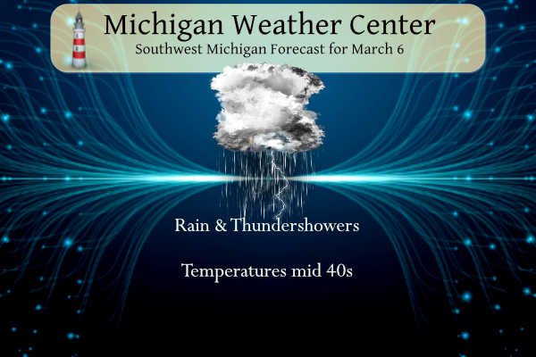
--Snow through the north, rain elsewhere today--

While we enter the zero hour for the advancing system, many
questions persist. The first is where will be the demarcation of
rain vs snow. That seems to be just north of the I 96 corridor.
Looking at model soundings there remains a good moist dendritic
growth zone from 4 AM until 9 AM in areas north of Lansing and
Grand Rapids.
 However, the one thing we do know is that freezing rain is not a
threat.

Latest reflectivity at 0800Z has a strong reflectivities that
given the melting is bright banding, which is what happens when
snow melts into rain. Looking at the webcams in and around
Holland, there is indeed reduced visibilities due to heavy
snow/rain fall. The good news is that temperatures to begin this
event were around 40 degrees F. The dew points were in the mid to
upper 20s. That correlates to a dry atmosphere. So as this system
moves in, it will slowly moisten the dry air before any
precipitation falls and then hits the ground. Given the warm
ground temperatures it will delay if not completely halt
accumulations. So there were be a period of potentially heavy snow
bands from 3 AM to 9AM. The latest HRRR does give areas north of
Grand Rapids upwards of 2 inches, however anything that does fall
will be wet and heavy.

In the regions containing the advisory the snow will stick, the
temperatures are cooler and the dendritic growth zone will be
longer lived. The heaviest snow will be along US 10 corridor and
along the US 127 corridor north of Lansing. This region could see
2 to 5 inches of snow.
 While the advisory is for today, the above mentioned area will
receive some more snow tonight on the backside of the exiting
low.

On the southern end of the low this afternoon will be a band of
heavy rain showers along the I 94 corridor. Upwards of a half an
inch of rainfall is expected. There is a chance for isolated
thunderstorms due to the instability this system will create.

-Dry through midweek--

This system will move quickly through the region and exit tonight
into Tuesday morning. high pressure will build over the region
which will bring a dry period through Thursday for Michigan. Temps
will be mild with clearing skies and highs in the upper 30s lower
40s.

--Another system to end the week--

The mid to long range models are becoming into fair agreement on
the timing of an approaching upper level low. There is good
baroclinicity with this system. That will only add to the
confidence of its timing and track. 850mb temperatures with that
system are -2 to -6 C currently. Given that the timing has any
precipitation arriving in the cold sector and in the evening and
into the overnight hours there is a good chance this will be snow.
Given there is some variations of QPF and that this is 5 days away
it is difficult to pinpoint snowfall amount at this time but
something to keep an eye on.
GR is still nearly 20 inches above normal in snowfall! Wow, what a winter!
Add to the list 2 days of thundersnow only 3 days apart. Was snowing hard this morning. Incredible winter!
*1000
Here is cape coral florida it made it to 87 today our pool was reading 94 this afternoon this is for you mookie lol… INDY
That sounds like mid summer in MI! Now that is warm, not the 40’s that mookie calling warm. We have a ton of cold and snow coming for us this entire month! Incredible!
Enjoy Florida INDY!
Thanks Its hot for March down here record highs today Ft Myers 91 punta gorda 90 shuuuuu…INDY
Possible snowstorm Friday im hearing great scotty …INDY
The preliminary RDB model gives GR 3 to 5 inches! Stay tuned for later updates!!!
Have a great vacation!! My sister goes down there for the winters. Today she called me and it was 88 there.
Breaking>>>>>a snowstorm is in our future! The crazy above normal snowfall just keeps coming and coming! Should be great ski conditions this weekend! Who would have thought?
After today, March will have started much warmer than average with below average snow. Just like the prior two months.
🙂
51 and sunny yesterday. 47 on Saturday. Much warmer than forecasts. Pretty atrocious winter activity conditions again.
Yesterday was a great early spring day with the official H/L of 51/31. There was no rain/snow and the sun was out for 658 minutes or 96% of the possible time. Overnight there was a period of moderates snow fall and there is just over a inch of snow now on the ground. At the current time it is 35 here in MBY. For today the average H/L is 40/24 the record high of 68 was set in 1973 and 1983 the record low of 0 was set in 1901 and 1920. The biggest snow fall of 5.6” fell in… Read more »
Yesterday was a really nice day for early March. Even a month from now, I’d be happy with 50 and sun.
Thundersnow again early this morning. What a cool winter!
I did see the big flakes of snow fall . but did not see any of the thundersnow.
Slim
I absolutely love this 2 week snow map! Forget Spring, Winter is in full force!
https://www.pivotalweather.com/model.php?p=snku_acc-imp&rh=2023030606&fh=384
Guitarist Gary Rossington, the last surviving founding member of Southern rock band Lynyrd Skynyrd, has died, the band announced on their official Facebook page Sunday evening. He was 71.
Sad. What an unbelievably talented group of musicians. Tuesday’s Gone is probably my favorite song. Rossington’s solo at the end is incredible. He bends the strings on that Gibson and makes it cry.
Gary was the last of the original members of Lynyrd Skyuyrd.
Slim
Getting light snow here but more notably, we had a flash of lightning about a half hour ago. Thundersnow twice in three days? Too cool.
Have a great day everyone, and make someone smile. 🙂