We had a high temp yesterday of 21° and the low was 3° at midnight last night. We have climbed to 13° at 5 am this morning. The coldest air in southern Michigan is in the SE part of the state where temps are still in the single digits.
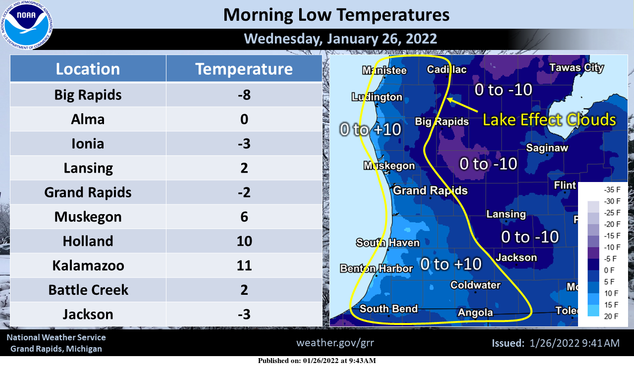
These we Wednesday morning low temps – this show the difference lake effect clouds can have on temperatures.
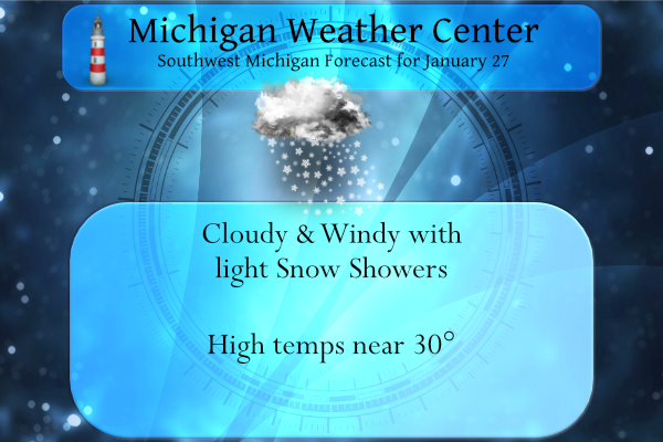
We will have some light snow today with little or no accumulation with the exception of NW lower Michigan where there is a winter weather advisory for 1 to 3 inches of snow. Most of the rest of the area will see a dusting to perhaps an inch.
Most of the rest of the week will be tranquil. Our eyes are now on a possible impactful synoptic event midweek next week which may be our nastiest storm of the season thus far.
Forecast Discussion
- Light Snow Developing Today -

A cold front will gradually move in from the NW this afternoon
and bring light snow showers. Most of our area will see very light
accumulations of less than an inch. Slightly higher snow
accumulations of an inch or two are forecast well to the north to
northwest of KGRR where deeper moisture will result in slightly
higher snow accumulations. Some travel impacts are possible later
today particularly well to the NW of KGRR due to the combination
of the snow and brisk SW winds ahead of the cold front.

- Light Snow Saturday Night Into Sunday -

Tranquil wx is fcst Friday through Saturday with a ridge of high
pressure in control. A clipper system will drop in from the nw
Saturday night and bring potential for a little light snow
Saturday night into Sunday. At this point moisture with this
system looks quite limited and there will be less potential for
snow enhancement from Lake MI moisture given increasing ice
coverage. Therefore minimal impacts are expected from this system.

- Impactful Winter Weather For Wed/Thur -

A consensus of latest medium range guidance continues to show
potential for a messy wintery mix of pcpn Tuesday night and
Wednesday. This will occur as thermal profiles moderate and a
southern stream low pressure system gathers ample gulf moisture
which will be advected northward. There is potential for
possibly significant freezing rain by midweek as well as warmer
air aloft overruns sfc temps potentially near to below the
freezing mark.

Then as the southern stream low pressure system moves NE there
will be potential for significant snow by Thursday as high
pressure to our north provides plenty of arctic air to the north
of the low pressure track. This system will have abundant gulf
moisture to work with and could potentially be one of our more
impactful synoptic events this winter.
Wow! For Boston:
…BLIZZARD WARNING REMAINS IN EFFECT FROM MIDNIGHT TONIGHT TO
MIDNIGHT EST SATURDAY NIGHT…
* WHAT…Blizzard conditions expected. Total snow accumulations of 18 to 24 inches with localized 30 inches possible. Winds gusting as high as 60 mph.
Micigan is at 100% snow-covered grounds with a average of 8 inches of snow on the ground And even more snow and cold on the way ..WHO KNEW??? InDY
We may get absolutely pounded next week and January was a very cold and snowy month, yet a certain person keeps spewing warm weather nonsense! Incredible!
Some modles give us 18 inches of snow GREAT SCOTTY…GET THE SPRITES ON ICE ICE BABY …InDY
Yes, check this out! This is one of the best snow maps I have seen in years! We are due for a monster!!
https://www.pivotalweather.com/model.php?p=snku_acc&fh=384
I was just looking at that …Thats only the next 14 days crazzy…. let it snow let it snow let it snow …InDY
Let it snow it snow let it snow …InDY
Nice snow band as we speak?
Incredible..InDy
What? It is snowing again? The great winter keeps going and going!
The latest CPC keeps the cold and snow going for weeks on end! I love it!
Quiet for the next 5 days. What do you know. That snow deficit will continue to grow.
WOOD then has rain and 40 degrees Tuesday.
The clouds have now moved in and there are a few flurries falling the temperature is now 26 with that very light snow falling.
Slim
Major snow storm next week?? Stsy tuned..INDy…
I think it is still too early to say for sure. We really do not want to see a ice storm but we are overdue for one and that is kind of scarry.
We shall see.
Slim
We definitely don’t want an ice storm! Snow yes, ice no!
20 degrees warmer here this morning (16 vs -6) as compared to 24 hours ago, thanks to the southerly wind.
The overnight was one of those nights when the temperature slowly went up. The low here and officially at GRR of 5 happened around midnight. At this time it is partly cloudy and 17 here. There was trace of snow fall here yesterday and there is 6.5″ of snow on the ground. As for next weeks possible system? That remains to be seen there is a lot and I mean a lot of time before we see how this plays out. But I will say we have now been in this cold and dry pattern for about 30 days or… Read more »