Very cold this morning. Our temp here at the station is currently 1.9° with a dewpoint of 0.2° at 6 am. We are on our way to a possible below 0 morning before sunrise. Yesterday we had 29.5° with a low of 4.5° and trace amounts of freezing drizzle mixed with a few snowflakes.
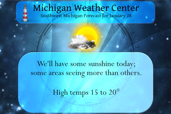
We have good chances of seeing some sun today especially in inland areas. The coming days ahead will feature moderating temperatures through early next week and a boring weather pattern. Further ahead, in the Tuesday through Thursday timeframe, we will be assessing a system that may bring snow, rain, or a wintery mix to parts of the region. Current model guidance indicates a range of plausible scenarios, so forecast details are uncertain at this early stage. I will wait until Monday before I am more comfortable putting my neck on the line with a forecast for that timeframe.
Forecast Discussion
- Tranquil Weather Through Saturday Afternoon -

A high pressure ridge will bring tranquil and cold wx through
Saturday afternoon. A few flurries may clip areas mainly near to
north of KMKG this morning and afternoon but ne winds should keep
most lake induced cloud cover and lake effect snow showers
offshore (although low clouds will move sw into our eastern fcst
area off of Lake Huron later today). It will be quite cold tonight
with low temps inland from Lake MI ranging from the single digits
below to single digits above zero.

Nocturnal land breeze convergence and light sfc winds could lead
to mesolow formation over southern Lake MI tonight. This feature
if it develops as the 00Z HRRR hints at could bring some light
snow showers mainly near to south of Holland overnight.

- Weak System To Bring Light Snow Saturday Night -

A weak low pressure system moving in from the NW will bring
potential for scattered light snow showers Saturday night.
Moisture and lift with this system look weak and any snow
accumulations should be quite light at less than an inch.

- Impactful Snow Possible Wed/Thur -

Significant medium range guidance discrepancies are noted in terms
of evolution of the system for midweek. However what seems more
certain is that this system will have ample gulf moisture to work
with and that a strong baroclinic zone will setup across the lower
Great Lakes to Ohio Valley regions. In spite of significant
medium range guidance differences confidence is fairly high in
potential for significant snow as this system will have abundant
moisture to work with.

My gut feel is that the strong high pressure ridge building se
from Canada will bring ample arctic air into our area such that
p-type will likely end up being predominantly snow (we are
favoring the colder medium range guidance solutions). It is also
noted that the 00Z deterministic ECMWF has now trended
significantly colder/further south with the Thursday system. The
coldest airmass of the season will arrive by Friday as h8 temps
plummet to around -20 to -22 C.
Hey guys how are you! I am another from Bills Blog years ago!
Hey Jevon! Hope you are well. Welcome to the party!
Next weeks storm is trending a little bit South! Plenty of time for it trend back to the North! We are due for a monster!
WOW! From NWS Boston:
322 PM EST Fri Jan 28 2022
…BLIZZARD WARNING REMAINS IN EFFECT FROM MIDNIGHT TONIGHT TO 5 AM EST SUNDAY…
* WHAT…Blizzard conditions expected. Total snow accumulations of 18 to 24 inches with localized 30 inches possible. Winds gusting as high as 70 mph.
Wild!
Still seems to be arguments on our season snowfall totals. As of today we are below average for the entire season, and below average for met Winter. All the #’s are in the link below. If you think these are wrong I would suggest taking it up with the NWS.
https://forecast.weather.gov/product.php?site=grr&product=cli&issuedby=grr
No arguments! November and January are above normal snowfall! facts!
Yes no augments just facts is right …Lets take a bet that February is above average snowfall to anyone anyone anyone ??? …DDDDDD…InDY
Get ready to rock and let the party begin! It is going to be wild!
https://www.pivotalweather.com/model.php?p=snku_acc&rh=2022012812&fh=384
Man, that would be a dream. I would love a large storm. But I fear it will be a lot of rain and then we will be in a icy frozen muddy mess. haha. I hope you are right! Its been cold!
Thnaks for your comments, however please keep in mind this is not my prediction but it does show one models depiction over the next 2 weeks! It clearly shows a trend towards more snow! My predictions will show up when we get closer to the events and I will always rely on the RDB model, which is the most accurate model on the market today! Let it SNOW!!!!!
Only 13* degrees outside in my hood pretty cold sanders for late January especially now as our average temperatures are going up right??…WHO KNEW?? InDY
November above average snowfall below normal temperatures January above average snowfall below normal temperatures February looks like above average snowfall and below average temperatures coming and we still have March and April before we see temperatures in the mid 60’s love it!!! WHO KNEW?? InDY
No mention of December? Hmm wonder why LOL
Well just the facts right?? Lol…5 out 6 Winter months is not bad I will take that ohh dont forget 30+ days with snow pack on the ground on going!! Incredible….InDy!
SPIN SPIN
In other words, barely any snow until January. And below average snowfall on the season. I love it!
Facts! We are well above normal for January snowfall in GR! Get your facts straight or don’t bother!
And above normal snowfall in November just like Indy said! It is funny how the facts always get in your way!
Keep the FACTS coming INDY! You are spot on as usual! What a winter!
Another quiet day of below average snow. Still looking at 40 degrees and rain on Monday. We really see the temperature averages starting to increase in February. Meijer had all the Easter and spring stuff out yesterday. I love it!
Check out how fast lake Michigan is building ice on it wow …crazy for late January im thinking…InDY
Amazing all of Michigan has snow on the ground 100% covered babby that hardly ever happens…InDY
8 this morning. It was weird to see the temp rise to 31 at 7pm last night.
It will entertaining to watch the weather in New England this weekend. I wonder if Boston will get 20 or more inches of snow.
Check out Florida the whole state is under wimter weather warnings and advisorys I dont believe I have ever saw that in my 20+ years
of forecasting weather crazy….Who says Winters are short lol…InDY
First off I am still on the fence for next weeks systems. While at this time it looks like there will be some rain and some snow it is still too early to say just how much. I just hope we can leave freezing rain out of the picture. At this time this does not look to be a windy system so that is good news. There was just over a half inch of new snow here yesterday and officially at GRR that now brings the monthly total to 25.5″ for meteorological winter Grand Rapids is now up to 35.6″… Read more »
Currently 10 degrees out in my hood theses morning low temperatures have been brutal but who is complaining not InDY…Lets keep it going all the way to April baby …InDY
Get ready, because will be heading into the snowiest part of winter next week and may last for weeks on end! Incredible!
Yes definitely no 40’s on the way and who even thought of 30’s lol…Let it snow let it snow let it snow….InDY
At this time most of the forecast indicate 40 or so on Tuesday with a chance of rain.
Slim
We are way to cold for 40’s and rain next week sorry Slim I dont agree with that forecast Im thinking it will change…InDY
Definitely no 40’s coming next week matter affect we me be feeling our coldest air of the season yet coming I cant wait to see wood tv 8 takes them 40’s out of there forecast and tell us why lol…This is why you can’t bank on week out forecasting and with Bill Steffens not being chief anymore this has been happening more and more with basically the only one I like to watch other then Bill on the weekends is Matt Kirkwood….. one thing we been banking on is for more cold and snow on the way thats been the… Read more »
Rock on!