Yesterday and overnight there was a wide variety of rainfall amounts around the area. We had a trace here in Otsego, 0.9 fell in Dorr, .22 in Plainfield, 1.14 in Stanwood and 2.30 near Mount Pleasant just to name a few.
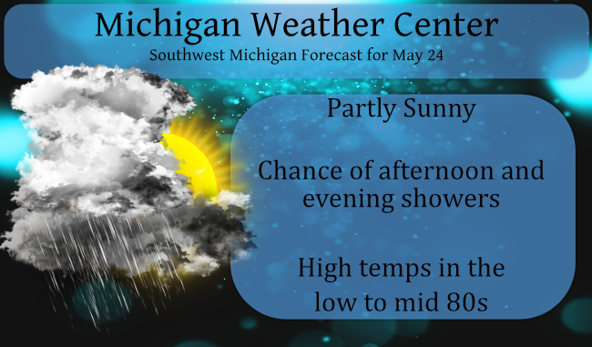
A cold front that passed through on Sunday will return north as a warm front today and tonight, leading to additional scattered showers and storms. With the warm front, temps will return to the 80s for today and tomorrow. After a mainly dry, warm and breezy day on Tuesday, expect numerous showers and storms late Tuesday night through early afternoon Wednesday with another cold frontal passage. Widespread showers return for Thursday night and Friday.
We haven’t reached a half-inch of rain in the Otsego/Plainwell area for the month yet. It appears this week will be our best chance to gain on our rainfall totals. I have noticed most of the farmers have corn trying to come up, I don’t know what the little cornlings are using for moisture to grow but these new hybrids are amazing.
Forecast Discussion
--Warm front returns north today, chance of storms--

The shallow backdoor cold front that came through Sunday evening
has settled south of the state, but bounces back north again
today and tonight as a warm front.

The upper ridge which was flattened on Sunday by a shortwave
gradually re-builds/amplifies today and tonight, but not before a
few additional waves ride along it`s northern periphery through
this evening. This will support a contination of scattered showers
and a few storms.

Latest RAP guidance shows 1000-1500 J/KG of SBCape developing
during the mid to late afternoon east of Hwy 131 and continuing
through mid evening. CAMs suggest that a cluster of tstms could
impact the LAN/JXN/BTL areas during this time frame, where sfc
covergence along the warm front is maximized.

Svr storms are not expected due to limited deep layer shear, but
a localized heavy rain threat will exist given the return of PWATs
near 1.75 inches.

Once any storms this evening end and the warm front continues
lifting north, we should have a predominately dry period from
late tonight into Tuesday with the warm sector becoming
established. Southwest winds on Tuesday may gust at times as high
as 35-40 mph inland from Lk MI with the low level jet overhead
and deeper mixing to 850 mb developing by afternoon.

--Cold front brings showers/storms Tue ngt and Wed--

Coverage of showers and storms expected to ramp up late Tuesday
night into Wednesday morning as a cold front presses in from the
northwest. Deep layer shear increases to over 30 kts as nrn stream
shortwave moves into the Lk Superior Region, but svr wx threat
will be low due to unfavorable time of day for fropa and limited
instability. That said, a localized heavy rainfall threat will be
present until the front clears the area Wednesday afternoon.

--More showers Thursday night and Friday--

Guidance continue to show a system tracking south of MI toward the
end of the week, and now seems a bit quicker with it. Widespread
rain showers expected to arrive Thursday night and continue into
Friday morning, with the possibility of many areas seeing over a
half inch of rain.

Present indication is that sfc ridging will prevail behind this
system over the upcoming holiday weekend, leading to mostly dry
and pleasant weather. Starting out on the cool side Sat, then
temps moderating by later in the extended weekend.

Another warm one. 82 degrees at 3pm with a heat index in the mid 80’s.
Just 9 hundredths of an inch of rain here yesterday, far from what we need. Pretty much all the grass that’s in the sun all day is now brown. Over 80 degrees again today with the dew point in the upper 60’s. What a cool Spring we are having?
After 8 warm days in a row and counting, it appears there is a good chance May will turn warmer than average for the month after a warm March and a warm April. I love it!
Temps in the 50’s this morning feels fabulous let’s keep the heat away going into the holiday weekend…INDY
Welcome back to the blog LOL
At this time it is cloudy and 55 here at my house. I recorded 0.10″ of rain yesterday and overnight. Off to the north of here there was much heaver rain fall yesterday. Along M 20 and more so along M 46 the fields were flooded late yesterday afternoon.
Slim
My wife and me took a road trip up to Bay City yesterday to put flowers on my mom and dad’s grave and had dinner with some friends. On the way up we were in Midland when the cold front came thru the temperature fell like a rock. It fell from 80 to 58 in the matter of minutes there was with no rain with the front but a lot of wind. By the time we got to Bay City the temperature had fallen to 56. We did pick up our family members and went out to dinner. After dinner,… Read more »