I remember back in the day when I was growing up in the 50s and 60s if we uttered the word ‘fart’ we would end up sitting in the corner with a bar of soap in our mouths. Nowadays it is more socially acceptable.
Cattle populations have grown over the past decades to accommodate food and milk resources for human consumption. South Dakota cattle outnumber humans by four to one. In fact, there are nine states where cattle outnumber humans. Michigan ranks 33rd with 9.9 million humans to 1.1 million cattle.
| Rank | State | Human | Cattle | Ratio |
| 1 | South Dakota | 844,877 | 3,650,000 | 4.32 |
| 2 | Nebraska | 1,868,516 | 6,150,000 | 3.29 |
| 3 | Montana | 1,015,165 | 2,550,000 | 2.51 |
| 4 | North Dakota | 723,393 | 1,770,000 | 2.45 |
| 5 | Wyoming | 582,658 | 1,270,000 | 2.18 |
| 6 | Kansas | 2,893,957 | 5,800,000 | 2.00 |
| 7 | Idaho | 1,612,136 | 2,190,000 | 1.36 |
| 8 | Iowa | 3,090,416 | 3,700,000 | 1.20 |
| 9 | Oklahoma | 3,850,568 | 4,300,000 | 1.12 |
There is varying information on the hazard of cow farts on our climate. Some scientists claim emissions from cow farts are responsible for 17 to 20% of carbon dioxide and methane which have an effect on climate change over the past 50 years or so. Others claim less than 1% so there are varying thoughts on the effect of farting/burping cows on our climate.
At Tuscia University in Viterbo, Italy, environmental scholar Giampiero Grossi said methane emitted by ruminant livestock accounts for about 5.5% of the greenhouse gasses that come from human activity. More than 70% of livestock emissions are from cattle, he said.
It’s been estimated that methane gas from cows is 23 times more damaging to the climate than the carbon dioxide from cars. However, the CO2 from cars sticks around a lot longer than methane, contributing more to global warming.
I wonder what effect dinosaurs had on the climate, did their farts cause the warm conditions during that period, I sure wouldn’t want to be standing around when they ripped one-off. 😳
In the words of Roseanne Roseannadanna (Gilda Radner) “it just goes to show you, it’s always something — if it ain’t one thing, it’s another.” Who remembers her from Saturday Night Live in the 70s? We can find all sorts of things to claim climate change over the past century and it’s all up in the air so to speak what is more damaging to our biosphere.
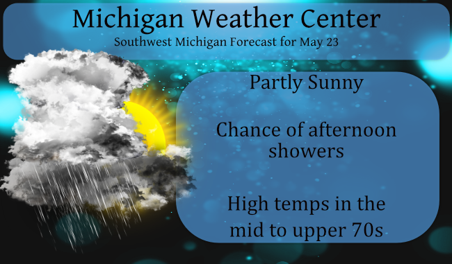
Yesterday we reached 87° and have a low of 63° this morning. We are still below .5 of an inch of rain for the month – the last time it rained was on the 16th with less than a tenth of an inch recorded.
The big question today is will we see some much-needed rain? At this time model forecasts are saying the area from Big Rapids eastward will see 3/4 of an inch of rain with lesser amounts the further south you go. You can see your point forecasts on the main page of this site. Regardless this won’t be a drought buster.
Forecast Discussion
--Afternoon storms with localized heavy rain near Mt Pleasant--

Flattening of the upper ridge occurs today as a shortwave over
Iowa moves to the east-northeast. At the same time we have a
shallow sfc cold front backing in from the northeast.

An area of enhanced low level convergence develops along this
front this afternoon northeast of GRR around Mt Pleasant and Big
Rapids, along with a narrow corridor of SBCapes near 1500 J/KG.
CAMs are similar in showing slow moving tstms developing in this
region this afternoon, resulting in localized heavy rainfall in
excess of one inch and perhaps even two inches.

Outside of the enhanced hvy rain potential northeast of GRR,
shower/tstms chances this afternoon and evening across the rest of
the area will be lower/scattered with much less in the way of
total QPF. Clouds will be on the increase today, with some areas
of fog/dense fog impacting the Lk MI shoreline at times.

--Still summerlike through mid week; cooler to end the week--

Our Sunday afternoon/evening "backdoor" cold front becomes a warm
front on Monday then returns north of the area through midweek. A
few showers/storms will remain possible along this boundary
tonight and Monday until a period of mainly dry conditions arrives
later Monday night into Tuesday in warm sector/southwest flow
regime. It actually turns quite breezy on Tuesday with gusts to
around 35 mph pushing high temps into the mid 80s inland from Lk
MI.

A sfc cold front coming in from the northwest on Tuesday night
looks to set off scattered to numerous showers and tstms which
linger into Wednesday morning. The front clears the area Wednesday
afternoon which ushers in a period of dry/cooler weather.

--Widespread soaking rain possible Friday--

Models have been fairly consistent in tracking an upper low and
sfc system from the cntl/nrn Plains Region to just south of MI on
Friday. Widespread soaking rain is shown to impact srn Lwr MI in
cool northeasterly flow, with the possibility of around an inch
of much-needed QPF. Confidence in Memorial weekend weather
currently low given uncertainly about the upper low and whether
it sticks around or departs to the east.
58* degrees out in my area time for the fans to go off tonight feels great outside …INDY
On the way home from Bay City it was 47 a good part of the way on M 46 and very heavy rain falling.
Slim
Wow we were in Midland when the cold front came thru the temperature fell like a rock. It fell from 80 to 58 in the matter of minutes that was with no rain. By the time we got to Bay City the temperature had fallen to 56. We did picked up our family members and went out to dinner. After dinner the temperature was now down to 50 and very windy. We left Bay City just before 6 and it was 49 with a light mist. On the way home it was light rain until we got to Shepherd where… Read more »
Wow to the wow well over a hour of soaking rain with more on the way woo wooo … Looking ahead to Memorial Day weekend looks cool temperature wise we shall see only 60’s in Ludington Michigan where I’m going perfect fire Weather put the heat away …INDY
Finally received some rain! All five hundredths of an inch of it. Boy is it humid now. Dew point at 70. 👎
The blog is sure quiet lol
Three days in a row at 86 degrees!
82 here already. The temp jumped seven degrees in the past hour. Please, please let us get some rain today.
So walking around the yard this morning I noticed quite a few yellow/brown leaves on the ground. They’re falling from our cherry and ash trees. Not a good sign as either they are stressed from the drought, infected with some disease, or we have skipped right over Summer and are in the Fall already.
Good read MV! Guess I always knew there was a lot of cattle but I’ve never seen the numbers like you posted them. My daughter and her husband are vegans and they claim the main reason is because of cattle methane. On a global scale I’m not so convinced, but who knows.
Great post, MV! I’m not sure about cow farts and their effect on the climate, but it seems plausible. Regardless, I can’t help but giggle. It’s like Uranus jokes. They get me every time. I refuse to totally grow up. Life is too short.
RIP Gilda – an original, a legend
For the 3rd day in a row the official high at Grand Rapids was 86. Gee I wonder with all of the on line gambling if there is a section for weather betting. Anyway the overnight low here has been 63. And there was no rain fall yesterday here as well. The current temperature here is 68 with cloudy skies. We are going up to Bay City for a day trip and it looks like there could be a good cool down in that area later this afternoon. The forecast is for a back door cold front to come thru… Read more »