Past El Nino Winters at GR
This winter season looks to have a strong to very strong El Nino event. That should give us a winter with less snowfall and mild temperatures.
Since 1950 there has been a total of 26 El Nino winter seasons. 11 were weak ones, 7 moderate ones, 5 strong ones and 3 very strong ones. The weak ones were 1952/53, 1953/54, 1958/59, 1969/70, 1976/77, 1977/78, 1979/80, 2004/05, 2006/07, 2014/15 and 2018/19. The moderate ones 1951/52, 1963/64, 1968/69, 1986/87, 1994/95, 2002/03 and 2009/10. The strong ones 1957/58, 1965/66, 1972/73, 1987/88 and 1991/92. And the supper strong ones 1982/83, 1997/98 and 2015/16. So How did the past El Nino winters play out here in Grand Rapids? I will look only at the strong and very strong events at this time. At Grand Rapids the average meteorological winter mean is 27.3° and the average cold season snow fall is 77.6″
Here is a list of the strong El Nino’s and the departures if colder than average for October and the mean temperature for that winters meteorological winter winter and the cold season snow fall. 1957/58 October departure -3.2 meteorological winter mean 24.9 season snow fall 70.3. 1965/66 October -1.6 meteorological winter mean 26.0. snow fall 67.0 1972/73 October -5.4 meteorological winter mean 25.5 snow fall 65.5. 1987/88 October departure -6.5 meteorological winter mean 24.3 snow fall 64.2. 1991/92 November departure -4.3 meteorological winter mean 29.6 snow fall 88.7. During strong El Nino winters at Grand Rapids the average mean for the meteorological winter was 25.3 for a departure of -1.4° and the average snow fall was 71″ (with a range of 88.7 to 64.2)
This winter is forecasted to be a very strong El Nino so now on the 3 supper strong El Nino winters.
1982/83 October mean was 53.5 (+2.0) November mean was 40.8 (+0.8) there was 5.2” of snow fall and 5.36” precipitation. December had a mean of 36.2 (+5.8) there was 8.2” of snow and 6.49” of precipitation. That Christmas had a record high of 65 and there was a thunderstorm. January had a mean of 27.6 (+2.8) 1.33” of precipitation and 5.7” of snow fall. February had a mean of 30.9 (+4.3) 1.12 precipitation and 2.9” snow fall. The meteorological winter was 31.6 and there was just 35.9” of snow fall of that 13.2” came in March.
1997/98 October had a mean of 49.9 (-1.6) there was 2.4” of snow fall. November had a mean of 35.6 (-4.4) there was 1.49” of precipitation and 11.3” of snow fall. December had a mean of 31.0 (+0.6) 4.09” of precipitation 11.5” snow. Christmas did have 1” of snow on the ground. January had a mean of 29.5 (+4.7) it was wet with 4.09” of precipitation and 20.3” snow. February had a record mean of 34.1 (+7.5) there was 1.50” of precipitation and just 0.5” of snow fall. The meteorological winter was 31.5 and there was 59.8” of snow fall.
2015/16 October had a mean of 52.1 (+0.6) there was a trace of snow fall. November had a mean of 44.5(+5.5) that is the 3rd warmest at GRR. The month has 4 days in a row of 70+ there was 3.33” of precipitation and 3.5” of snow. December had a mean of 39.1 (+8.7) that is the record for the warmest December at Grand Rapids. There was 3.33” of precipitation and just 2.5” of snow. Christmas was green. January had a mean of 26.0 (+2.9) 2.15” of precipitation and 20.8” of snow. February had a mean of 29.5 (+2.9) there was 2.78” of precipitation and 14.8” of snow. For the winter season there was 61.1” of snow and the meteorological winter mean was 31.5. For the very strong El Nino winter seasons the average meteorological winter mean was a mild 31.5 and the average snow fall was 51.96″ so yes we very well could be looking at a mild and much less snowy winter season this winter.
The official H/L yesterday at Grand Rapids yesterday was 54/44 there was 0.04” of rain fall. There were 16 HDD’s there was no sunshine. For today the average H/L is 58/41 the record high of 85 was set in 1953 and the record low of 18 was set in 1974. The record rain fall of 2.13” fell in 1933 and the record snow fall of 1.1” fell in 1976. Last year the H/L was 70/33.
AREA FORECAST DISCUSSION
NATIONAL WEATHER SERVICE GRAND RAPIDS MI
317 AM EDT SAT OCT 21 2023
LATEST UPDATE…
SHORT TERM/MARINE
SHORT TERM
(TODAY THROUGH SUNDAY)
ISSUED AT 317 AM EDT SAT OCT 21 2023
OUR MAIN FOCUS IN THE SHORT TERM PORTION OF THE FORECAST IS ON THE
RAIN EVENT THAT WILL UNFOLD ACROSS THE AREA TODAY.
SKIES HAVE CLEARED OUT MORE THAN EXPECTED THIS MORNING, WITH MOST
OF THE AREA SEEING MOSTLY CLEAR SKIES AS CLOUDS HAVE PUSHED EAST.
THIS HAS ALLOWED FOR A LITTLE BIT OF PATCHY FOG WITH THE GOOD
RADIATIONAL COOLING CONDITIONS AND MOIST BOUNDARY LAYER.
THIS CLEARING WILL BE SHORT LIVED HOWEVER AS MID AND UPPER LEVEL
MOISTURE IS ADVANCING QUICKLY AHEAD OF THE NEXT SHORT WAVE AND
ASSOCIATED SFC LOW MOVING INTO THE REGION. THIS RAIN EVENT DOES
NOT LOOK TO CAUSE MUCH IMPACT FOR THE AREA AS IT WILL MAINLY
PRODUCE LIGHT AMOUNTS OF RAIN MOSTLY UNDER A QUARTER OF AN INCH.
IT WILL MAINLY JUST CAUSE A DREARY FALL DAY FOR THE AREA.
THE RAIN MOVING IN THIS MORNING WILL BE IN THE WARM AIR ADVECTION
PORTION OF THE SYSTEM. THIS RAIN LOOKS TO FALL OUT OF A CLOUD DECK
GENERALLY EXPECTED TO BE AT OR ABOVE 5K FT AGL, WITH LOW LEVEL
MOISTURE LACKING HERE AS THE SFC LOW STAYS WELL SW. THEN, WE WILL
TRANSITION TO THE DEFORMATION PORTION OF THE UPPER WAVE THAT WILL
BE SWINGING THROUGH LATER TODAY. THIS WILL CAUSE SOME FGEN BANDING
TO PRODUCE MORE RAIN FOCUSED NEAR OR JUST SOUTH OF THE I-96
CORRIDOR. THIS SHOULD START ENDING FROM NORTH TO SOUTH AFTER 6 PM,
AND SHOULD HAVE CLEARED OUT OF OUR COUNTIES BY ABOUT 10 PM.
THE AIR BEHIND THIS SYSTEM IS FAIRLY COOL WITH 850 MB TEMPS
DROPPING TO AROUND -2 TO -4C BY 12Z SUN. THIS IS PLENTY COLD
ENOUGH FOR LAKE EFFECT, WITH A FEW LAKE EFFECT SHOWERS POSSIBLE
TONIGHT AND VERY EARLY SUN. THERE ARE MANY THINGS GOING AGAINST
THE SHOWER POTENTIAL HERE. THE FLOW WILL BE FROM THE NNE TAKING
ANY SHOWERS OUT OVER THE LAKE, AND RIDGING WILL BE BUILDING IN
FAIRLY QUICKLY WHICH WILL REALLY BRING INVERSION HEIGHTS DOWN,
EVEN WITH LAKE MODIFIED AIR.
LONG TERM
(SUNDAY NIGHT THROUGH FRIDAY)
ISSUED AT 233 AM EDT SAT OCT 21 2023
RISING HEIGHTS AND SURFACE RIDGING BRINGS FAIR WEATHER SUNDAY
NIGHT INTO MONDAY, THEN RETURN FLOW BEHIND THE DEPARTING HIGH
BRINGS IN MOISTURE WITH LIGHT SHOWERS POSSIBLE BY MONDAY NIGHT.
THERE IS STILL UNCERTAINTY IN THE DETAILS FOR RAIN CHANCES
TUESDAY THROUGH FRIDAY. HIGHEST POPS ARE EXPECTED ON TUESDAY NIGHT
INTO WEDNESDAY AS A FRONT SLOWLY MOVES ACROSS OR STALLS OVER LOWER
MICHIGAN THEN AGAIN THURSDAY NIGHT ASSOCIATED WITH STRONG
ISENTROPIC ASCENT AND UPPER DIFFLUENCE AHEAD OF DEEPENING WESTERN
CONUS TROUGH. THERE IS ENSEMBLE SUPPORT FOR RAIN ON FRIDAY AS WELL
AND ENOUGH DIFFERENCES IN THE DETERMINISTIC MODEL RUNS TO EXPECT
THE CURRENT FORECAST TO SHIFT A BIT OVER THE NEXT COUPLE DAYS.
Detailed Forecast For Grand Rapids
Today
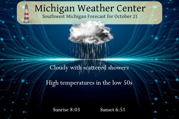
Showers likely, mainly after 2pm. Mostly cloudy, with a high near 48. Calm wind becoming west 5 to 8 mph in the morning. Chance of precipitation is 60%. New precipitation amounts between a quarter and half of an inch possible.
Tonight
Showers likely, mainly before 7pm. Cloudy, then gradually becoming partly cloudy, with a low around 38. North northwest wind around 10 mph, with gusts as high as 18 mph. Chance of precipitation is 60%. New precipitation amounts of less than a tenth of an inch possible.
Sunday
Mostly sunny, with a high near 52. North northwest wind 7 to 10 mph.
Sunday Night
Mostly clear, with a low around 33. West northwest wind around 6 mph becoming calm in the evening.
Monday
A 20 percent chance of showers after 2pm. Partly sunny, with a high near 54. South wind 5 to 11 mph.
Monday Night
A chance of showers between 8pm and 2am. Mostly cloudy, with a low around 47. Chance of precipitation is 40%.
Tuesday
A 40 percent chance of showers after 8am. Mostly cloudy, with a high near 65.
Tuesday Night
Showers likely and possibly a thunderstorm. Mostly cloudy, with a low around 55.
Wednesday
Showers likely, mainly before 2pm. Cloudy, with a high near 63.
Wednesday Night
Showers likely, mainly after 8pm. Mostly cloudy, with a low around 50.
Thursday
A chance of showers. Mostly cloudy, with a high near 58.
Thursday Night
Showers likely. Mostly cloudy, with a low around 47.
Friday
A chance of showers. Mostly cloudy, with a high near 56.
GO BLUE!!!
I was colder as usual than surrounding areas last night. It was 33 degrees this morning with some patchy frost. Coldest morning of the season so far. I now sit at 38 with some light rain.
Bring on winter and the RDB says near to above normal snowfall! Rock n roll baby!