After the clouds departed we had a rather nice day in SW Michigan. Our high temp yesterday was 57° and the low 31°. We should exceed that today with lots of sun and temps in the low to mid-60s. Tomorrow will be another warm day with temps in the low 60s though we will have increasing chances of rain.
Yes, springtime is in the air (the spring equinox is on Sunday). We were watching several red-bellied woodpeckers chasing after the females and making all sorts of racket yesterday.
Weather History for SW Michigan
March 13
1990: A spell of record warm weather continues across Lower Michigan with temperatures in the 70s. Lansing hits 74 degrees during a string of four straight days in the 70s.
1993: The Superstorm of 1993 dumps three to four feet of snow across the Appalachians and draws down record cold arctic air across Lower Michigan. High temperatures struggle to reach the lower 20s with gusty winds making it feel even colder.
March 14
1904: A snowstorm drops up to a foot of snow across Lower Michigan with record daily snowfall of 10.5 inches at Grand Rapids, 10 inches at Lansing and 8.0 inches at Muskegon. This snow would contribute to some of the worst floods on record in southwest Lower Michigan when it melts off during the last week of the month.
2019: Thunderstorms with heavy rain combined with snowmelt and frozen ground bring significant flooding across parts of central Lower Michigan. Newaygo County saw the worst flooding, with more than 150 homes and 9 businesses flooded, as well as the closure of more than 100 roads and the complete washout of more than 30 roads. The flooding continued for several days with damage estimated at nearly 2 million dollars.
March 15
1912: Cold and snow continue during a very wintry month. Lansing sets a daily snowfall record with 11.5 inches and Grand Rapids with 5.2 inches. Lansing falls to one degree below zero the next morning.
1990: Four days of record warmth culminates with highs of 77 degrees at Lansing, 75 at Grand Rapids and 72 at Muskegon.
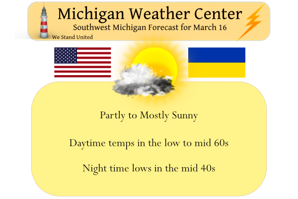
March 16
1945: The warmest March on record in southwest Lower Michigan produces record high temperatures in the 70s.
March 17
1943: Heavy rains and melting snow result in flooding across southwest Lower Michigan. Childsdale Dam on the Rogue River gave way. Several families were evacuated from Comstock Park near Grand Rapids.
1973: A record snowstorm dumps over a foot of snow across southern Lower Michigan. Jackson is buried under 19 inches of snow and Lansing has a record 16.5 inches.
March 18
1925: The Tri-State Tornado kills 695 people and injures over 2,000 along its 219 mile-long damage path through Missouri, Illinois and Indiana. It is by far the worst tornado in United States history. The weather in Lower Michigan is relatively tranquil with highs in the 50s and rain changing to snow during the night.
March 19
1885: Lansing falls to 11 below zero during a string of eight straight days with low temperatures below zero. It is the coldest March on record there.
Weather History for SE Michigan
March 13
On March 13, 2017, a clipper brought widespread 1 to 2 inches of snow accumulation to SE Michigan. With easterly winds off of Lake Erie, lake enhancement leads to a small area of 3 to 6 inches in the Detroit Metro area. Thousands of area residents were still without power during this event due to the record March 8th wind storm a few days prior.
Also on March 13, 1990, the overnight temperature dropped to only 59 degrees in Flint, which is the record maximum low temperature for the day. This was also the second day in a string of four days (March 12-15) that record maximum low temperatures were set.
March 14
On March 14, 2019, a tornado outbreak occurred across the I-69 corridor during the afternoon and evening hours. 4 tornadoes developed from a line of severe storms – an EF0 near Corunna, an EF2 near Vernon, an EF0 near Flushing, and an EF0 near Genesee Township. The Vernon EF2 tornado had max estimated winds of 125 mph, was on the ground for 20 minutes, and had a path length of over 18 miles as it tracked northeast. Thankfully no injuries were reported from these storms, but numerous homes suffered damage.
On March 14, 1997, low pressure tracked across Southeast Lower Michigan. The storm brought widespread precipitation, mostly in the form of freezing rain, to Southeast Michigan from late on the 13th into the morning of the 14th. Total precipitation amounts ranged from around an inch to nearly two and a half inches. In the Detroit Metropolitan area, the ice storm resulted in power outages to over 425,000 homes and businesses; one of the largest outages in history. Several thousand residents were without power for as long as 4 to 5 days. In addition to powerlines, falling trees damaged dozens of cars and houses throughout the area.
March 15
On March 15, 1990, the temperature rose to 77 degrees in Detroit, a record high for the day at the time. This marked the fourth day in a row (March 12-15) that record daily highs were set.
On March 15, 2012, thunderstorms produced three rare early-season tornadoes. An EF0 caused minor damage in the town of Ida in Monroe County. In Lapeer County, trees were uprooted and a home was moved off of its foundation when an EF2 struck on the same evening. The most destructive tornado, an EF3, struck the town of Dexter with winds estimated between 135-140 mph, causing extensive structural damage and destroying multiple homes. Of the 13 March tornadoes ever recorded in SE Michigan, 4 of them occurred in March 2012.
March 16
On March 16, 2004, a snowstorm began over Southeast Lower Michigan that dumped 7.0 inches of snow on Port Huron. The storm lasted through the 17th.
March 17
On March 17, 1973, a powerful winter storm hit all of Southeast Michigan. The storm started on the evening of March 16, 1973. Detroit received 9.9 inches, Flint had 13.7 and Saginaw was buried under 21.3 inches. This storm stands as the 3rd heaviest snowfall in Saginaw history and the 4th heaviest in Flint history.
March 18
On March 18, 1959, the overnight temperature dropped to 3 degrees in Flint, setting the record for the lowest overnight temperature for this day in Flint.
March 19
On March 19, 1921, the Detroit area experienced a minimum temperature of 32 degrees right after midnight, which rose slowly to 42 degrees at 8 am and then rose very quickly to a high of 76 degrees at 3 pm.
Also on March 19, 2012, Flint and Saginaw saw their high temperature soar to daily records of 80 degrees. Flint has only reached 80 degrees or warmer in March a total of 6 times in its climate record, with most (4) of them coming in March 2012. Saginaw has also done it 8 times, with half of them also occurring in March 2012.
Forecast Discussion
...Warm today and Thursday, then rain...

High pressure over Ontario continues to move east. As a result,
winds have turned to the southeast and are advecting in slightly
higher dewpoints over temperatures in the lower 30s. This has caused
some fog to develop, but will burn off after sunrise leading to
partly cloudy skies. Temperatures will climb into the 60s today and
Thursday before a cold front approaches late in the week.

The 00z model run shows the ECMWF and GFS in pretty good agreement
with the movement of a sfc low from the Sooner state northeast
toward Michigan. Confidence has increased that we`ll see measurable
rain from this system and that much of the precipitation will be
rain. That`s good news considering areas north of I-96 are
abnormally dry with moderate drought conditions noted in parts of
Mason and Lake counties.

Light rain will develop Friday morning and continue into Saturday
before ending Saturday afternoon. It`s possible a little wet snow
may mix in with the rain as it begins and ends across the northern
cwa.

The next decent chance of rain will come next Tuesday when another
southern Plains low makes a run at the Great Lakes.
It was a beautiful Spring day today. The birds have been busy looking for places to nest. I sure like hearing them sing in the morning.
Some people said the NWS tends to talk more about upcoming cold than heat . I don’t believe that at all and just as proof I don’t see a bias here in some of these discussions from 2012. Here is a section from 7/5/2012 issued by GRR. HEAT RELATED HEADLINES CONTINUE TO LOOK GOOD. STILL EXPECTING THE HIGHEST HEAT ACROSS THE SOUTH THE NEXT COUPLE DAYS. 850MB TEMPS CONTINUE TO WARM SLIGHTLY EACH DAY…SO TRIPLE DIGITS LOOK LIKELY IN AREAS FROM GRR TO THE SOUTH AND EAST THURSDAY AND FRIDAY. DEW POINTS AROUND 70 SHOULD PUSH HEAT INDEX READINGS INTO… Read more »
The some people is just mookie! His warm weather bias is off the charts to the point of utter absurdity!
What an amazing day. It was close to 70 where I was in Allegan County. Looking foreword to more days like this.
This isn’t possible is it? Snow till April!
https://www.pivotalweather.com/model.php?p=snku_acc&fh=384
Wow!!! You are completely nuts!!! Your trusty model says Washington DC will be seeing around 16 inches of snow between now and the end of March! LOLLLLOLLLOLLOLLOLOOLL!!! Give me a break!!
https://weather.com/weather/tenday/l/303b0e8e1241fc4aa6917782fcb6acc5e397301c948a6bda6c311c30e4c5f84f
False, it is not a trusty model! Get your facts straight!
Get ready for a couple lousy weather days Fri and Sat! Cold and rainy = horrible! Give me cold and snow over a cold rain any day!!
Who cares, as long as it’s not snowing I’m happy!!
20 degrees above average. It’s nice to have the window open to get some fresh air inside.
I hate the new Wood web site! Horrible!
Sister station WLNS went that way a couple of months ago. It takes some getting used to.
Horrible esp, because it is supposed to be an improvementI will probably switch stations and find a good web site!
I didn’t like the update on the Storm Team 8 radar on there app either. I downloaded one from another state that is the same as what there’s used to be
The Michigan Weather Center has the best radar. Just sayin.
Friday = rain and temps in the low 40’s! Maybe mookie and Andy will be golfing?
Good thing Sunday will be a great day for golf!!
Sunday
Sunny, with a high near 52.
Sunday Night
Mostly clear, with a low around 34.
You guys really have low standards to call Sunday a good golf day! Most of the day temps in the 40’s with a 15 to 20 mph wind. Wow!
While it is unofficial I now have a temperature of 66. The official 3PM reading at GRR was 62. 67 at Kalamazoo. 64 at Holland and Lansing. All in all a very mild March 16 in west Michigan.
Slim
Forget golf, low temps in the 20’s and 30’s all week, rain and wind rolling in and golf courses soggy and the grass not even growing yet! I will wait till real golf weather hits with sunny and higher temps! Incredible!
This is ridiculous, especially coming from someone who enjoys skiing in slushy man made snow.
Conditions are perfect! Grass is hard and short. Reminds me of golfing in Arizona. Lots of roll!
If you think golf course conditions are perfect in Mi in March, are are nuts! I would never waste my money on golf with such horrendous conditions! The grass is still dormant! Give me a break!
But you waste tons of money driving 4 hours north to ski on trash slush!!
lol and more false comments!
Phew! It’s going to be so nice the next few days. Time to get out the golf clubs and the BBQ!
The official high at Grand Rapids yesterday was 50 the official overnight low at GRR was 28 the low here at my house was 26 and at this time it is partly cloudy and 29 here at my house with a good amount of frost. The record high for today is 79 set in 2012 and the coldest maximum is 13 set in 1900 for a spread of 66° The record low for the date is +3 set also set in 1900. Last year the H/L was 42/28 the last time it reached 60 or better on any March 16… Read more »
Wow that is quite the spread. A high of 13 vs 79, a difference of 66 degrees!
Looks like the difference between the low and high today will be somewhere around 30 to 35 degrees. Frosty white outside this morning.