For what it is worth, the CPC is giving us warmer and dryer than normal conditions for the rest of the month into early August. August is predicted to be warmer than normal with equal chances of above or below normal rainfall.
[columns] [span6]
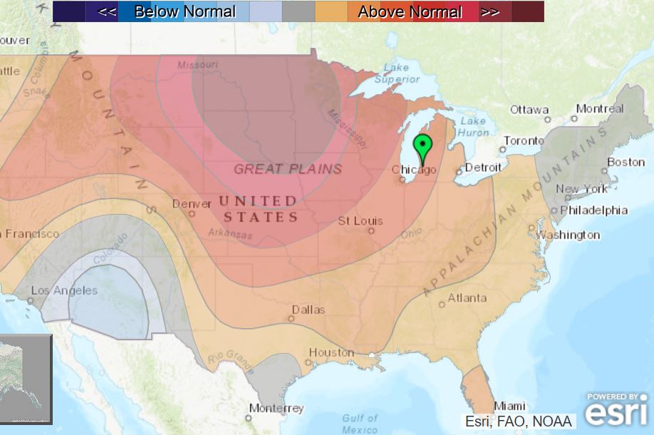
6 to ten day
[/span6][span6]
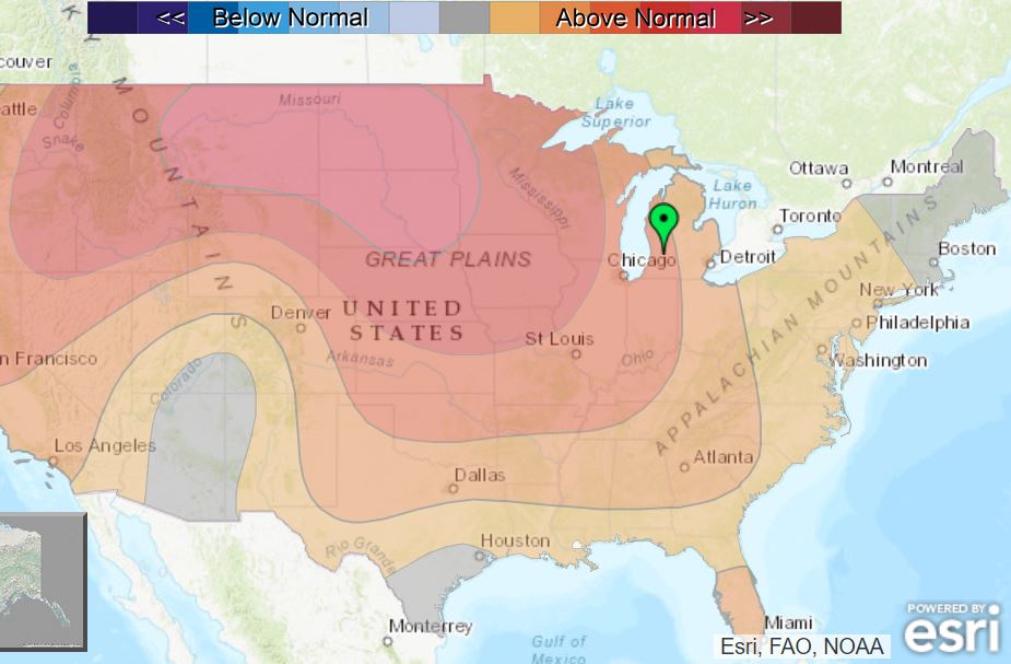
8 to 14 day
[/span6][/columns]
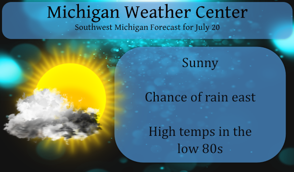
Rainfall chances today will be well inland probably east of Battle Creek and Ionia. On the western side of the state, the story will be the increasing winds up to 25 mph which will cause hazardous swim conditions on Lake Michigan. Our next chance of rain will come late Thursday on into the weekend.
Forecast Discussion
- Isolated thunderstorms this afternoon

A backdoor cold front tracks down from the north later this
afternoon into the evening. Decent instability is progged with ML
CAPE values topping 1500 J/kg and DCAPE up around 1000 J/kg.
However moisture is limited and expected to keep the risk in our
CWA low for storms today. If they do get going...any stronger cell
could lead to gusty winds. The main window for storm is from 19z
to 23z. They should remain east of a Grand Rapids to Battle Creek
line.

- Additional storms Thursday into the weekend possible

A weak low level jet moves in Thursday into Thursday night from
the west. Elevated instability builds which should allow for a few
showers and thunderstorms. A frontal zone remains over the region
into Saturday when a stronger low level jet arrives...later into
the day and into the night. Deep layer shear increases then and
the instability will be greater. Thus a risk for organized storms
looks possible. So in addition to a risk for some stronger
storms...locally heavy rain will be possible. PWAT values climb up
to around 1.75 inches...supporting that risk.
Thundering here again. Go figure.
This has to be one of the thicker smoke layers I can remember seeing. Yesterday afternoon the sun was a golden-copper color, and the sunsets the past couple nights have looked really strange. The sun completely disappears about 20 minutes before even reaching the horizon.
I would agree that the past few days has seen some of the most smoke I can remember. So far today there seems to be a little less smoke and there is more blue in the sky. I wonder how much the smoke cut down on yesterdays high temperatures and if it held up the overnight lows the last couple of days. The overnight low here was 63 and the airport the low was 65 at the current time it is 71 both here and officially at GRR with hazy sunshine. Like I said there is more blue than yesterday… Read more »