As you have probably noticed we have milky skies above us off and on over the past few weeks which is caused by fires out west and in Canada. The jetstream has pulled in smoke from British Columbia, central and southern Canada last week which is a tinderbox as it is in the American west. 70% of these fires were caused by lightning – over 700,000 lightning strikes were recorded between June 30 to July 1st in British Columbia.
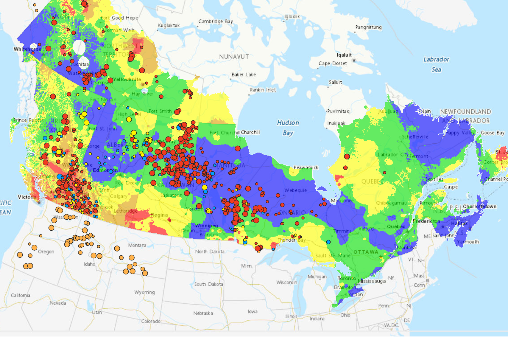
Seems there are active fires over a large area of Canada and the American NW due to extreme temps and dry conditions in the plains and large forested regions. Temps in Lyton BC have reached 121°F which is hot by Canadian standards (or in the U.S. for that matter). Below is a map of active wildfires in Canada alone (red Dots):
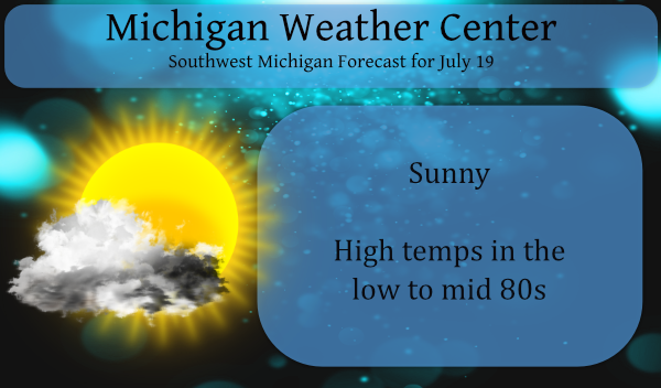
Luckily we have seen our conditions improve over the Great Lakes region over the past few weeks. This week will be comparatively dry with warm temps as it should be in the latter half of July. Today we will see mostly sunny skies with the haze once again overhead from smoke from the mentioned fires. The best rain chances this week will be Tuesday evening and Thursday night.
Forecast Discussion:
- Fairly Quiet Pattern This Week

Synoptic pattern shows Western CONUS upper high with downstream
trough axis across the Northeast prevailing this week. The central
Great Lakes are in a northwest flow regime on the western edge of
the trough with a series of frontal passages bringing the chance
for showers and a few thunderstorms Tuesday evening and Thursday
night. Severe weather threat is very low with both of these as
moisture and instability is limited. Temperatures will be near
seasonal averages through the week.

- Stormy Weekend Possible

Shortwave trough moving over the western ridging could bring a
better chance of thunderstorms Saturday and or Sunday although at
that time range ensemble spread makes any details lack confidence.
Ingredients appear to be there for some storms with at least
potential for heavy rain and maybe low end severe threat.
The sun was beautiful this evening. Red with a haze by it.
MV – do you know what the blue, yellow, and orange dots represent?
It is odd that there wasn’t a legend provided on the map…
Yesterday official high at Grand Rapids was 83 and that is exactly average. The overnight low here was 60 and the official overnight low at GRR was 63. For July the current mean is 71.5 and that is a departure of -1.3. At this time it is 63 here with white skies due to all the the smoke. While the sun is shining thru that thick smoke giving it a kind of reddish tint. It sure looks hazy out at this time.
Slim
We may get some really cool sunsets. 😎