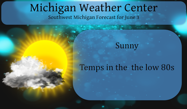
Temperatures will continue to climb for the next several days, and so will the humidity as dew points increase. Highs around 80 are expected Thursday, mid-80s Friday, and upper 80s over the weekend. We don’t see many chances for rain through the weekend. We have some fog around this morning which will dissipate bringing us sunny skies for today.
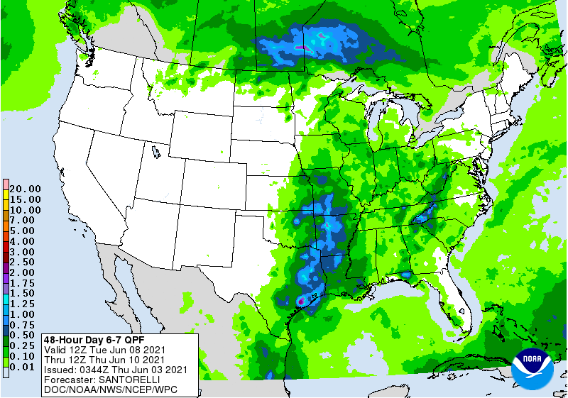
The big question is when will it rain? Model forecasts have teased us with rain and pattern flips for several weeks now, this is why I don’t put much stock in long-range outlooks. The only thing which has been flipping back and forth are the temps. Many areas are up to six inches below normal for the year which is a bit concerning especially for the farmers who don’t have irrigation. Looking at QPF predictions for the next two days I am not seeing more than a few hundredths of an inch if that.
Below is the QPF forecast for next Tuesday through Thursday which shows around a tenth of an inch or less for most of the state
Forecast Discussion
- Patchy dense fog to start the day today

Fog and low clouds have been developing over the past couple of
hours as temperatures cool off into the 50s.  Guidance continues to
show the fog expanding toward daybreak.  Lakeshore areas and
northwest zones are at the least risk for dense fog. A few spots
like MOP and AMN have been under a half mile at times recently.  For
now...not enough confidence to go with a headline but will need to
monitor the trends closely. We will mention the risk in the
Hazardous Weather Outlook and on Social Media.


- Increased risk for thunderstorms tonight...need to monitor Fri
night

Moisture has been trending upward with the mid level wave moving in
tonight. Guidance has also shown more qpf with recent runs. There
will be some instability around and low level wind fields are
suggesting gusty conditions with the showers and possible storms.
It is also worth noting that there are currently more storm in
Manitoba with this upstream wave than the models were forecasting.
So we will bump up the POPs and mention possible wind gusts with
any storms. Severe risk looks low but I would not rule out some
gusts topping 30 knots.

Friday night 850 mb and 925 mb wind speeds increase considerably
across the Northern Great Lake region.  This is in response to
another mid level wave that will be tracking into Ontario.  Elevated
instability is shown by the models across Northern Lower MI
including our northern zones.  At this time the main dynamics with
the wave stay up in Canada so we will hold off on increasing POPs in
our northern zones.  Still with some instability over the northern
zones and increasing LLJ...we will need to keep track of trends with
this system.

- Well above normal temperatures for most of the period

Assuming the convection stays north of the CWA Friday night into
Saturday we will be in a steady warm air advection regime. A back
door cold front makes an attempt to move into Lower MI on Monday.
At this time it looks like it will not reach our CWA. Temps at 925
mb of 20 deg C today...low 20`s Fri and mid 20`s Sat support
daytime highs moderating each day with upper 80s to near 90 likely
by Saturday. By Thursday of next week there is a better chance
for a cold front to drop down from the north so we will start
trending the temperature downward a few degrees then.
NWS Detroit calling for a HOT and dry summer. Big surprise. I love it!
Who knew?!??
But where is Rocky and Indy lately?
Taking my meds lol No Drinking smokin and burning a fire what else to do on a beautiful June day?? ….INDY
Warm and dry? Now THAT’s an understatement. 🙂
We’ve been mentioning the lack of convective weather again this spring. Bill just posted this on his blog:
https://www.woodtv.com/weather/bills-blog/who-stole-our-thunder/
Crazy, over a month since a rumble of thunder? That almost seems impossible for this time of the year.
All the coming heat combined with the suns high angle is only going to make the drought worse. The field behind us has corn this year and it’s already showing signs of stress and it’s only 6 inches tall yet. Starting to remind me of 1988 when we just couldn’t get rain and it continued to get hotter and hotter.
For the YTD this year rain fall total at Grand Rapids is 8.55″ in 1988 at the start of June it was 9.83.June 1988 there was only 0.25″ in the whole month of June. In June of 1988 while there were 10 days of 90 or better the overnight lows were not too bad as 10 nights got down into the 40’s and only 6 nights were in the 60 and none were in the 70’s. Now on the dry side This spring was dryer than both 1930 and 1988. This spring GR only had 5.34″ of rain fall that… Read more »
So this year is now the driest start ever? Ouch. Just seen a tractor out in a field on the way home. There was a giant cloud of dust behind it. Reminded me of Pigpen on Charlie Brown.
Not the driest start ever but one of the driest. 1934 the January to June total was 7.30″ and the March, April and May total that year tied this year with 5.34″
Slim
Welcome to the first HOT stretch of summer. And summer hasn’t even officially begun yet. I love it!
The overnight low here at my house was 53. The official overnight low at GRR was 51. At this time it is sunny and 60 here. So far here in my area the grass is still rather green but in driving around town there are now spots were there is a lot of brown showing up. While the forecasted highs from Saturday to next Wednesday are well above average (the average is 77 to 78) the record highs in the time are in the mid to upper 90’s even then we could see some top ten highs reached.
Slim