Welcome to spring, better known as the vernal equinox which begins at 11:06 pm tonight. Between 2020 and 2048, March 19 equinoxes will happen every leap year in Central, Pacific, and Mountain time zones in the United States. In the same period, the years between the leap years will see a March 20 equinox. In 2024, the March equinox will fall on March 19 in all time zones in the United States. There are only two times of the year when the Earth’s axis is tilted neither toward nor away from the sun, resulting in a “nearly” equal amount of daylight and darkness at all latitudes. These events are referred to as Equinoxes. The word equinox is derived from two Latin words – aequus (equal) and nox (night). At the equator, the sun is directly overhead at noon on these two equinoxes. The “nearly” equal hours of day and night are due to the refraction of sunlight or bending of the light’s rays that causes the sun to appear above the horizon when the actual position of the sun is below the horizon. Additionally, the days become a little longer at the higher latitudes (those at a distance from the equator) because it takes the sun longer to rise and set. Therefore, on the equinox and for several days before and after the equinox, the length of the day will range from about 12 hours and six and one-half minutes at the equator, to 12 hours and 8 minutes at 30 degrees latitude, to 12 hours and 16 minutes at 60 degrees latitude.
NWS Forecast
Weather History
1885: Lansing falls to 11 below zero during a string of eight straight days with low temperatures below zero. It is the coldest March on record there.
On March 19, 1921, the Detroit area experienced a minimum temperature of 32 degrees right after midnight, which rose slowly to 42 degrees at 8 am and then rose very quickly to a high of 76 degrees at 3 pm.
Also on March 19, 2012, Flint and Saginaw saw their high temperature soar to daily records of 80 degrees. Flint has only reached 80 degrees or warmer in March a total of 6 times in its climate record, with most (4) of them coming in March 2012. Saginaw has also done it 8 times, with half of them also occurring in March 2012.
1907: The highest March temperature in Oklahoma City, Oklahoma, was set when the temperature soared to 97 degrees. Dodge City, Kansas, also set a March record with 98 degrees. Denver, Colorado, set a daily record high of 81 degrees.
1948: An estimated F4 tornado moved through Fosterburg, Bunker Hill, and Gillespie, Illinois, killing 33 people and injuring 449 others. 2,000 buildings in Bunker Hill were damaged or destroyed. The total damage was $3.6 million.
2003: One of the worst blizzards since records began in 1872, struck the Denver metro area and Colorado’s Front Range started with a vengeance. Denver International Airport was closed, stranding about 4,000 travelers. The weight of the snow caused a 40-foot gash in a portion of the roof, forcing the evacuation of that section of the main terminal building. Winds gusting to 40 mph produced drifts six feet high in places around the city. Snowfall in the foothills was even more impressive. The heavy wet snow caused numerous roofs of homes and businesses to collapse. The estimated cost of property damage alone, not including large commercial buildings, was $93 million, making it the most costly snowstorm on record for the area. In Denver alone, at least 258 structures were damaged. Up to 135,000 people lost power during the storm, and it took several days for power to be restored. Mayor Wellington Webb of Denver said, “This is the storm of the century, a backbreaker, a record-breaker, a roofbreaker.” Avalanches in the mountains and foothills closed many roads, including Interstate 70, stranding hundreds of skiers and travelers. In the Eldora Ski area, 270 skiers were stranded when an avalanche closed the main access road. After the storm, a military helicopter had to deliver food to the resort until the road could be cleared. Two people died in Aurora from heart attacks after shoveling the heavy wet snow. The National Guard sent 40 soldiers and 20 heavy-duty vehicles to rescue stranded travelers along a section of I-70. The storm made March 2003 the snowiest March on record, the fourth snowiest month on record, and the fifth wettest March on record. The total of 22.9 inches is the most significant 24-hour total in March. The storm also broke 19 consecutive months of below-average precipitation for Denver. The 31.8 inches of snow was recorded at the former Stapleton Airport in Denver for its second-greatest snowstorm on record (the greatest was 37.5 inches on 12/4-12/5/1913) with up to three feet in other areas in and around the city and more than seven feet in the foothills. Higher amounts included: Fritz Peak: 87.5 inches, Rollinsville: 87.5 inches, Canin Creek: 83 inches, Near Bergen Park: 74 inches, Northwest of Evergreen: 73 inches, Cola Creek Canyon: 72 inches, Georgetown: 70 inches, Jamestown: 63 inches, Near Blackhawk: 60 inches, Eldora Ski Area: 55 inches, Ken Caryl Ranch: 46.6 inches, Aurora: 40 inches, Centennial: 38 inches, Buckley AFB: 37 inches, Southwest Denver: 35 inches, Louisville: 34 inches, Arvada: 32 inches, Broomfield: 31 inches, Westminster: 31 inches and Boulder: 22.5 inches. This storm was the result of a very moist intense slow-moving Pacific system that tracked across the four corners and into southeastern Colorado, which allowed a deep easterly upslope to form among the front range.
Forecast Discussion
- Small chances of snow North today and Wednesday

The couple of chances of snow up North that we will see today, and
then again Wednesday, will be associated with a couple of different
short waves brushing the area. The circumstances will be far from
ideal with each of the waves to bring much more than a couple of
tenths of an inch across the North.

The first wave approaching the area today is coming in from the WNW.
The first thing going against much precipitation from this wave is
it is expected to shear out as it drops through the area today. In
addition, deep moisture is never really in place. We initially had
some low level moisture that is making its way out currently. By the
time the mid/upper level moisture lowers enough, there is no low
level moisture to help it reach the ground. The best chance where
these layers of moisture will overlap enough to get some snow at the
sfc will be across the U.S.-10 corridor this morning.

The snow chances then end this afternoon as the wave and moisture
moves by, leaving some short wave ridging in place. Then later
tonight into Wednesday, we will see the next short wave approach the
area from the NW. This wave will remain intact and even strengthen a
bit as it approaches. The problem with this wave for precipitation
chances is that the track of it just barely brushes our northern
counties again. Moisture is once again limited for most of the area,
with just a thin layer up around 4-5k ft, and no real depth in our
area.

- Medium to High Confidence for Snow/Mix Late Week

Upper troughing will extend south into the Great Lakes from the
polar vortex across Hudson Bay by Thursday. An area of snow blossoms
in a baroclinic zone across the NW CONUS/SW Canada on Wednesday and
moves southeast along the arctic front, arriving in Lower Michigan
by late Thursday night into Friday. Models are converging on the
evolution of a sfc wave forming along the front, leading to higher
confidence in the chances for some measurable snow. The surface low
is progged to shear out and weaken, becoming an open wave by Friday
with snow and mixed precip diminishing, but it appears that the
timing of the snow will impact travel for the morning commute.

- Low Confidence on Storminess early Next Week

Western CONUS troughing amplifies and goes negative tilt early next
week and a surface cyclone will evolve over the Plains. Ensemble
spread is significant on the details of how this evolves. The
current forecast is most reflective of the GFS with a less highly
amplified solution and snow arriving on Sunday, changing to rain on
Monday. The more amplified, blocky solutions of the ECMWF and GEM
would hold off precip until Monday or Tuesday.
Let it snow, let it snow, let it snow!
Looks like we may have a snow system somewhere in the region on Friday. I guess winter isn’t over yet after all. Who would have thought? Incredible!
Winter weather Advisorys coming that’s a bonus in March!! Let’s Go!! INDY
Woodtv shows 37 for tomorrow, so I guess Mookie and I were right as usual, Kirkwood was WAY off again with his forecast last week as usual!
You guys don’t have a clue! It may be about 37 degrees at midnight, but tomorrow’s afternoon high in GR will be around 27 degrees! Wow! You guys are clearly wrong again!
Kirkwood was spot on again!
Wind chills in the teens all day tomorrow! Thanks for the heads up for this very cold winter day tomorrow!
I wish I could give my furnace a rest I’m thinking it thinking it’s going into Winter again ..DDD ..INDY
Rock on Indy! What a cold winter week! Bring on the snow!!!!!!!!!!!!!!
I see yesterday was yet another below normal temp day! Incredible!
Some people declared winter over months ago! How wrong can they be? Get ready for a WWA later this week! WOW, just wow, WOW!!!!!
If you like nice warm Spring/Summer temps – forget about it! This week = winter temps and you will not see a temp as high as 60 degrees for at least the next 3 to 4 weeks! You will see plenty of highs in the 40’s to low 50’s with wind! Summer temps are many, many, many weeks away, so get used to cold and cool temps!
If you like the cold, enjoy the next few days. Looks like this is the end of it before we glide into summer!
lol!! We won’t see 60 for another month according to Rocky! Make sure we mark that one down Mookie!
As predicted, WOOD had 27 degrees for tomorrow a week ago. It’s now a forecast for 37 degrees. More wishcasting that didn’t turn out!
High in GR is forecast to be 27 degrees afternoon! Great job by Wood and as usual you are 100% wrong! Incredible!
WOOD has 37 for tomorrow LOL
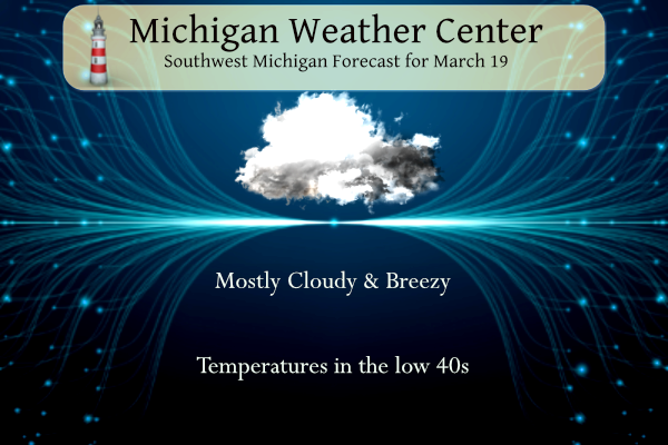
It is a rather windy March day once again. With winds gusting up to near 40 MPH and a temperature of 41 it sure don’t fell like it is that warm.
Slim
What; cold and windy, just wait till tomorrow with wind chills in the teens!!!!!!!!!
I know Bill S mentions that spring (especially now through April) is a good time to be cool. Keeps the tornadoes south and prevents a damaging crop freeze… at the same time, this is still very unpleasant weather. Not enough snow and too warm for winter activities. Way too cold for spring activities. It is good for running, but that’s about it
The official H/L yesterday was 35/25 there was 0.01” of precipitation and a trace of snowfall. The highest wind gust was 29 MPH out if the NW. There was no sunshine. For today the average H/L is now up to 46/28 the record high of 81 was set in 2012 the record low of 0 was set in 1923 the most rainfall of 2.12” fell in 1948 the most snowfall of 3.3” fell in 1971 the most on the ground was 9” in 1965. Last year the H/L was 34/17.
Slim
It looks like WOOD’s temp forecast from last week for a high temp of 27 degrees for this Wednesday was spot on, despite Andy and Mookie blabbing about them being totally wrong and all the other sites showing 59 degrees! Guess what WOOD is correct and Andy and mookie are 100% wrong! Some things never change!
Here is the proof of their ridiculous comments!
WOOD has 27 degrees for a high next Wednesday. I am betting this will turn out to be very wrong. Not sure why WOOD always does this.
March 12, 2024 12:32 pm
Andy W
Andy W
Oh yeah, Kirkwood wishcast big time there!
Ok now do your total seasonal snowfall prediction for this past winter season that you put out in November/December! Some things never change on Rocky being 100% wrong on his snowfall predictions!
I could have predicted this, Andy and mookie have never admitted when they have been wrong! Pathetic!