The warmer temps and rain have caused the grass to start greening up and the early spring flowers to poke up from the ground. We have crocuses blooming in the flower beds.
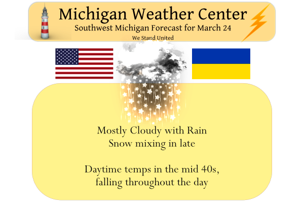
We have had .65 of an inch of rain from this slow-moving low-pressure system thus far in Otsego. Temp is currently 44° at 6 am. Yesterday’s high was 56° and the low 42°. We had a few peeks of the sun in the late afternoon. It will be cloudy today with rain showers mixing with wet snow showers late this afternoon. Highs in the lower to mid-40s. Any rain tonight will change to all snow with little or no accumulation.
As part of Severe Weather Awareness Week, below is a family emergency plan brochure that can be printed (right-click/open in new tab) this will have to be done with all pages.
It is important to have a plan in place for emergencies. As my old Boy Scout mottos says – BE PREPARED!
Do you have a plan?
Where will you go?
What will you do?
Do you know the alert systems in your area?
How will you communicate?
Family Emergency Plan
family_emergency_plan_brochureForecast Discussion
-- Another gray and damp day --

Large, lumbering upper level trough with smaller embedded 500 mb
vorticity lobes encompasses the Great Lakes down to the Gulf
coast. Occluded surface low over Lower Michigan this morning is
elongating toward the northeast as pressure falls shift north of
Georgian Bay but troughing hangs back over Lower Michigan. Low-
level clouds will persist through the day. There will be enough
lift within the clouds to support drizzle or light rain showers
for much of the day. Precipitation becomes more likely later in
the afternoon into evening as saturation and lift return to the
DGZ (which will be around 600 mb today). By that time, the low
levels should cool enough to support a mix or change over to wet
snow, particularly northwest of Kalamazoo-Lansing, before the
steadier precip diminishes with the loss of DGZ moisture late
evening. Would expect drizzly light precipitation to continue into
much of the night, which may become a nuisance in parts of
Central Michigan where temperatures dip to 32 degrees or hair
lower.

-- Cold weekend --

The upper level low or trough will remain in place over Quebec
into early next week, keeping us in northwest flow. A potent
shortwave/Clipper will reinvigorate rain changing to snow showers
Friday evening into the night.

Then a narrow tongue of Arctic air on the back side of the
synoptic-scale trough dives into the Great Lakes for Sunday. The
ECMWF, GFS, and many of their ensemble members continue to show
850 mb air of about -15 C, which would be enough for temperatures
several degrees below 32 even in the afternoon with some sun and
full mixing to 850. Even if highs stay in the mid 20s, it is
unlikely be the coldest day of the month (that honor resides with
March 12 which had highs in the teens). However, normal high
temperatures are approaching 50 this time of year, so Sunday`s
afternoon highs may be a similar magnitude below normal as on
March 12. Also, the record for coldest high temperature on March
27 is in the mid-20s. There is still some degree of uncertainty
for the high temperatures on Sunday, depending on the track of the
narrow core of cold air (not to mention the temperature at 12:01
AM).

-- Unsettled mid-next week --

There will likely be a slow recovery in temperatures Mon-Tue but
it looks mostly dry. Ensembles diverge substantially on
temperatures Wed-Thu, depending on the track and evolution of the
next springtime cyclone developing in the central US. But with
that will come more chances for precipitation.
It’s like snowballs are falling from the sky!!
I am glad somebody else saw those huge snowflakes. They were beautiful! Believe me I don’t really want more snow – I am ready for Spring but they really caught me by surprise.
Wow, what an incredible cold snap and no change in sight!
https://www.pivotalweather.com/model.php?m=gfs&p=sn10_acc&rh=2022032412&fh=240
And a quiet blog ..lol Indy
“For this time of year, having a high below freezing
happens less then 10 percent of the time (xmACIS) so this is
unusual but not unprecedented. The last time this happened was
March 27th, 2015.”
That’s from the NWS. Definitely unusual cold but not unheard of. Sounds like we are not quite done with winter like temps.
Interesting how that works?
Highs in the 30?? Isn’t it Spring?? Lol..InDY
Fun fact I noticed: The angle of the sun in GR almost exactly corresponds to the average temperature each day throughout March. Today the average temp is around 48 and the sun angle is 48 degrees. Works for about the whole month.
This is a coincidence, it does not work all year. For example, the average high is 83 July 1st but the sun angle is 70 degrees. However this does seem to work for several months of the year… Including at least February and April too
That is an interesting factoid. Thanks for sharing.
Let’s review the facts: we have just had 10 above average temperature days in a row, March has been a warm month, March has been below average snow, and we continue to be below average snow on the season. I love it!
Wow, we are entrenched in a cold pattern! Forget doing much outside the rest this week, unless you dress for mid winter! I am considering a trip up to Nubs Nob for one last ski weekend blowout! Absolutly incredible!
The local ski resorts are already closed for the season.
In MBY another 0.25″ of rain fell yesterday and over night night low was 43. At the current time it remains 43 here. I did not hear any thunder or see any lightning but the record books for Grand Rapids will record that there was a thunderstorm event here yesterday.
Slim