Doesn’t look good for spring-like conditions over the Great Lakes region for the next couple of weeks or so, the CPC guesses are for below-normal temps and above-normal precip. The drought outlook for spring doesn’t look good for the western half of the U.S. This doesn’t bode well for the corn, wheat and soybean crops this year. With what is going on in Ukraine and Russia (they produce 30% of the world’s wheat crop) we could see issues for production reaching those countries who need these crops the most.
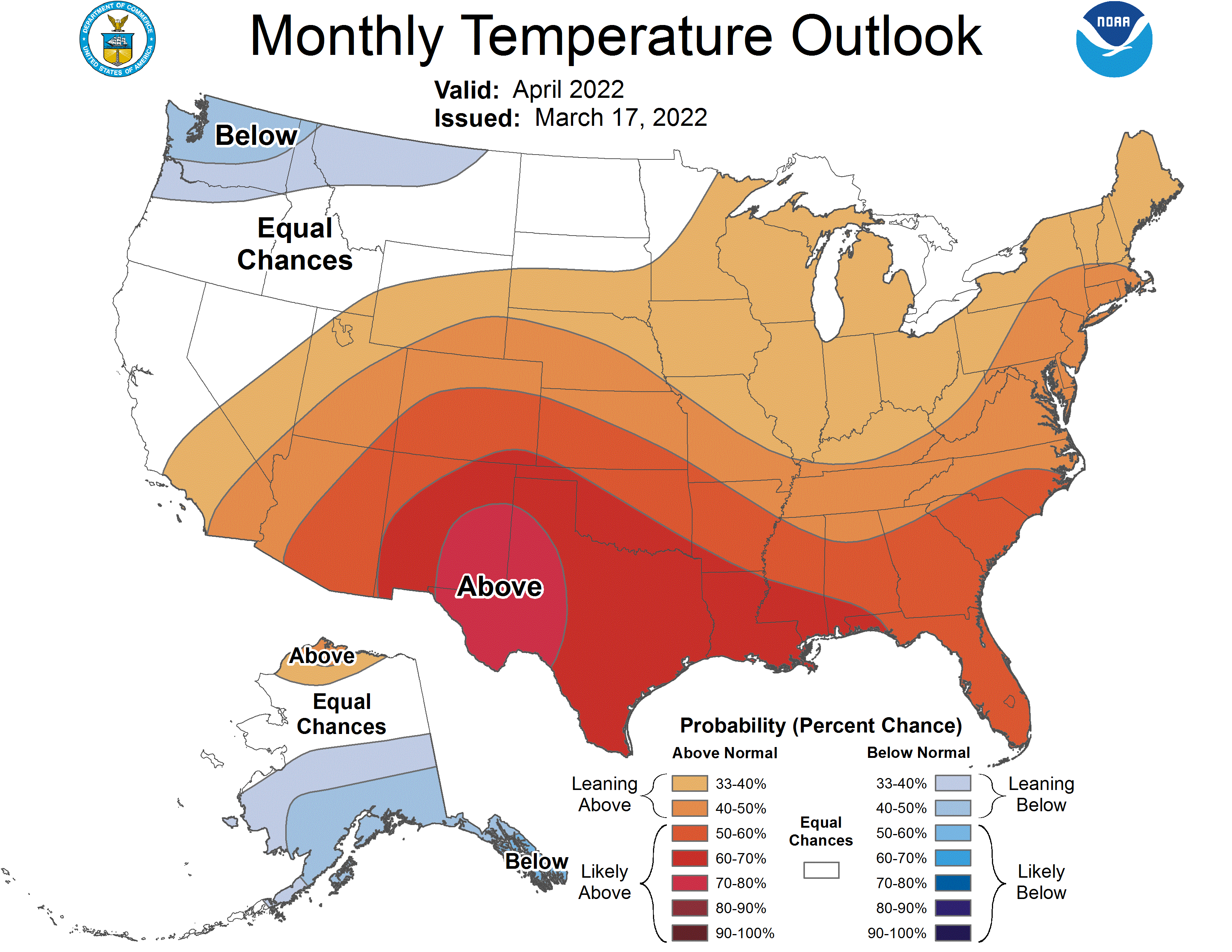
As we get into April, temps will improve to near to above normal and rainfall will be above normal and is to remain so into the late spring.
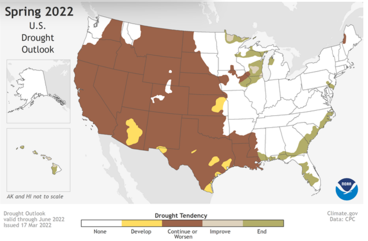
This map depicts where there is a greater than 50% chance of drought persistence, development, or improvement based on short- and long-range statistical and dynamical forecasts from March 17 through June 30, 2022. (NOAA)
“Severe to exceptional drought has persisted in some areas of the West since the summer of 2020 and drought has expanded to the southern Plains and Lower Mississippi Valley,” said Jon Gottschalck, chief, Operational Prediction Branch, NOAA’s Climate Prediction Center. “With nearly 60% of the continental U.S. experiencing minor to exceptional drought conditions, this is the largest drought coverage we’ve seen in the U.S. since 2013.”
Short-term drought recently developed in a region stretching from North Carolina southward through parts of Florida. Dry conditions will bring an elevated risk of wildfires across the Southwest and southern Plains and north to the Central Plains, especially when high winds are present. Drought conditions in the Southwest are unlikely to improve until the late summer monsoon rainfall begins.
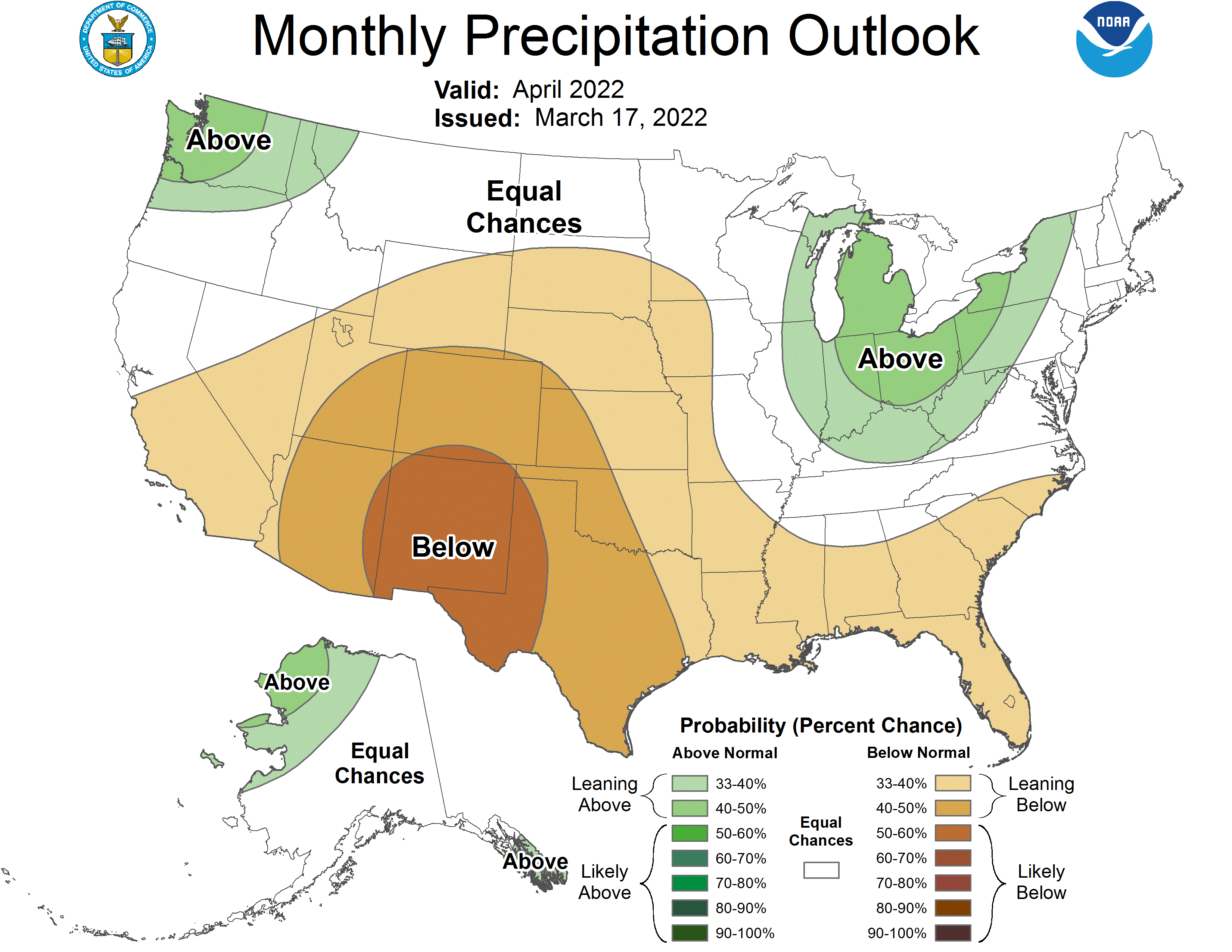
More than half of the U.S. is predicted to experience above-average temperatures this spring, with the greatest chances in the Southern Rockies and Southern Plains. Below-average temperatures are most likely in the Pacific Northwest and southeast Alaska.
Above-average precipitation is most likely in portions of the Great Lakes, Ohio Valley, mid-Atlantic and the west coast of Alaska, while below-average precipitation is forecast for portions of the Central Great Basin, Southwest, Central and Southern Rockies and Central and Southern Plains, eastward to the Central Gulf Coast.
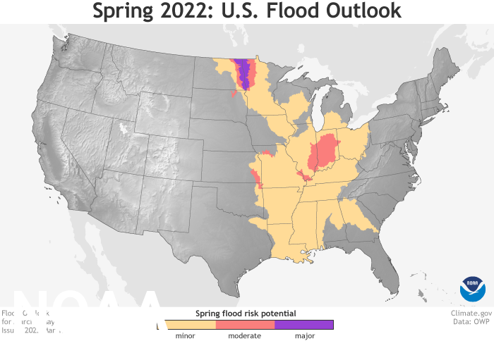
This map depicts the locations where there is a greater than 50% chance of moderate or minor flooding from March through May 2022. (NOAA)
There is a minor-to-moderate flood risk throughout much of the eastern half of continental U.S., including the Southeast, Tennessee Valley, lower Mississippi Valley, Ohio Valley, and portions of the Great Lakes, upper Mississippi Valley, and middle Mississippi Valley. An above-normal ice breakup and flood potential are also present in Alaska.
“Due to late fall and winter precipitation, which saturated soils and increased streamflows, major flood risk potential is expected for the Red River of the North in North Dakota and moderate flood potential for the James River in South Dakota,” said Ed Clark, director, NOAA’s National Water Center.
Spring snowmelt in the western U.S. is unlikely to cause flooding.
NOAA’s National Hydrologic Assessment evaluates a number of factors, including current conditions of snowpack, drought, soil saturation levels, frost depth, streamflow and precipitation.
April Outlook
[columns] [span6]
[/span6][span6]
[/span6][/columns]
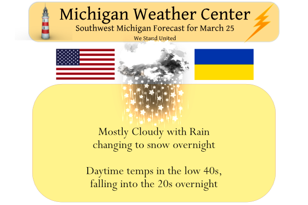
Wow, the cold and snow just keeps rocking! No, not a nice warm early Spring, quite the opposite! A major cold snap is here! Get ready now!
Sounds as if area wide we could see a dusting to 2″ with the potential for a 3″ total for some folks..
From the GR NWS:
“HIGH TEMPERATURES BELOW FREEZING FOR HIGH TEMPERATURES
AFTER THE 25TH OF MARCH IS UNUSUAL. SINCE 1980, BETWEEN THE 25TH
AND THE FIRST OF APRIL GRR, LAN, MKG AND AZO HAVE HAD HAD HIGHS
BELOW FREEZING 3% OF THE DAYS IN THAT TIME PERIOD.”
They say the last time this has happened was 2015, and prior to that 2001. So not unheard of but unusual. And if that wasn’t enough they are saying we could see a surge of warmer air with possible strong/severe storms followed by maybe another slug of colder air. Interesting pattern.
Get ready for the extended cold snap! Get your winter coat, hat and gloves ready to rock!
I was driving around the area yesterday and while the grass in my neighborhood has some green starting to show there are many areas on the north side of town that are very brown and it will take a more rain to get many areas to green up.
Slim
How about not only more rain , but some warmer temps! The ground will be frozen this weekend! Incredible?
Yesterdays official high at Grand Rapids was 48 just before 3 AM and the low was 33 just before midnight. Here in MBY I recorded 0.34″ of rain fall yesterday and overnight there was some snow that mixed in with the rain but it was too warm for any to stick. The overnight low here was 34 and at this time it is 37 here.
Slim
They said it was going to be a cool week but yesterday marked GR’s 11th above average temperature day in a row!
The high yesterday was just before 3 AM not sure many people were out and about to “enjoy” that. But yeah this month has been above average and now has a mean of 37.0 that is a departure of +2.6.
Slim
Yeah I’ve been loving the mild evenings!
Lol…its 36 outside ….Warm Spring night right?? NO!! Indy
We have about one week left of March at a +2.6 degree departure. I’m thinking even with the cool ending to the month it is going to be difficult to go below average. 2.6 is a pretty decent departure from average… I’m guessing we will end up around 1.0-1.5 degrees above average for March
Check out the latest 10 day snow map! Not bad!
https://www.pivotalweather.com/model.php?p=snku_acc&fh=240
Walked out of bar last night and it was snowing great scotty ….Is it the last week of March or what?? InDy
Accumulating snow is in the forecast and the CPC has us entrenched in cold air well into April! What a cold stretch! Incredible!
And a quiet blog through April….lol..InDY
We have had .83 of an inch of rain from the current system moving through the state. Yesterday’s high was 49 and the low 36.