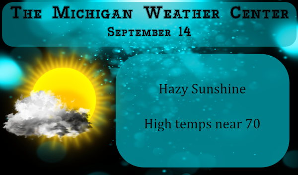
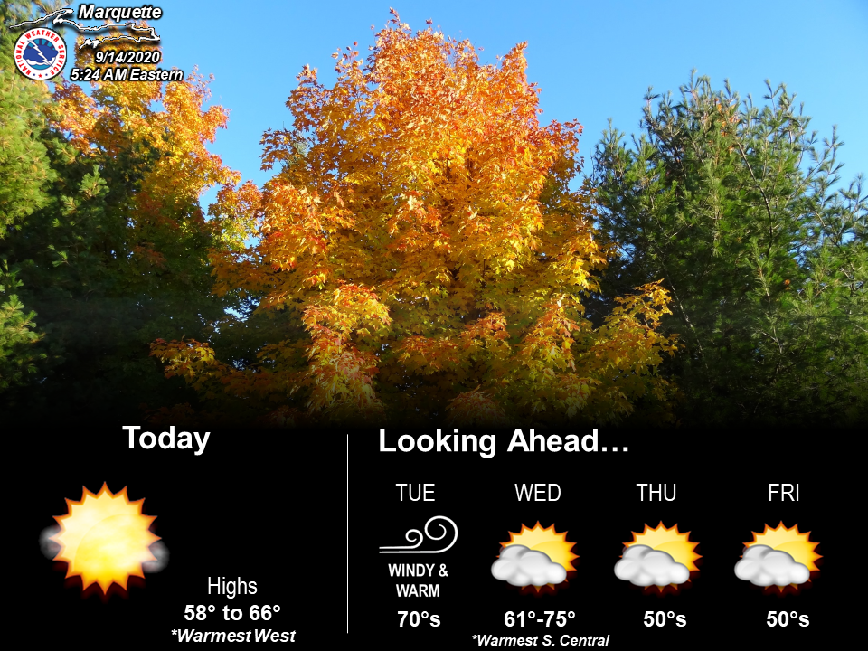
We are looking at a sunny dry period over this week with near-normal temps at least through the first half of the week before cooling back to the 60s the second half. Looking at the NAM, HRRR and GFS precipitation models I am seeing no rain until early next week. Tuesday and Wednesday will be the warmest days of this week with temps in the mid-70s. Low temps may get into the mid to upper 30s to low 40s by the end of the workweek with chances of frost north of I96.
Smoke from the western fires will create hazy milky skies for the next couple days which will create some gorgeous sunrises and sunsets.
Compared to the past couple of years we have had a lot of walnuts falling off the trees. On Saturday morning it was almost as if it were raining walnuts, I wouldn’t want one falling on my head. This year they are larger also. We have a lot of squirrels that bury them in the yard. We find small holes where they dig them out through the year, the ones they miss grow into new trees.
[columns] [span6]
SW
[/span6][span6]
SE
[/span6][/columns]
[columns] [span6]
North
[/span6][span6]
U.P.
[/span6][/columns]
Forecast Discussion
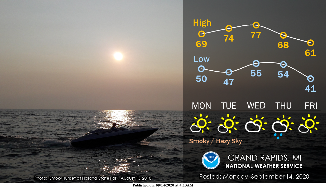
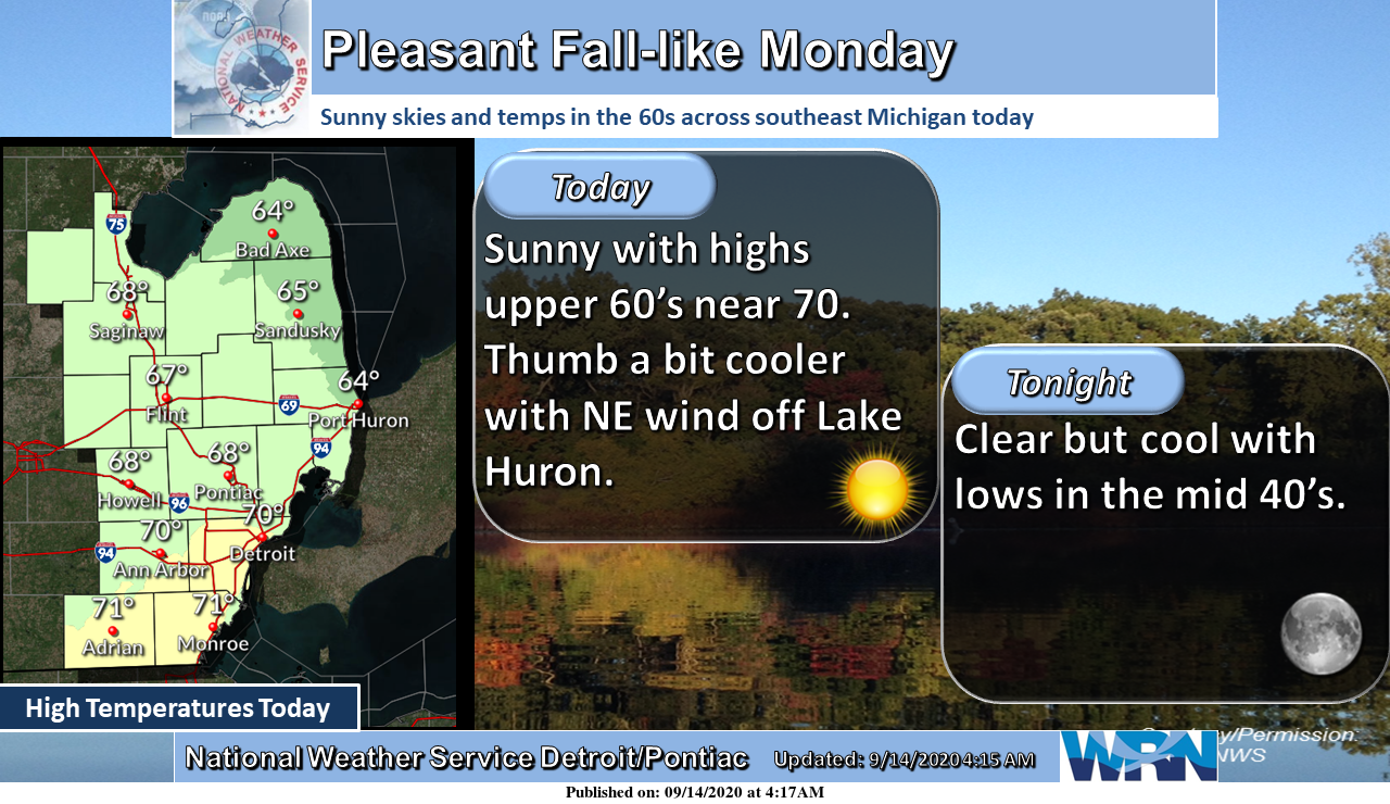
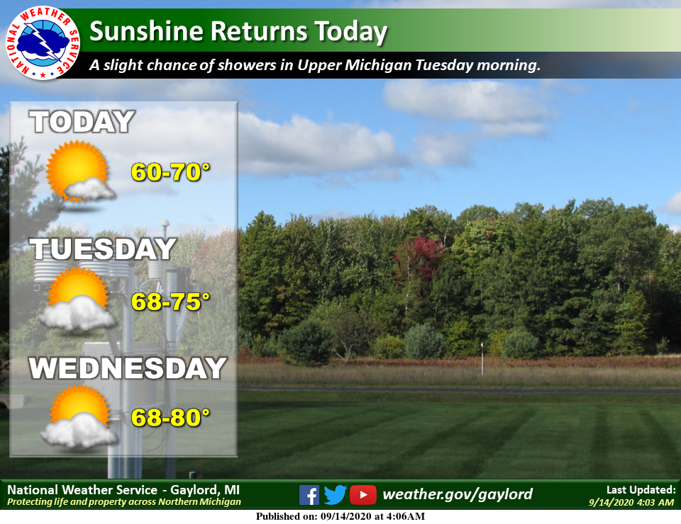
-- Mainly dry/comfortable week, smoky skies --

Dry pattern prevails this week as surface ridging and low dew
points dominate. Smoke from western fires caught up in the
northwest flow aloft will be streaming into the area, at least for
the next couple days per latest RAP guidance. So while plenty of
sunshine is anticipated it should be more of a hazy/milky looking
sky. Some brilliant sunrises/sunsets with deep oranges and reds
will be possible due to the smoke layer aloft.

We are dealing with some patchy fog early this morning as well as
a low cloud deck sliding down from the north. Both of these are
expected to mix out/dissipate early today.

-- Warming through Wednesday, then a cool down --

Surface high center drifts across the nrn GrtLks Rgn today then
moves to the Mid Atlantic on Tuesday. After light winds with
highs around 70 today, increasing southerly flow on the back side
of the high will send highs into above normal territory for
Tuesday and Wednesday with highs in the mid to upper 70s.

Sfc cold front slips south through the region on Wednesday night
and early Thursday, but offers little potential for rain due to
limited moisture. Probably just a period of low clouds and
drizzle/sprinkles with the frontal passage before the next sfc
high builds in from the northwest later Thursday into Friday.

-- Chilly weekend with patchy frost --

The period of stronger north/northeast winds late in the week
behind the cold front delivers a rather chilly air mass for mid
September, with H8 temps around or slightly below 0C and dew
points in the 30s. As the next 1035 mb sfc high settles overhead
by 12Z Saturday, this sets the stage for a decent risk of frost on
Friday night with winds going light/calm. Models diverge on how
quickly the sfc high departs next weekend, but frost may be
possible again on Saturday night. Most at risk would be areas
north of I-96.
Five tropical cyclones at one time the Atlantic. Hasn’t happened since 1971. Almost through the alphabet. I believe that has only happened once before, as well.
A beautiful 64* degrees out at thee YARDofBRICKS NE of GR this weather would be wonderful durring the summer it’s perfect outside FALL …INDY
It feels like a beautiful Fall day outside. It is sunny but hazy but atl least the air doesn’t smell like last night. It is 63 degress here at my place.
Looking out as far as the eye can see lots of 60’s and a few low 70’s no 80’s I’m thinking mookikee was giving us Floridas forcast last week lol…Such a cool Fall we are having the leafs are changing colors about a month or a little less from now we will be at peak…..Feels so fresh outside Fall love it!!…Have a super Monday!! INDY
The departure from average so far this September at Grand Rapids is at -2.6. Some other sites with cooler that average means so far are Flint -2.1. Alpena -3.1 The Sault -4.0 and at Marquette they are at a whopping -6.3 so far this month.
Slim
Lots of 60’s coming up keeping September below average forget the heat ….INDY
51° here at this time with a kind of milky sky that is either smoke or high fog. My guess it that it is smoke.
Slim
The sun set last night had a rather “bronze” tint to it last night. Looked odd but I was guessing it was from the smoke. What a mess out West with the fires!
It looks like another of many below normal temp days! What a stretch!
I have lost count last month lol….FALL INDY