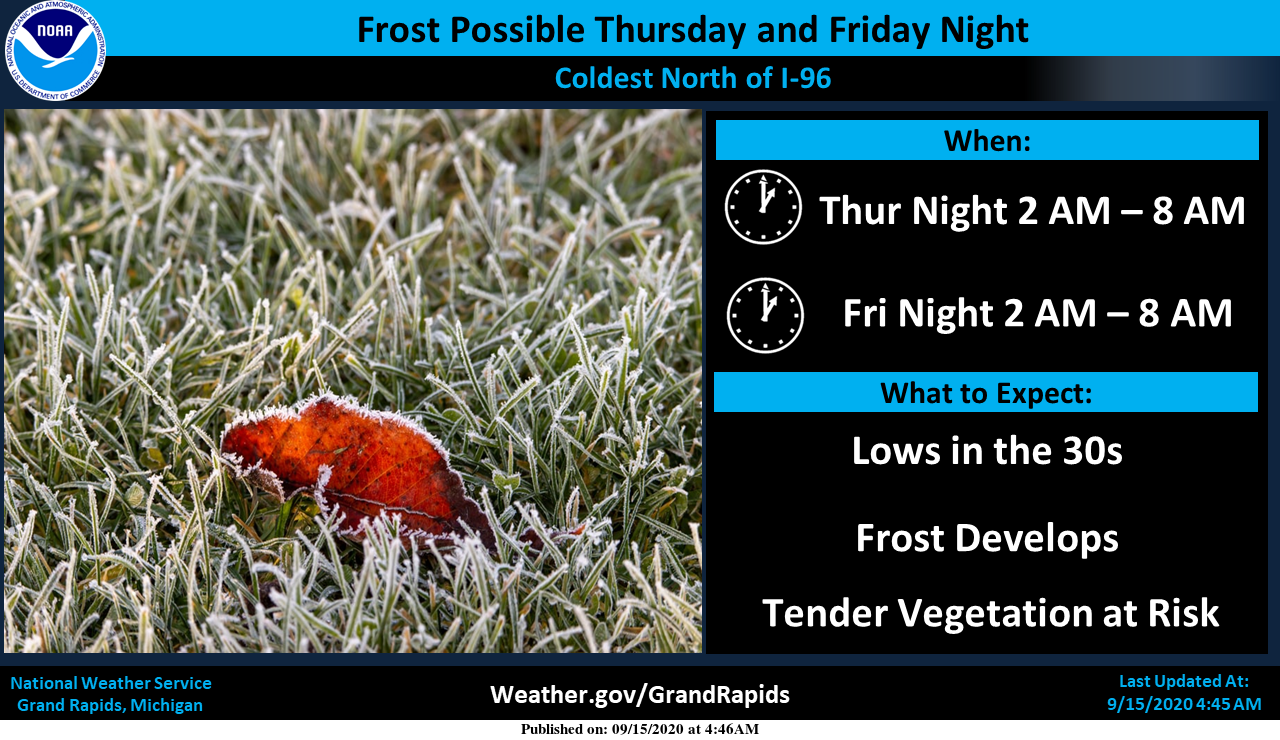
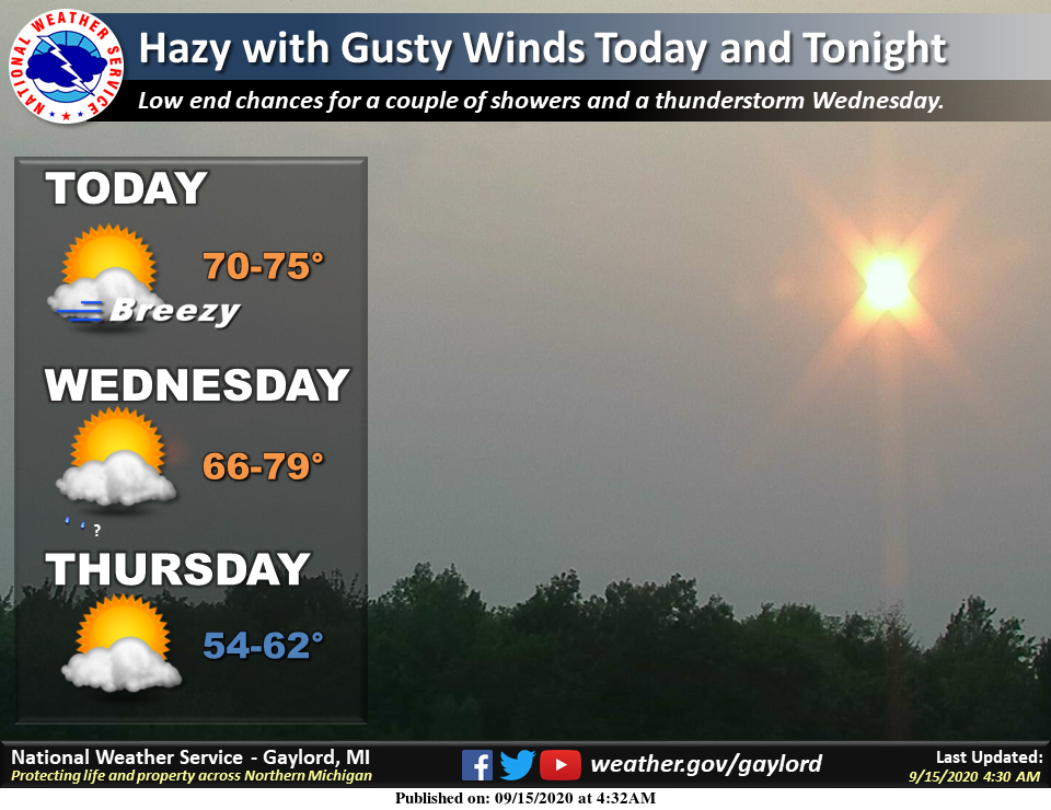
The NWS has been hinting at chances of frost coming towards the end of the week with nighttime temps in the upper 30s to low 40s. This would be outside the cities and more or less in the lower-lying areas. Grand Rapids is predicted to be around 43° while Otsego is predicted to be 39° Thursday night and 38° Friday night. Further north Big Rapids is showing 37 and 35 for the same nights. In my humble opinion the greatest chances of frost will be better north of US 10 for frost.
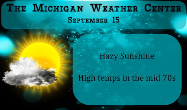
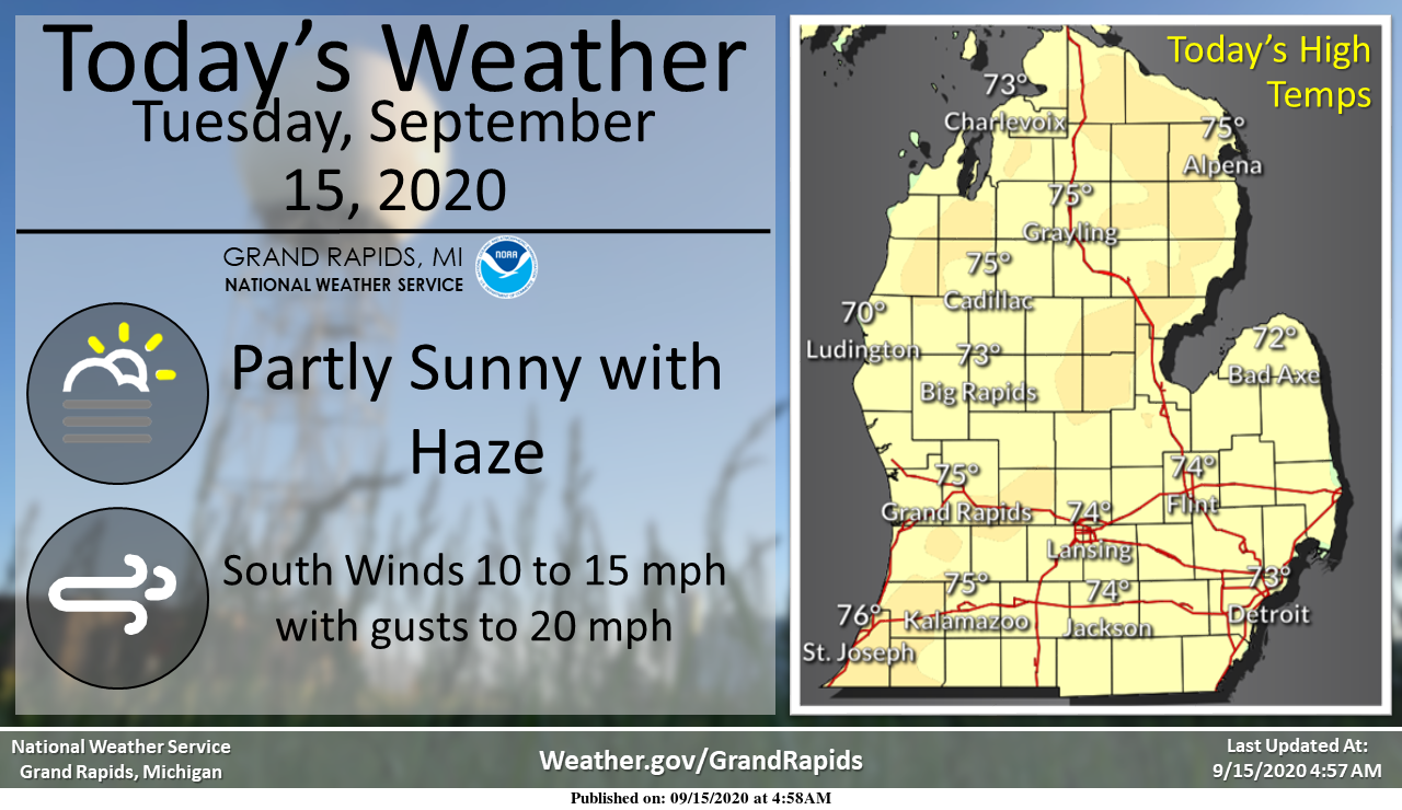
Keep in mind the NWS where I get some of my forecast data has been a bit off temp wise for the past week. Yesterday it was predicted to be near 75 however due to the smoke from the wild fires out west creating a haze temps were lower. Smokey skies may still be around today and tomorrow which may once again lower the predicted highs of the 70s today. We do have a southerly return flow of air moving in today which should help push temps warmer than yesterday. We have a slight chance of rain Wednesday evening which may bring a few sprinkles. Our next best chance of wide spread rain may not come until the 25th.
[columns] [span6]
SW
[/span6][span6]
SE
[/span6][/columns]
[columns] [span6]
North
[/span6][span6]
U.P.
[/span6][/columns]
Forecast Discussion
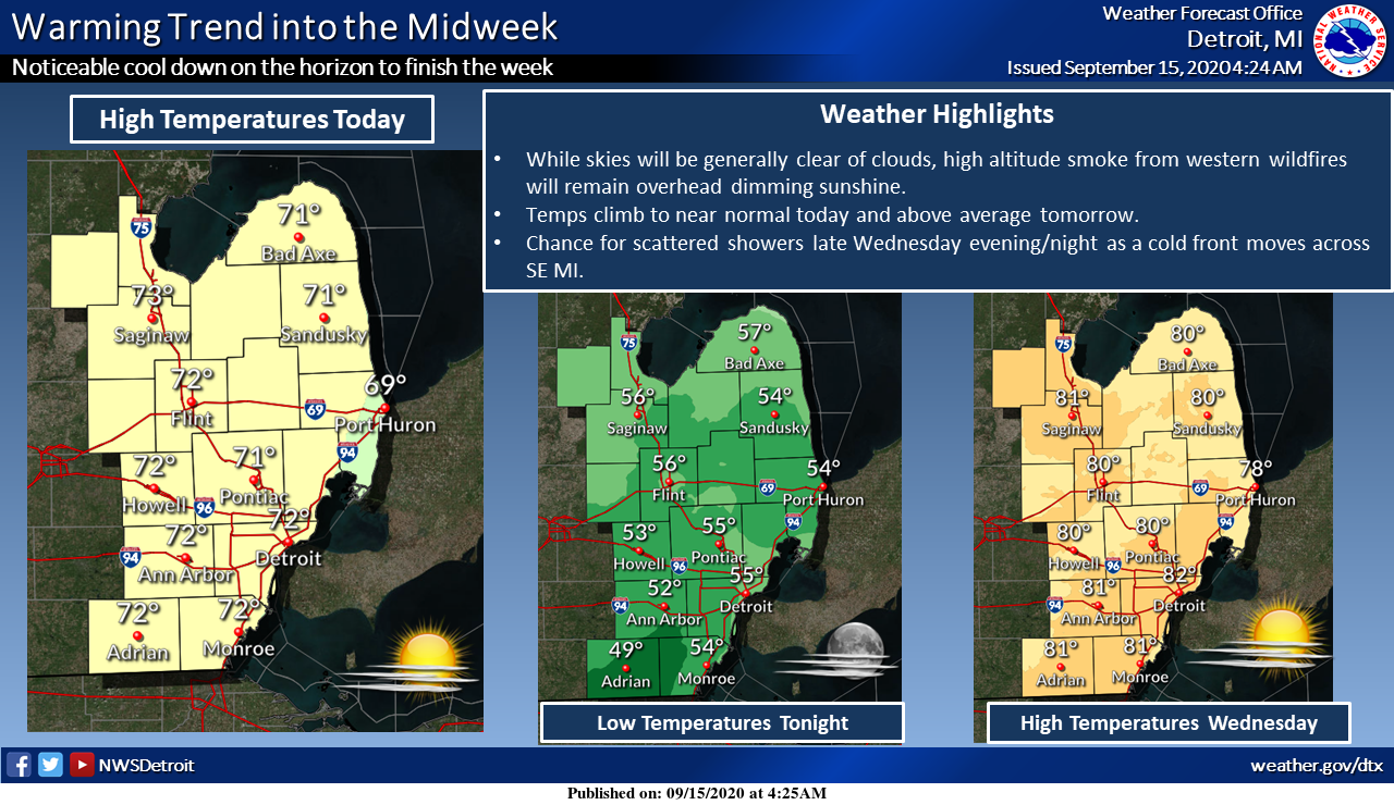
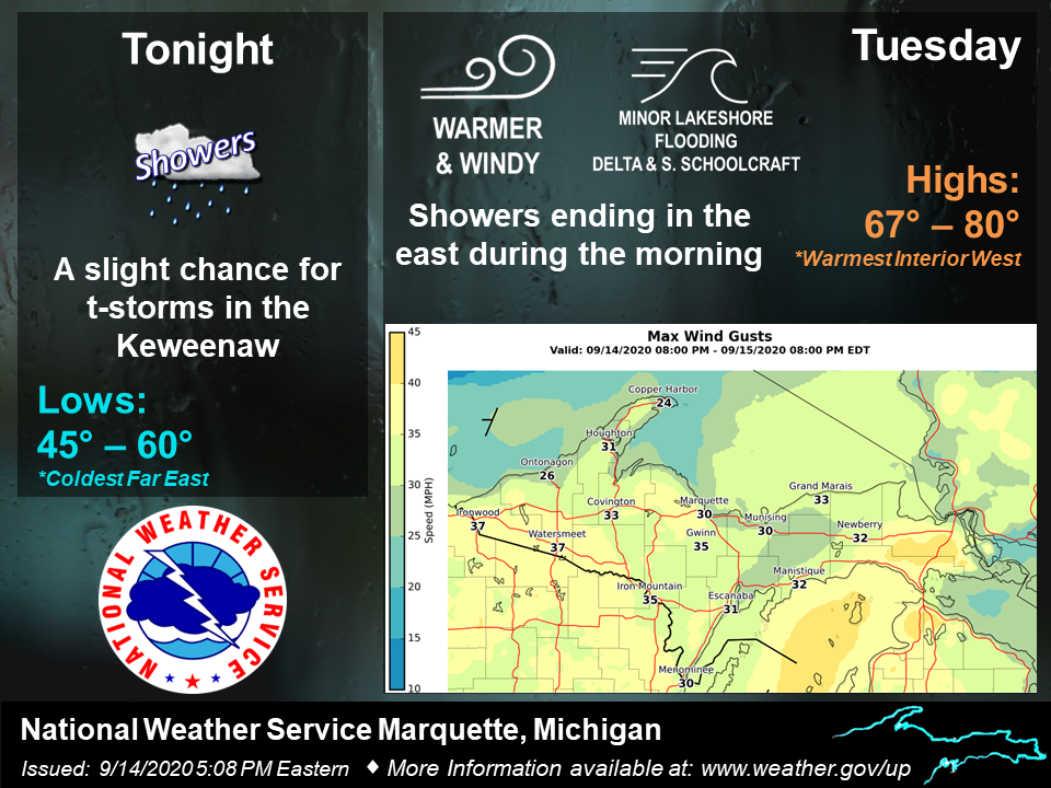
--Warmer with smoky skies today and Wednesday--

Southerly/return flow on back side of departing sfc high sends
warmer temps into the region today and Wednesday before cold
front arrives from the north late Wednesday. H8 temps push 18C
although mixing won`t be that deep (more like 900 mb) so we`re
looking at highs mainly in the 70s. Plus the persistent thick
smoke aloft may help shave a few degrees off the highs.

As far as the smoke aloft is concerned, experimental RAP/HRRR
smoke guidance keeps it around through Wednesday, but the tail
end of the 48 hour guidance suggests it may finally be pushed
south and out of the area on Thursday. This happens as the upper
trough digs farther south into the region and trajectories turn a
bit more northerly.

Interesting too in the experimental guidance is that the smoke
layer appears to lower as the cold front drops south late
Wednesday, even suggesting some potential for some low
concentrations of near surface smoke for a time on Wednesday
evening.

--Chilly Thursday through Sunday, patchy frost--

Cold frontal passage looks a bit quicker in latest guidance and
slips south through the region late Wednesday afternoon and
Wednesday evening. Precip potential still looks low although can`t
rule out a few light rain showers with the band of low clouds
accompanying the front.

Surface ridging is also quicker to build in behind the front,
now implying a frost potential developing as early as Thursday
night north of I-96. The surface ridge and associated cold/dry air
mass hangs around through early Sunday, so the nighttime frost
threat will exist on Friday and Saturday nights too. Best threat
for widespread frost is north of I-96 on Friday night.

--Dry pattern prevailing--

With dry air mass and surface ridging generally prevailing, the
next 7 days will remain mostly dry other than the potential trace
amounts with the Wednesday evening cold frontal passage.
According to ECMWF ensemble data, our next decent chance of
measurable rain is not until a week from Thursday.
I am glad to see the frost is not here. I have lots of tomatoes to ripen. It’s been an awesome summer for them. I put some Mum plants in this week. I have noticed that alot of the trees are turning colors here. We have noticed the smoke here too to the point I kept windows closed today. Sunday night late the smell of smoke was really strong.
It now has gotten noticeable more hazy in the last couple of hours. Now the sky is a milky white. It is warmer then yesterday and the current reading here is 74.
Slim
The sun is very dim and deep red now and it’s still a ways off of the horizon. Looks very odd.
Get ready for a big cold front by Thursday! Incredible cold!
Loving this below normal pattern we are in 60’s as far as the eye can see who would of thought ?? The leaves will really be changing fast in the coming weeks with the cool temps love it ….INDY
Early Frost who knew well it is the middle of September it can happen it’s called a below average pattern folks “weather terms” we shut the windows again overnight I told my wife the furnace maybe kicking on this weekend lows in the upper 30’s lower 40’s blow the dust of the winter coats it’s time ..Have a beautiful FALL day …INDY
The sky is still smoky today but not as bad as yesterday. The overnight low here at my house was 48. At this time with hazy skies the current temperature is 57.
Slim
We had to shut our windows last evening because the smell of smoke was strong.
The smoke has sent a big portion of the country into an artificial cool down. Really unique weather right now.
On that same topic, Bill usually tries to minimize western fires as no big deal and not a result of climate change. But I haven’t seen him even mention the fires once this year. With all the record temps and drought, I think we all knew a devastating record-breaking fire season was coming soon. It’s so sad. I read that breathing the air out west is the equivalent of smoking 22 packs of cigarettes a day.
For sure that smoke is not good for anyone. You know in the past there have been huge forest fires here in Michigan. There was one that burned all the way across the thumb. Just something to think about that it could happen here as well.
Slim
Artificial cool down ??? Lol….INDY
Yes, the smoke is an outside event caused primarily by man that has now influenced our weather.
“Weather terms” below average pattern we have been in now for over 2 weeks …Not sure fire smoke has anything to do with good try though….INDY
https://www.wlns.com/news/michigan/northern-hemisphere-had-its-warmest-summer-ever-noaa-says/
I’ve read several articles on this, definitely has been a warm year all over.