We still have some scattered showers around SW Michigan this morning with a temp of 51° at 5:30 am. Our high temp yesterday was 51° and the low was 26°. We have had .35 of an inch of rain thus far which brings us to 4.10 inches for the month and 6.54 inches of rain and melted snow for the season.
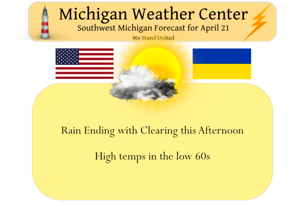
The big story today is the warmer temps we have in store with the promise of 80° for Saturday and the mid-70s for Sunday. This will feel hot after temps in the 40s for an extended period of time. Temps will be at or above 60° for today and tomorrow. Any showers will depart off to the east quickly this morning leaving behind some clouds. The skies will become mostly sunny for the afternoon. More showers are expected to arrive Friday and there could even be a few thunderstorms. Sadly temps will drop back into the upper 40s to the low 50s next week once again.
Forecast Discussion
-- Drying out today with warmer conditions moving in --

Rain/showers remain fairly widespread over the area as of 3 am this
morning. Regional radar imagery shows that the back edge of the
somewhat heavier rain is approaching the coast, with some lingering
drizzle/light rain over Eastern WI and IL. The rain will remain
possible until the front, which is approaching Milwaukee and
Chicago, pushes through this morning. Once the front moves through,
the rain will end, and the clouds will break up soon after.

What is somewhat interesting about this system is that we actually
will likely end up warmer today than yesterday, even with a cold
front moving through. A look at 850 mb temperatures shows a quick
dip in temps briefly right behind the front. 850 mb temps then
recover quickly, and are mixed well with the emerging sunshine. The
upper cold pool stays north of the area, causing the limited drop in
temps aloft.

-- Storms Fri afternoon/night with warmer air to follow --

Friday will start out with the drier conditions holding in place,
but the dry air will not last long. We will see showers enter the
far SW corner of the area by noon, and continuing to spread NE
through the remainder of the day. This rain activity is ahead of the
warm front that will be pressing NE through the area through Friday
night.

We agree with the SPC having the area in general thunder for this
batch of precipitation. It appears that we will not have sufficient
instability for thunder until almost 00z Sat for the far SW corner
of the area. Instability will spread in with the elevated warm front
pressing north, but never becomes surface based with this
precipitation.

With the elevated nature of this convection, the only threats would
be some hail and locally heavy downpours. Mid level lapse rates are
below 6 until the warm front moves through and precipitation ends.
There could be some minor and brief training of storms to produce
the locally heavy rainfall. Once the front clears early Saturday
morning, the entire area should stay dry until Sunday morning with
warm and breezy conditions.

We will see the showers and a few storms then develop Sunday morning
as the cold front then approaches the area from the west. The low
level jet axis ahead of the front will bring a good stream of rich
moisture from the Gulf over the area. We expect there to be quite a
bit of cloud cover present in the axis of moisture. This will limit
the degree of heating that could take place and destabilize the
atmosphere. If some places were to see some sunshine, that would
increase a threat of severe weather with deep effective shear values
pushing 50 knots.

-- Colder air with a few showers early next week --

The cold front is expected to push through the area centered around
Sunday evening. This is a fairly strong and dynamic front, so gusty
winds are likely as the front comes through. There is good cold air
advection that takes place that will only help mix down winds well.

It does take a while to get the coldest of the air into the area,
probably around Monday afternoon. Monday will be one of those days
where the max temp occurs early in the day, and then falls through
most of the rest of the day.

The upper cold pool is then expected to rotate overhead on Tuesday.
It will bring 850 mb temps of -7 to -10C by late Tuesday afternoon.
The instability with this and the trough will help to generate some
showers. Some of these could have some mixed snow under them.
Tuesday`s temperatures are likely to only top out in the 40s. We
will see the showers move out by Wednesday. A moderation in
temperatures will also occur as the cold pool pulls east.
Such a cool Spring we are having im thinking its Fall outside wow …INDzy
We have had on and off snow since November thats long enough but the no show 70 degree stretch continues now thats crazy …When will see our first 70 degrees day in GR is the big question…InDY
Saturday!
Hovering right around 80 here in Nashville! Incredible weather! Should get warmer as we enter Alabama!
Breaking News>>>>>this season accumulating snows may finally be over! That is the good news! The bad news is MI is squarely in below normal temps well into May! Get used to it!
https://www.pivotalweather.com/model.php?p=snku_acc&fh=384
This was posted days ago by NWS. More than a half foot below average snow. I love it!
Way more snow than the prior year and colder and great outdoor winter sports season! Get a grip!
GR is once again one of the coldest spots in Southern Lower. I’m starting to wonder if it’s a measurement issue. April temps:
GR 40.6 average
Lansing 43 average
Detroit 44.4 average
Give me a break! You are nuts!
I see 60’s in Lower Michigan as of 12:30pm. It’s good to see the warmer air return!
Well its pretty much May now probably should happen sooner or later right?? Lol….INDY
The sun is shining here and it’s about 50 degrees.
Finally a little sun is breaking through the clouds! Now let’s warm up the temps and cut down on the wind a little bit! What a cold start to 2022 we have seen! Wow, just wow!
The sun has just now made an appearance here. Not only has it been cool and wet this spring, it’s been windy too.
I will need to mow soon. Several neighbors have already mowed their lawns.
Grand Rapids is usually cooler, cloudier, and windier. Nothing unusual there.
40s for the balance of the year, with an occasional 48 hour anomaly. Life…in The Southern Arctic.
Where’s the sun and warmer temps?
Hey Rocky, from yesterday, my wife and I are thinking Central Texas. Her family is mostly from there. Weather is better there. Not real humid. We’re just tolerating the winters less and less in Michigan, LOL!
I would prefer Saint George, Utah or Sedona or somewhere in the Carolinas! Beautiful weather that is sunnier and warmer than GR.
It you can stay away from the humid 90+ degree days, it may be good! Central TX does get some upper 90’s!
Yep you’re right, not nearly as humid where my wife’s family lives. I’ll be fine with that, do not want to live anywhere near the coast down there, that is WAY too humid for me! But like I said yesterday, that would be 4 or 5 years down the road for us.
Yes, Houston is like Hell on Earth during the summer! No thank you!
Good morning from Indianapolis! It’s 55 with drizzle here currently. I am on my way to Alabama.
Have a good trip!
I am thankfully heading south for about a week. This has been one of the gloomiest springs I ever remember. I actually do not mind the cool weather, I just like the sun
This has been a windy, cloudy and rather cold spring season so far. The average high so far in April at Grand Rapids is almost 7° below average.
Slim
Wow, does that mean our nightly lows have actually been above average?
Who cares! This has been a very cool, cloudy, windy Spring, so far! Face the facts!
No, the average low so far this April have been below average as well. Well maybe not on Oxford street!
Slim
Rock on Slim! Mookie is such a warm weather nut he actually believes some of the junk he posts on here!
Nightly lows must be at least close to average then if I’m doing my math right.
You are wrong as usual!
Enjoy your trip Nathan! I’m off to Alabama!
Thanks Kyle/Sandy. And enjoy your trip Kyle!
Enjoy your trip!
60’s and sunny today! 77 and 72 degrees this weekend. I love it!
It is a little after 9 and there is no sun here yet. Cloudy and 49 here now.
Slim
The official high at Grand Rapids yesterday was 54. Yesterday was the 7th day in a row the mean was below average at GR. For the month of April so far there have been only 5 days when the mean has been above average and 14 days when it was below average. The current mean of 40.6 is a departure of -4.9. Here in MBY I recorded 0.60″ of rain fall yesterday and overnight. The low here was 48 and it looks like the official low at GRR was 47. After a brief warm up this weekend it still looks… Read more »
183 days since the last time it was 70 degrees in GR the days keep adding up …InDY
Amazing cold stretch of weather! 2022 so far well below normal temps! Chance of 70 degrees this Saturday?
Well if the rain holds off looks like another wet weekend ahead we will see …InDY