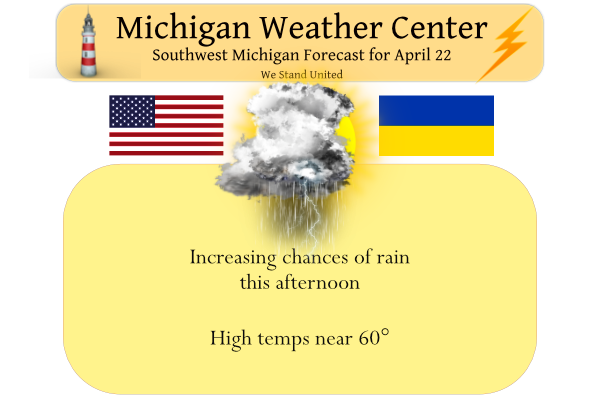
Yesterday turned out to be a great spring day for outdoor activities with a lot of sun. We had a high temp of 64° after a morning low of 42°. The clouds will thicken up this morning with showers moving in, especially this afternoon. There could even be a few thunderstorms around by the end of the day. High temperatures will mostly end up in the 50s today. Showers and thunderstorms will be around tonight. We could see over half an inch of rain between today and tonight. We will see a mild weekend with temps in the 70s, we could see our first 80° day in many locations tomorrow.
Hazardous Weather Outlook
A few storms will be possible this evening and tonight. The storms are not expected to become severe. Lightning and locally heavy downpours will be the main threat.
Forecast Discussion
-- Showers developing today and a few storms tonight --

Today will be a day that is not so great, in between the nice day
that Thursday ended up being, and the summer-like day that is
expected on Saturday. There are showers out to our SW, with some
storms further SW across Wrn IA and Ern NE. This precipitation is
associated with a branch of a low level jet and associated sfc warm
front that will be moving across the area.

Most of the rain that occurs during the daylight hours will be just
rain. Models are in good agreement that elevated instability does
not arrive over the area until toward 00z tonight, or just after.
This will keep the chances of thunder for mainly tonight. All of
this is expected to push north of the area by 12z Sat.

-- Warm weekend that ends with storm chances --

Once the showers and eventual storms push out of the area early
Saturday morning, the area should stay dry for about 24 hours until
Sunday morning. Skies should go at least partly sunny, if not mostly
sunny as we get into the warm sector. The return flow of moisture
does not get in here until Sunday morning. We will see breezy winds
from the SSW bring in quite warm air with 850 mb temps in the mid
teens C. Model guidance indicates that 80 will not be out of the
question for the inland areas of Southern Lower. Shower/storm
chances on Saturday will be about zero as the warm sector being
overhead will cap the atmosphere pretty well per forecast soundings.

We will see moisture be on the increase later Saturday night and
Sunday as the cold front approaches the area. We should have a fair
amount of cloud cover overhead by 12z Sun. This cloud cover will
help to temper the amount of instability that can build on Sunday
ahead of the cold front. If we see more breaks in the clouds on
Sunday than is currently expected, we could see a better potential
of some severe weather as the front moves through Sunday afternoon.

There are some favorable dynamics that could cause severe weather if
we build the instability enough. Deep layer shear is pushing 50
knots with the stronger mid level flow overhead. The low level jet
axis will also be over the area, leading to some favorable low level
shear values of around 30 knots. This will eventually come to an end
as the front pushes through Sunday evening.

-- Colder and unsettled early next week --

We will see a break in the precipitation chances on Monday, before
they return for Tuesday. Tuesday is when we see the long wave trough
and cold pool aloft sink south over the area. The air coming down at
850 mb is around -9 to -10C. This will help to produce a few
instability rain/snow showers, and maybe even a few lake effect
showers. This will all wind down early Wed as the upper trough moves
east of the area.

High pressure centered around Hudson Bay will then funnel drier air
down across the area from the NE for Wed and Thu.
A little thunder and lightning going on here.
Here too.
With light rain falling the current temperature both here at my house and at GRR is 47.
Slim
This is an absolutely lousy day of weather! The beat goes on and on and on!
At the pool, 85 and sunny 🙂
Only a matter of time until we get sustained warmth in Michigan. I like the winter… but I also like the summer!
80’s and gorgeous at the pool here in Cabo! Heaven on Earth!
Current conditions = 46 degrees with rain! Another great Spring day? Wow!
Today looks like another below normal temp Spring day! Wow, just wow!
Good morning from Birmingham, Alabama! I’m a hour behind West Michigan in terms of time. It’s 9:20 currently here with a temperature of 70 with lots of sunshine. We are going for Mid-80s today. I’m going to enjoy it! Everyone have a great weekend!
Hope you are having a good time.
Slim
80 and sunny here in Cabo too!
Thanks Slim! and enjoy Cabo Andy!
Oh we are! Enjoy your vacation too Kyle!
Currently 44 degrees outside feels like in the 30’s with the wimd chalk up another below available April day I think I have lost count now wow. ..InDY
What a cold, wet and windy Spring! All this when the warm weather nuts said a blow torch would be here by March! What a joke!
Above average temp day yesterday, what do you know? As usual, however, GR was the coldest of the major reporting stations. And remains much colder in April. Measurement issue?
GR: 62 degrees
Lansing: 65 degrees
Detroit: 67 degrees
It should also be noted that both Lansing and Detroit (and many other locations in Southern Lower Michigan) were well into the 70’s as early as mid March. GR only made it to 67 that day. Very curious.
It looks like the warmest reading for lower Michigan so far this year is 73 at Kalamazoo. Some other locations did reach 72 way back in March. Now what was the readings at you place Mookis (ans just is you location???)
Slim
You are totally nuts!
I guess if you have a issue with the Grand Rapids NWS official readings you should take that up with them.
Slim
Mookie just can‘t admit that it has been a cold and wet Spring! He is so desperate he now will not believe the NWS GR reporting station! If you don’t like the hard core facts, just start making something up! Totally ridiculous and total lunacy! He probably believes that QAnon is real and based on factual data! Wow, just wow!
False. Totally appropriate questions when suddenly GR has been consistently cooler than other major reporting stations in Lower Michigan. It’s okay to ask questions.
NWS GR acknowledged there could be many factors in play, but they are confident in their temperature readings at their specific location.
Lol. Terri D Wood tv 8 just said the warmest air in over 6 months for tomorrow whats that tell you all?? Cold …INDzy
It has been an amazing below normal temp pattern! Simply incredible!
lol, of course they are confident in their readings! They have high quality equipment and know what the Hell they are doing! Your questions were totally ridiculous!
And the NWS is able to calibrate their equipment.
Slim
I could be wrong, but perhaps the lake is keeping GR a bit cooler than those inland locations? Similar to how it keeps GR warmer in the late fall.
Yes, with a west, northwest or south west wind that can and is the case. Also there have been several days when a strong cold front came thru and the temperatures dropped more here in the west than in the east.
Slim
Of course that is 100% correct and that never crossed mookie’s mind because he can not face the facts! It has been a cool, cloudy, wet and windy Spring! Get used to it and face the facts!
Yesterdays official high/low at Grand Rapids was 62/43 it was the 1st time in 7 days that the mean was above average. The overnight low for today was 38. At this time the clouds are moving in and the current temperature here is 46.
Slim
Happy Earth Day!!!
April Showers bring May flowers!
More clouds, rain and wind coming! No surprise!