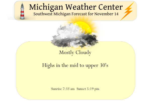
Yesterday we only managed to reach 35° with a morning low of 29.5°. We had about an inch of snow here in Otsego which has since melted. It will be mostly cloudy today with highs only in the mid to upper 30s. Skies may become partly cloudy by sunset, then clouds from the next storm system will move in overnight. Light snow should overspread the area by midday Tuesday. Periods of snow will continue each day through Saturday.
Light snow is expected to spread from south to north across Lower Michigan starting around mid-morning near I-94 and reaching I-96 by early Tuesday afternoon. A second area of snow will move from across areas north of Big Rapids during the late morning hours and continue into Wednesday. This area will be lake enhanced from Lake Huron and this is where the heaviest snowfall from this event is expected. Most of southwest Lower Michigan is expecting 1 to 2 inches of snow by mid-morning Wednesday. Expect some icy or snow-covered roads after dark on Tuesday.
An upper-level system stalls over this area by Wednesday and that will keep us colder than normal with periods of snow and or snow showers into the weekend. At this point, the snowiest part of this is Thursday into Friday west of US-131 as the coldest air of the season comes over the warmer waters of Lake Michigan, then creating lake-enhanced snow showers.

Here are just a few of the snow reports we have received, along with a map showing estimated snow totals across West Michigan. This early in the year, warmer air along the immediate lakeshore often results in the highest snow totals being pushed inland a bit, which is exactly what happened in this case.
Forecast Discussion
--Cold and fair weather into Tuesday--

The upper level trough that coupled with lake enhancement and
brought the lakeshore their first significant snowfall of the
season will continue its trek eastward. A ridge of high pressure
will build over the region today and allow for downsloping
through the region. This will continue to advect cold air into
southwest Michigan.

 This weeks temperatures will be in stark contrast to the
warm temperatures we experienced just last week. Temperatures
will be 10 to 15 degrees below normal as opposed to the 10 to 20
above normal temperatures that we saw as recently as last
Thursday. While timing and precipitation may vary for the forecast
into next week, the one inescapable fact will be the persistent
cold.

--Several chances for snow through the week--

  The upcoming week will bring several opportunities for winter
weather. The first will be Tuesday into Wednesday. An upper level
low situated over south central Canada will dominate the weather
pattern through this timeframe. The extending trough will drive a
baroclinic system through the region with its associated mid to
low level low moving through the Ohio valley. The best moisture
with that system will move into the southern portion of the Mid
Atlantic region. Michigan will remain on the cold side of the
low.

 There will be enough moisture to bring precip Tuesday into
Wednesday. Latest model soundings and ensembles see to be in good
agreement that the region should remain cold enough that that any
precipitation will remain as snow through Tuesday.

 The upper level low propagating eastward will become an open
wave and become more barotropic as a positively tilted mid level
trough will stretch across the mid west and into the southern
United States. A cold and moist air mass will drop southward,
across the lake bringing another chance for snow Thursday into
Friday. The -10C to -15C air advecting across the lake could
couple with the northwest flow to potentially bring some impactful
snow Thursday.

--Colder, snowier with accumulations possible through the weekend--

The merry go round of systems will continue through this weekend as
another system swings through. Northwest flow will be the dominate
factor with lake enhanced synoptic snowfall persisting through
Sunday. There is still some variation as to where the heaviest snow
develops but currently seems to be forming along and west of the US
131 corridor.
Nice 10 day snow map for mid November! Wow, just wow!
https://www.pivotalweather.com/model.php?p=snku_acc&rh=2022111418&fh=246
School closings already are very possible Friday get the snow shovels ready….INDY
Looks like a nice lake effect set up on the way! Grand Rapids could be in an ideal spot with a strong west wind. Generally the heavier snows hug the 131 corridor in a strong west wind
The afternoon AWD was the most exciting one, in my opinion, since last winter. Looks like lots of snow chances coming up 😀
*AFD forecast discussion
“Ideal set-up will be in place Thursday through Sunday to see some
potentially significant lake effect snow and travel impacts.”
The southern buoy is still 50F. So with W/NW winds in the teens and some clipper systems… that’s a good setup
I’m looking forward to it!
Check out the snow chances coming this week could we be seeing our first Winter storm watches ??? Stay tuned 😉 INDY
It is possible, but I expect some Advisories! Bring it on!
Snowy week ahead loving the headlines thanks Slimm… INDY
Who would have thought? No matter how much snow we actually get we know fixxxer will be saying it was bust and overblown! What a joke!
Lol…. yeahhh especially in that one town I forgot the nane of it!!! INDY
Yes very funny, we could get 12 inches of snow and he would say not much of a storm and over hyped! Delusional!
The iPhone weather app shows a low of 6 degrees next Tuesday with a feels-like of -3… I have to imagine there is something wrong with the app? I’ve never heard it being that cold this time of year.
The first sub 10° low at Grand Rapids is a +9 on November 17th 1959 there was also a low of +9 on November 19th the first low below +5 was on November 23rd 1956 and the record low for any day in November is the incredible low of -10 on November 25th 1950 after the low reached -9 on November 24th 1950. So while it is hard to believe it is possible but unlikely.
Slim
With a mean of 33.5 yesterday was the coldest day here at Grand Rapids since April 1st The official H/L was 37/30 there was 0.02” of precipitation and a reported 0.4” of snow fall. There was just enough snow fall here to lightly cover the ground. The overnight low here in MBY was 31 and the current temperature is 35 with cloudy skies. For today the average H/L is 48/33 the record high of 68 was recorded in 1902 the record low of 16 was recorded in 1969 and the most snow fall of 4.5” was reported in 1974. Last… Read more »