Yesterday was cloudy with a high of 39° and a low of 28°.
Snow Today into Wednesday – Heavier Snow Possible Thursday into Weekend – Much Colder this Weekend
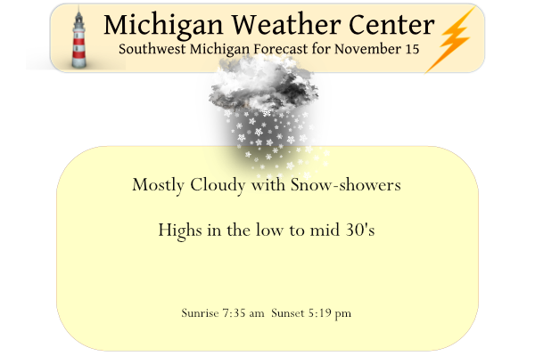
Snow will overspread much of Lower Michigan this morning and continue into Wednesday morning before ending for a while. Snowfalls of 2″ to 4″ is expected by mid-morning Wednesday. Roads will likely remain just wet during the daytime today, but slushy/slippery conditions may develop by Tuesday evening. There are no advisories for today as the snow should melt on the roads.
Unseasonably cold air will arrive for the weekend with locally heavy lake-effect snow showers as daytime temperatures drop into the 20s. Looking ahead it appears any snow accumulated will begin to melt next week as temperatures rise back into the 40s.
Forecast Discussion
--Potential Tuesday Evening Commute Impacts--

The forecast remains on track, a negatively tilted trough will
come up from the south and move through southern lower Michigan
today into tomorrow. Several waves of forcing will bring periods
of snowfall with the strong FGEN and associated Omega values late
afternoon and this evening. CAPE values late this afternoon and
evening will be upwards of 230 J/kg which is high for this time of
year. That will allow for periods of heavy snow showers.

There could be minor impacts this morning as bands of snow will
be moving over the I 94 corridor mid to late morning which could
cause wet roadways.

The bigger concern will be the evening commute as the easterly
flow and already deeper moisture could have some Lake enhancement
from Lake Huron. The latest models continue to have 2 to 4 inches
along the US 127 corridor.

 Wet roadways and reduced visibilities from the previously
mentioned snow bands will cause some concern for the evening
commute and urge drivers to give themselves more travel time.

However, given the warm ground could stifle any accumulations and
that any convective bands will move through quickly, have decided
against an advisory.

The strongest low level flow will pull eastward overnight,
shifting all the moisture with it and leaving cold northerly flow
in its wake. As the system pulls away there remains some
instability and a rain/snow mix of flurries or sprinkles will be
possible Wednesday.


--Widespread Snowfall Thursday through Sunday--

 Any brief respite from the upcoming snow will end by Thursday as
a near text book lake enhanced snow set up set-up will settle
over the region Thursday through Sunday.
 There will be some minor breaks but we could see some potentially
significant lake effect snow and travel impacts.
 A deep upper trough that will extend all the way back to Hudson
bay will deepen short wave troughs propagating around it. This
will drop near record cold temperatures from the west as several
shortwaves pass through.

Lake Michigan water temps according to the latest buoys and models
remain around 10C. The cold air moving over this warmer air mass
will create significant instability Thursday into Friday.
Especially since latest models have 850mb Temps of -15C Thursday
evening.

 While accumulations could remain marginal at first, there will
have been already two snowfalls to cool the ground, especially
along the lakeshore.
 Strong northerly flow will set up with a deep omega field
Thursday through Friday. This will allow for the potential for
significant accumulations across lower Michigan with the highest
amounts west of the US 131 corridor.

 This weekend will see highs struggle to get out of the 20s. So
prepare for the first bitterly cold temperatures of the season. As
previously mentioned any lingering warmth of the ground may
actually exacerbate impacts as the falling/melting re-freezes on
the roadways. The periods of snow along with the potential for
refreezing on the roadways could bring a treacherous combination
of travel conditions.
What a day! The snow just keeps coming and coming! Up to 2.3 inches and counting! What a storm! What a winter!
1.7” officially on the board here at my house. And so the season snowfall tally begins
Get ready to rock West Mi! Nothing like January conditions in mid November! Who would have thought?
For the Buffalo area:
* WHAT…Heavy lake effect snow possible. Total snow
accumulations in this long duration event of multiple feet
will be possible in the most persistent lake snows.
I’ll be interested to read the discussion at 3:30, but the NWS point-and-click forecast is interesting. It shows a continuous west wind from Thursday-Sunday. With lake temps up to 50F and temps in the teens and 20s… this event definitely has potential
Here you go: -Heavy Lake Effect Snow at Times Thursday through Sunday– Height falls continue over the GrtLks Rgn through Saturday as strong upper jet jet dives straight south through wrn Canada on the back side of digging longwave trough. H8 temps fall off to about -15C by Friday night, with sfc temps falling below freezing Thursday night and remaining there through the entire weekend. Ideal synoptic set up will be in place from Thursday onward for occasional bouts of heavy lake effect snow, with the polar jet west and south of MI, delta Ts around 25C, and deep cyclonic… Read more »
Things are nice and snow covered currently. There was 3 cars involved in a crash here on I-96. All 3 involved occurred on the icy bridge over the Grand River near Kent Street. First slick spots of the season.
The snow that fell on the ground here has melted. Some snow remains on rooftops. Roads are clear and dry now.
Matt Kirkwood wood tv 8 just said hes concerned about Saturday very heavy lake effect snows coming….Snowvember we will call it hows that sound?? INDY
Awesome baby!
Took a quick measurement and lo and behold now have the first one inch of snow fall here in my yard. BTW the average first one inch snow fall at Grand Rapids is November 19th so just a little ahead this year.
Slim
We have just over an inch on the railings of our deck. It’s 34 here. The concrete and asphalt surfaces are clear and wet, but not slippery.
Lots of slide offs in GR easily could of put at winter weather advisory out …INDY
Let it snow let it snow let it smow .. INDY
Okay, I believe it. Our grass is nearly completely covered.
Looks like the N. Indiana office put a winter storm watch for Barrien for late tonight through Thursday morning with the northerly flow.
Currently 30* degrees with snow falling its a beautiful morning perfect weather for opening day of fire arms be safe today …INDY
NWS says 2 or so inches for here over the next 24 hours or so. Local TV met said 1-3 inches. I will believe it when I see it. The ground is far from frozen.
Hey Slim get them Winter boots ready for your afternoon walks ….INDY
Got them
Slim
Look at the deep freeze coming most of the lower 48 strong a November Polar vortex wow to the wow ….INDY
Wow just wow!
https://weatherstreet.com/models/gfs-acc-snow-forecast.php
Above average snowfall for November looks like it ….Let it snow let it snow let it snow .. so much for a quiet weather pattern lol…INDY
Chexk out the snow moving in its going to be a perfect wintery day across west Michigan….Get out and enjoy it!! Who knew??? INDY
Bring it!
Snow is currently sticking to the roofs and trees (and even some of the grass now). Starting to look like Christmas season!
Welcome to the start of Michigan’s fire-arm dear season. Boy how times have changed when I was younger today was almost like a state Holladay. Employers would ask who was going deer hunting and over on the east side of the state I 75 would see massive traffic jams. There were reports of over 750,000 hunters and would be hunters heading up north. On the weather front the official H/L at Grand Rapids yesterday was 39/29. There was no rain/snow fall and no sunshine. The overnight low here in MBY was 27 when some clearing took place and is now… Read more »
The number of deer hunters and their economic impact has steadily declined over the past couple of decades. The state should change opening day to the 2nd Saturday of November. I think would increase the number of hunters for opening day.