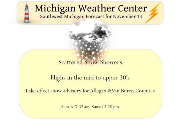
We have a cold 30° at 6 am this morning with a coating of snow on the ground, the first of this season. The winter weather advisory for Allegan and Van Buren counties is set to expire at 1 pm today, not expecting more than an inch or two of new accumulation.
After a rather warm start to November, we now get an extended period of colder-than-normal temperatures and some snow nearly every day into at least the beginning of next week. While we do not, at this point expect widespread heavy snow, most areas will see snow nearly every day this coming week except for Monday. Tomorrow may very well be our warmest day of the week with temperatures only reaching 40°! High temperatures for the end of this week will be below freezing.
Forecast Discussion
--Lake Effect Snow Continues Through First Half of Sunday--

North to northwesterly flow moving onshore from Lake Michigan will
allow for snow bands to continue to cause snowfall until 7 AM.

A 500 mb trough extending through the lower peninsula will allow
for enough upper level instability to aid snow generation through
the mid to low levels. A positively tilted mid to low level trough
will pivot over the Michigan Indiana border and shift the winds
from north to northwest. This will allow for snow bands to
infiltrate inland further between 09 to 12Z. The model RH between
1000 to 500 mb shows the moisture associated with this and its
track. It will propagate eastward across the state and will into
lower Canada by 12Z. Once that feature moves eastward, the main
snowfall should cease, though there could be light lingering
snowfall along the lakeshore through the morning. Expect the snow
to be heavy for a brief period along the US 131 corridor as the
before mentioned bands move through. There will allow be lake
enhance bands through Mason and Lake counties through the DGZ is
fairly shallow so it will not be able to tap into the moisture and
instability, thus limiting additional snowfall. Low level Omega
will end this afternoon and any showers will cease mid to late
afternoon. Expect skies to slowly clear as a ridge of high
pressure build in tonight into Monday morning.


--Cold air will dominate the upcoming week with chances for snow--

As that high pressure build it will allow for temperatures to
remain cold. Max temperatures this week will struggle to crack 40
with lows in the 20s.
 The mid week will be dominated by an upper level low that breaks
off and swings southward across the northern plains. that low will
guide a system into the region bringing in copious amounts of
moisture. Michigan will remain on the cold side of the system
with much of the low to mid level flow coming from the east. This
will give us several chances for lake enhanced snowfall through
the second half of the week.
This morning we got up to snow on the rooftops and a dusting on the grass. It all melted fast. I haven’t seen any snowflakes all day.
So much for a warm November! Accumulating snow is in our future! Winter rocks!
https://www.tropicaltidbits.com/analysis/models/?model=gfs®ion=us&pkg=asnow&runtime=2022111318&fh=312
Cold and snow as far as the eye can see! I love it!
8 years ago we were about to enter a period of historic snow in November. I lived in Eastern Ottawa County at the time and will never forget it.
https://www.mlive.com/news/grand-rapids/2014/12/record-breaking_november_grand.html
I remember it well! Plenty of snowshoe and skiing weather!
Let it snow let it snow let it snow … INDY
Nothing more than just the occasional snowflake flying past the window here in inland areas
I have a trace of snow here with very light flurries atm. Certainly nothing unusual for November 13, but definitely a big change from the first half of the month! The second half of this week looks possibly eventful… we will see
Had a nice time in TC yesterday. Whitecaps on the east bay. On and off snow showers throughout the day. We headed home after sundown. North of Cadillac about 7:30, the snow really came down. The road was totally covered and visibility was poor. Halfway between Cadillac and Clare, no snow and the roads were clear and dry the rest of the way home.
The string of above average days was broken yesterday. After 14 days in a row of above average temperature Grand Rapids had a below average day. The official H/L was 41/32 there was a trace of snow fall and just 3% of sunshine. The overnight low so far for today has been 31. At the current time I have a reading of 32 and there is light snow falling. There is now a trace of snow on the ground here at my house for the 1st time for the winter of 2022/23 season. The average H/L for today is 48/34… Read more »
Cold and snow rules! Get prepared now!