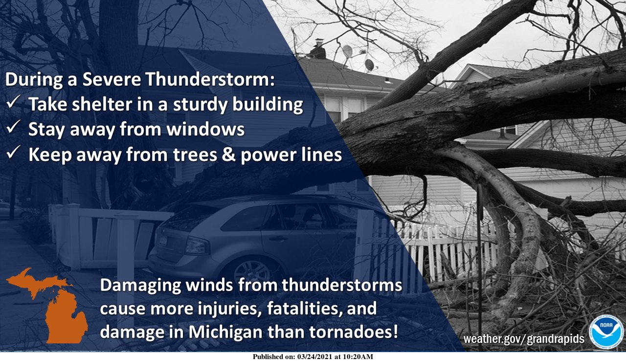
This is Severe Weather Awareness week and that time of the year to be provided with the reminder of how to stay safe during severe weather events. Spotter training will be held virtually this year by our friends at the Nation Weather Service from the NWS office in Grand Rapids. Our Spotter training can be found on-site here.


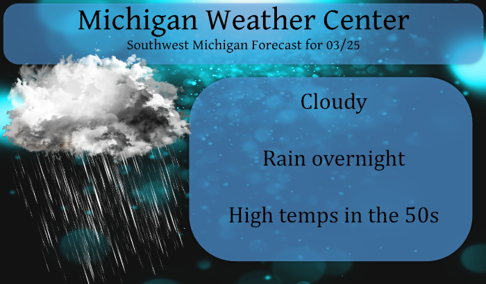
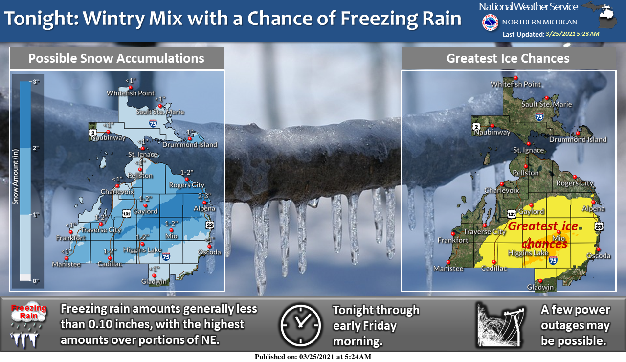
Our first real rain event of the month will move in tonight. Soaking rain and a few thunderstorms are expected for Southern, and parts of Central Lower Michigan Thursday evening through Friday morning. We may see a light wintry mix develop across Central Michigan, but snow and ice amounts look fairly light. Gusty winds will also develop late Thursday night into Friday morning.
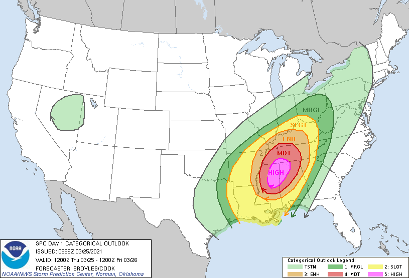
Here is the SPC outlook for today and tonight:
Forecast Discussion
- Wet and Windy tonight into Friday morning-

The last time most of our Climate Stations (GRR,LAN,MKG) had over
an inch of rain in 24 hours was December 12th. That was also the
last time any of those locations had more than a 0.50" of rain in
24 hours. It looks like we have an excellent chance of getting a
widespread 1.0" to 1.5" precipitation event over our southern and
central CWA tonight into early Friday morning. Most of that rain
will fall in about 10 hours (give or take 2 hours) from about 9 pm
till about 7 am. The highest rainfall rates should be in the 11
pm to 4 am time frame.

As for where the heaviest rainfall is expected tonight, the GFS
axis of heaviest rainfall is from Mount Pleasant through Grand
Rapids to South Haven. The GFS ensemble mean gives around 1.25
inches along that axis. The 00z ECMWF ensemble mean is very
similar but maybe about .25" less than the GFS ensemble total.
The ECMWF has been very similar on the rainfall from run to run on
this event over the past 2 days. The axis of the rainfall and the
rainfall amounts along that axis also have been rather similar on
every single run in the past 2 days (8 runs total). All of our HI
RES models are very similar with this rainfall event in location
and amount. There has been good continuity over the past 24 hours
with the HI RES models too. All of this would suggest high
believability for around a inch of rainfall in 12 hours or less
overnight tonight.

Maybe you want meteorological reasoning to really believe it will
rain like that tonight when it has been dry for so long here? We
have a 150 knot polar jet wind core that came onshore early
Wednesday, over the west coast of the United States. That in turn
booted the system that was over the SW CONUS then, out into the
Southern Plains early this morning. That system will lift north
northeast and becomes seriously negative tilt at upper level
tonight, over southern Michigan. That causes mid level frontogenis
and a very nice trowal developed. This results in a very strong
cold conveyor belt in the 925 to 700 mb levels. We have around 1"
of precipitable water to works with in that trowal. Given the
strong dynamics and deep moisture from the Gulf coming this way,
there is no reason I can think of, that would say to me we will
not see around an inch of rain in 12 hours or less over a good
part of our southern and central CWA tonight.

As for thunderstorms, there is elevated instability in the I-69
area after midnight, till around sunrise. The most unstable cape
values approach 500 j/kg in that area so it would make sense to
believe a few thunderstorms will occur in the early morning hours
of Friday near I-69.

Snow is possible over the northern part of the precipitation
shield early Friday morning but this is a questionable thing given
the 850 mp 0c isotherm barely gets into this system. Evaporative
cooling with dry air on the edge of the system may help the cause
of creating some snow but this is to marginal to believe more than
inch of snowfall is possible near and north of Route 10.

It will be a windy system too. The ensembles of the GFS and ECMWF
suggest wind gusts to near 40 mph near I-96 during the early
morning hours of Friday (near the cold conveyor belt). Since this
will be during the dark hours and we will not have good mixing at
that time. So, it would seem widespread gusts over 45 mph are
very unlikely then, so we do not plan to issue a wind advisory.

- Next system Sat into early Sunday then cooler -

The next system is the result of that 150 knot jet feature that
came on shore Wednesday. Even though it started to dig into the
western trough, it ends up moving more eastward over the next few
days. The surface low develops in the Central Plains early
Saturday and tracks toward Michigan. The surface low tracks north
of this area Sunday morning. That will result in a mostly rain
event for this area from later Saturday into midday Sunday. The
forecast precipitation amounts have been increasing with the
models over our area over the past few days but still most area
will see much less than a quarter inch of rain from this event.

Cold air follows this system but it marginally cold enough and
moist enough for some lake enhanced rain/snow showers from midday
Sunday till around sunset. By midnight Sunday night warm advection
at mid levels will be setting into the area so that will clear any
remain clouds, allowing for a cold Monday morning. Most area will
have below freezing low temperatures then.

- Warmup midweek with another system coming through-

The next upstream system comes onshore of the west coast of the
United States, on Monday. That builds a big a large upper ridge
over the central CONUS by Tuesday. This in turn will bring us
another warm up before by Tuesday as that upper ridge moves into
this area. Highs could approach 70 in some area by Tuesday
afternoon, if not then there is even a higher chance of 70 degrees
for a high on Wednesday.

Meanwhile there will be a series of jet streaks tracking through
the upper trough that slowly heads our way following the large
upper ridge. Those jet streaks will cause surface lows to track
northeast along the slowly advancing cold front. I would expect
some sort of rain event in the later Wednesday or Thursday time
frame. That will depend on just how the surface lows track along
the front relative to it`s position relative to Michigan. There
is to much uncertainty to say to much more about that even at
this point. One thing for sure, cold air will follow that system
toward the weekend.
Well how about that? We have lightning here!
Hazy 74* degrees on the gulf right I couldn’t imagine living here in the heart of Summer with it being so dang hot and muggy I can feel it already in the air no thanks coming home to 40’s abd 50’s will be a shock in the arm a cold shock lol well back to my ice cold Sprites …INDY..
The over night low here at my house was 45 and that was also the overnight low at GRR. At this time it is cloudy and 46 here at my house. My Crocus are now in full bloom and I also now have some daffodils out as well and I have seen dandelions out on my walks.
Slim
The current March mean temperature at Grand Rapids is 40.5° At this time GR would be in line for the 12th warmest March at GR. The 39.5 mean at Muskegon would be good for the 9th warmest and the 40.3 at Lansing would be good for 10th warmest. All locations are currently at one of the driest in history but that looks to change. We will also have to wait to see where we end up on the sunshine as well. The current snow fall of just a trace at Grand Rapids and Lansing and the 0.1” at Muskegon are… Read more »
As the month winds down as one of the warmest and sunniest on record, I can’t believe how off many of the experts were in regards to their March predictions this year:
“Latest 8-14 day fcst has temps >avg but that appears front loaded. I think winter will return at times 2nd half of month. St. Patty’s storm? GFS model has it.” Matt Kirkwood tweet on March 3rd
Just think 9 more months to Christmas day today soon the days will be getting shorter lol…Love how’s it’s Spring and out of all people on this blog you’re still talking about Winter!!!!! Woo woooo!! INDY
Yes, clearly mookie is totally hopeless and irrelevant!
Kirkwood was right about a St. Patty’s storm. It clobbered the deep south.
Yes he was ….Now his daughter has Covid19 so he’s on lock down hopefully his family gets better …..INDY
He meant snowstorm for GR for St Patty’s
To be fair, he was just citing the GFS model.
Which is a total crap shoot that far out. He knows that.
Lol still a meteorologist for major networking in Grand Rapids Michigan!! INDY…
I bet that’s why he used a question mark.
March 2021 is also among the least snowy as well with just a trace at Grand Rapids and Lansing and 0.1″ at Muskegon.
Slim
Watch April have more snow then March lol….INDY
Indy, It has happened many times in the past as recently and 2019. 2018 and 2006.
Slim
Pretty easy when we have a snowless March LOL
Well I’m glad you agree we will have snow in April DDDDDD!!! Love it for being Spring now lots of Winter talk happening 9 months till Christmas day woo woo …INDY…
We have very competing forecasts today. NWS GR says near 70 degrees again by Tuesday and Wednesday. WOOD says 60 Tuesday and 48 Wednesday. I will make a note of this and see what happens next week.
Sounds like some Woodtv wishcasting for cooler temps! They really hate that this has been such a warm spring already!
Yes, I’m guessing WOOD is much too cold as usual, but I have it marked down and will revisit it next week.
Oh my, another high risk for Alabama and Mississippi. The second one in just nine days and yet, only the third one issued in the past two years. Talk about rotten luck. I hope it’s not as bad as predicted.
I so want to go chase but theses cotton fields down here I have no idea about probably not a good Idea at 530am this morning orange beach had a temp of 72* degrees and 97% humidity its muggy outside definitely feel something brewing In Alabama! INDY
Hey INDY, you could just go view them from a good distance? That would be fun too! Might be worth looking into!
Be safe and have fun, Indy!
Im thinking a Sprite and beach day in sight no chasein for me sounds like really scary tornadoes to my north today ..INDY