Scattered showers over Lake Michigan gradually spread onshore this morning. A few rumbles of thunder are possible. This afternoon coverage will be best south of Grand Rapids before dry conditions return this evening. Light and variable winds this morning become more northerly as the front moves through.
Grand Rapids Forecast
9 17 grrU.S.A and Global Events for September 17th:
1829: A typhoon, Japan’s most catastrophic storm, inflicts widespread damage over much of the country. On the southern island of Kyushu, the storm surge off the Ariake Sea kills over 10,000. The German physician Philipp Franz von Siebold was present during this storm and succeeded in taking barometric pressure readings around Nagasaki at the risk of drowning.
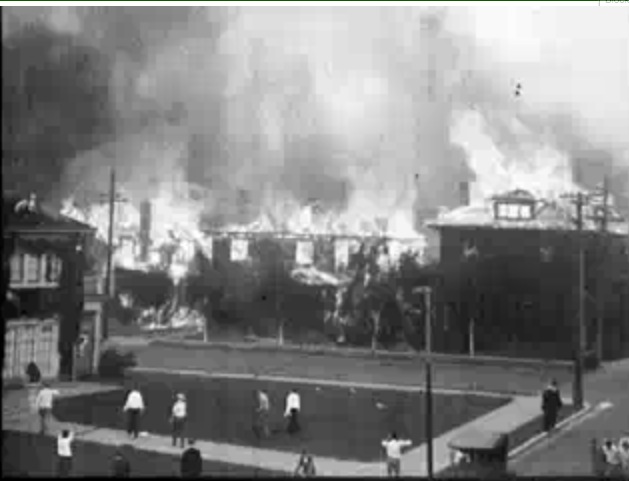
1923: A devastating fire threatens the University of California at Berkeley on this day. This fire killed two and caused $10 million in damages. While the exact cause is unknown, the fire began in the dry forest northeast of Berkeley. Strong northeasterly winds blew cinders into the air which led to rapid-fire growth. Click HERE for a video from archive.org.

1989: Hurricane Hugo hit the Virgin Islands, producing wind gusts to 97 mph at Saint Croix. Hurricane Hugo passed directly over the island of Saint Croix causing complete devastation and essentially cutting off the island from communications. A storm surge of five to seven feet occurred at Saint Croix. The only rain gauge left operating, at Caneel Bay, indicated 9.40 inches in 24 hours. Hurricane Hugo claimed the lives of three persons at Saint Croix and caused more than 500 million dollars in damage.
2004: The remnants of Hurricane Ivan submerged Pittsburgh in 5.95 inches of rain in one day. That is the most rainfall Pittsburgh has seen in a 24-hour period since records began in 1876. Click HERE for a tweet from the NWS Office in Pittsburgh, Pennsylvania.
Forecast Discussion
The combination of a frontal boundary moving across our area and
upper trough will combine to bring scattered showers and isolated
convection today. KGRR/rgnl radar trends early this morning show
scattered light rain showers across our area. Rain is a little
more widespread across central Lake MI near the frontal boundary
and where there is greater instability as a result of relatively
mild Lake MI waters. Isolated convection has been noted over
central Lake MI as well mainly west of Pentwater.

Scattered showers will continue to develop across our area today
but much of the day will end up being dry. The (relatively) best
chance for rain and isolated convection inland will come from mid
to late afternoon into early evening over our se fcst area
coincident with the diurnal peak in instability. The pcpn
potential over our se fcst area will also be aided by deeper
moisture over that area and some stronger mid to upper level pva
over the eastern half of lower MI.

Lingering showers and isolated convection in the evening will
gradually end overnight as north to nw winds advect a drier
airmass in. We will need to monitor for patchy fog development
early Monday morning as skies become partly cloudy to mostly clear
with residual boundary layer moisture in place where it rains
today. However weak boundary layer mixing in addition to low level
drier air advection will likely inhibit fog from becoming more
dense or widespread. Fair wx with seasonable temps is forecast for
Monday as high pressure continues to build in from the west.

Northwest flow aloft will alow for some shortwaves to move through
the area. Signs for 500 mb positive vorticity advection to move
through Tuesday along with some 700mb warm air and moisture
advection. This will cause an increase in cloud cover and could set
the stage for some showers with later Tuesday into Tuesday night. At
this time chances (20-30%) are more focused west of 131. This is
apparent in the GEFS and ECMWF ensemble members as well, where more
members show precipitation closer to the lakeshore than farther
inland. High pressure then gradually builds in for at least the
remainder of the work week. We`ll be on the western edge of the high
which will result in southerly flow allowing temperatures to slowly
warm each day with highs around 80 for inland areas Friday.

There is less confidence going into next weekend with varying
solutions of low pressure tracks. This again can be seen in the
ECMWF and GEFS ensembles.

Get ready for 2 more below normal temps days! I can’t remember the last time we have seen an above normal temp day! Wow, just wow, WOW! Incredible stretch!!!!!
SOL = Same Old Lions! Horrendous defense!
Most of the next week looks to be uneventful. There is a chance of showers today and a very slight chance of showers mid week. Temperatures will be cool to start and then warm up by mid week. Highs will start off in the upper 60’s before warming to the upper 70’s with a 80 or so tossed in for good measure. Lows will be in the in the 40’s and 50’s.
Slim
Looks like we will still be in the low 70s to start October. It’ll be interesting to see how long we can hold onto the warmth into October. Seems like a lot of years see a pattern change around October 10th
The official H/L yesterday was 72/50, there was a trace of rain fall and 4 HDD’s. The sun was out just 16% of the time the highest wind speed was just 13MPH out of the W. For today the average H/L is 74/53 the record high of 92 was set in 1906 and the record low of 37 was set in 1902 and 1959. The record rain fall amount of 2.29” fell in 1997. Last year it was a summer like 83/61.
Slim