There has been some discussion as to “why” Grand Rapids has been cooler compared to average in the last couple of years. One comparison is between Grand Rapids and Lansing. I know that Lansing in the past has been cooler than they are now. It looks like they moved the sensor location from a “colder location” to one that is mor representative to the actual conditions. Here is a copy of the most recent response that I received from the Grand Rapids NWS office.
“Jim, I’ll address this question. We looked into this issue earlier this year and corresponded with NCEI. They took time to look at whether the homogenization process used for the 1991-2020 normals introduced an irregularity or error into the Grand Rapids normals data. The end of the investigation concluded no irregularities and no errors were brought into the 1991-2020 normals data for Grand Rapids.Part of the investigation looked at changes in normals values (deg. F) from the 1981-2010 normals to the 1991-2020 normals for four sites in our region: Grand Rapids, Muskegon, Lansing, and Kalamazoo.
Aside from the comparison to Muskegon’s high temperatures, the changes in departures from Grand Rapids to the other sites amounts to fractional differences. Given proximity to Lake Michigan, local climatology may be more heavily influenced in Muskegon’s case.
Basically, what all this is saying is that the 1991-2020 normals did not introduce some sudden irregularity or error into the record for Grand Rapids.
You mention Lansing in your statistical comparisons. What you’re seeing in the differences in departures compared to Grand Rapids is twofold-
- Lansing’s normal temperatures year-round are slightly cooler than Grand Rapids, per the 1991-2020 normalized data
- Recent trends show that Lansing’s average temperatures are often reading slightly warmer than Grand Rapids
When you combine these two factors, you’ll get departures that are more spread out due to the fact that Lansing has cooler normal temperatures than Grand Rapids (1991-2020) but recently has shown some trends in the opposite direction, leading you to think that Grand Rapids is off given the spread. What we may actually be seeing in the normalized data is the fact that the Lansing ASOS often read cooler than surrounding areas as it was sited in a lower spot on the airfield. The NWS, in conjunction with the FAA, moved the ASOS to a more representative area in 2004. Part of that cooler dataset may have potentially influenced the normalized values, impacting both the 1981-2010 and 1991-2020 normalized data, though it is not known to what degree.
Let’s look at June 2023 stats. Coincidentally, Grand Rapids and Lansing both had average temperatures of exactly 68.8 degrees. The departure for Grand Rapids was -0.1F, effectively normal. The departure for Lansing was +0.8F. The spread there is 0.9 degrees between the departures, which is not alarming. Larger spreads in departures could be caused by a whole host of factors, such as differences in cloud cover, precipitation, wind direction, etc. between Grand Rapids and any other site taken over the cumulative impact of 30 or 31 days.
Our technicians perform preventative maintenance at these ASOS locations with a standard temperature calibration to ensure nothing is off. We are always keeping an eye on data quality to make sure the readings are representative, and if an error with any piece of equipment is detected, the issue is addressed.”
Brandon Hoving, PEM
Observing Program Leader
Meteorologist
Climate Services Lead
CoCoRaHS Regional Coordinator
National Weather Service
Grand Rapids, MI
Here is the response from NCEI
“Good morning James,
Thank you for reaching out to NCEI. The only explanation I can provide as to why you are seeing slightly different temperatures in Grand Rapids recently, is that the location of the station seems to have changed slightly:
https://www.ncei.noaa.gov/access/homr/#ncdcstnid=20010114&tab=LOCATIONS
This happened in 2021. Although it is not a big change, this is a possible reason for the slight differences. Here at NCEI we are not responsible for the stations, we just collect and archive the data provided to us by the National Weather Service. To get a better answer I would suggest reaching out to the NWS in Grand Rapids:
I hope this information helps. Please let me know if you have any other questions.
All the best!
Sandra”
Sandra Rayne Ph.D
Physical Scientist
NOAA’s National Centers for Environmental Information (NCEI)
Climate Sciences and Services Division (CSSD)
151 Patton Ave
Asheville, NC 28801
One this I will add is for the 1st 15 days of September 2023 the mean at Grand Rapids is 66.2° and at Lansing it is 66.3° so the actual temperatures at both locations are very close. Remember that Lansing is a little more south than Grand Rapids is.
The official H/L at Grand Rapids yesterday was 72/47, there was no rain fall the sun was out 77% of the possible time. There were 0 CDD’s for the month so far there have been 60. There were 5 HDD’s and for the month so far there have been 33. For today the average H/L is now down to 74/53 the record high for the day is 89 set in 1906 and 1955. The record low of 32 was set in 1902. Today is the 1st day that has not reached 90 or better since May 24th There are 11 more dates that have reached 90 or better before we have the last one on September 29th The record rain fall for today is 2.26” in 1981. Last year the H/L was 80/53.
HORT TERM
(TODAY THROUGH SUNDAY)
ISSUED AT 338 AM EDT SAT SEP 16 2023
AN ADVANCING UPPER LEVEL TROUGH WILL GRADUALLY MOVE INTO THE AREA
THIS AFTERNOON INTO SUNDAY. THE INITIAL ROUND OF POSITIVE
VORTICITY ADVECTION WILL BRING MORE CLOUD COVER TO THE AREA. SOME
UPPER LEVEL DIVERGENCE MAY PROVIDE SOME ADDED SUPPORT FOR
ISOLATED SHOWERS (20-30%) THIS AFTERNOON AND EVENING MAINLY ALONG
AND WEST OF 131. PRECIPITATION CHANCES INCREASE SUNDAY (30-50%)
AS THE ENVIRONMENT CONTINUES TO SATURATE AHEAD OF A STRONGER ROUND
OF POSITIVE VORTICITY ADVECTION WITH THE TROUGH AXIS. THERE WILL
BE SOME INSTABILITY TO WORK WITH (500J/KG) SO WOULD EXPECT SOME
THUNDERSTORMS DURING AT LEAST THE AFTERNOON HOURS SUNDAY, BUT WITH
A WEAK SHEAR PROFILE NO SEVERE STORMS ARE ANTICIPATED.
TEMPERATURES TODAY WILL INCREASE INTO THE LOW TO MID 70S TODAY AND
LOWS DROPPING INTO THE 50S TONIGHT. SUNDAY WILL BE SEVERAL DEGREES
COOLER WITH HIGHS IN THE MID TO UPPER 60S.
LONG TERM
(SUNDAY NIGHT THROUGH FRIDAY)
ISSUED AT 338 AM EDT SAT SEP 16 2023
THE LONG TERM PERIOD BEGINS SUNDAY NIGHT WITH NORTHWEST UPPER FLOW
IN PLACE BEHIND THE PASSAGE OF THE UPPER TROUGH. THE FLOW THEN
TRANSITIONS TO ZONAL BY MID WEEK, AND FINALLY UPPER RIDGING BY THE
END OF THE WEEK. THROUGH THIS ENTIRE TIME, SUNDAY NIGHT INTO
THURSDAY NIGHT WE EXPECT DRY WEATHER. AT THE SURFACE MUCH OF THE
TIME WILL FEATURE SURFACE HIGH PRESSURE. FEEL THE ECMWF MAY HAVE A
BETTER HANDLE ON THE LATE WEEK PATTERN ALOFT WHICH SHOWS MORE IN THE
WAY OF RIDGING OVER THE GREAT LAKES AND ADDITIONAL DRY WEATHER. THE
GFS ON THE OTHER HAND AS A SHORTWAVE MOVING THROUGH ALOFT AND A
SURFACE COLD FRONT. OUR OFFICIAL FORECAST DOES HAVE SOME
PRECIPITATION OUT IN THE FRIDAY AND SATURDAY TIME FRAME AND THIS IS
A NOD TO THE GFS AS IT IS INCLUDED IN OUR MODEL BLENDS. COULD SEE
THESE SMALL POPS (20-30 PERCENT) BEING LOWERED WITH TIME AS WE FEEL
THE ECMWF IS THE LIKELY WAY TO GO. BOTTOM LINE IN TERMS OF
PRECIPITATION IS A DRY FORECAST FOR THE MOST PART FOR THE UPCOMING
WORK WEEK.
AS FAR AS TEMPERATURES GO WE SHOULD SEE A SLOW MODERATING TREND AS
WE MOVE THROUGH THE WORK WEEK WITH HIGHS WARMING FROM THE UPPER 60S
ON MONDAY TO NEAR 80 LATER IN THE WEEK.
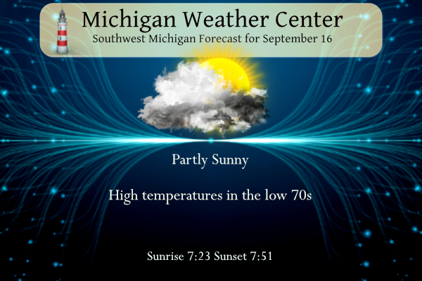
Detailed Forecast For Grand Rapids
Today
Partly sunny, with a high near 74. Light and variable wind becoming south southwest around 6 mph in the morning.
Tonight
A chance of showers before 2am, then a chance of showers and thunderstorms between 2am and 5am, then a chance of showers after 5am. Mostly cloudy, with a low around 57. Calm wind becoming east northeast around 5 mph after midnight. Chance of precipitation is 40%.
Sunday
A chance of showers, with thunderstorms also possible after 11am. Mostly cloudy, with a high near 69. North northeast wind 5 to 8 mph. Chance of precipitation is 40%.
Sunday Night
Partly cloudy, with a low around 49. North wind 5 to 8 mph.
Monday
Mostly sunny, with a high near 68. Light north northwest wind increasing to 5 to 10 mph in the morning.
Monday Night
Mostly clear, with a low around 45.
Tuesday
Mostly sunny, with a high near 72.
Tuesday Night
Partly cloudy, with a low around 55.
Wednesday
Mostly sunny, with a high near 79.
Wednesday Night
Partly cloudy, with a low around 56.
Thursday
Mostly sunny, with a high near 80.
Thursday Night
Partly cloudy, with a low around 58.
Friday
Mostly sunny, with a high near 77.
Detailed Forecast For Lansing
Today
Partly sunny, with a high near 73. West southwest wind 5 to 7 mph.
Tonight
A 20 percent chance of showers after midnight. Mostly cloudy, with a low around 55. Light and variable wind.
Sunday
A chance of showers, with thunderstorms also possible after 2pm. Mostly cloudy, with a high near 67. Light and variable wind becoming north 5 to 7 mph in the morning. Chance of precipitation is 50%.
Sunday Night
A slight chance of thunderstorms before 8pm. Partly cloudy, with a low around 50. North wind around 6 mph. Chance of precipitation is 10%.
Monday
Partly sunny, with a high near 66. North northwest wind 6 to 10 mph.
Monday Night
Mostly clear, with a low around 46.
Tuesday
Mostly sunny, with a high near 70.
Tuesday Night
Partly cloudy, with a low around 53.
Wednesday
Mostly sunny, with a high near 76.
Wednesday Night
Partly cloudy, with a low around 55.
Thursday
Mostly sunny, with a high near 79.
Thursday Night
Partly cloudy, with a low around 58.
Friday
Mostly sunny, with a high near 76.
Guess what? It was another below normal temp day! Over a week straight! Wow, just wow, WOW!!!
Rain concern fading fast…
I didn’t realize the Lansing sensor was moved in 2021, that probably explains why Lansing has been constantly above average recently. I kind of wish sensors were not moved around though (even if the location is more accurate) since it impacts the average temperature history
For those going to Luke Bryan concert Have Fun and be safe!
More below normal temps are on the way! Wow!!
Thanks for the FACTS Slim – so all of this hype about incorrect data coming from the NWS is all BS and just more warm weather hype! Who would have thought! The GR NWS rocks and FACTS are the FACTS! GR has been in an overall below normal temp pattern for months on end! Rock on!!
Grasping over a cool Summer lol…INDY