With the Hurricane season now underway it is a good time to look at the Hurricane category’s
History
The scale was developed in 1971 by civil engineer Herbert Saffir and meteorologist Robert Simpson, who at the time was director of the U.S. National Hurricane Center. The scale was introduced to the general public in 1973, and saw widespread use after Neil Frank replaced Simpson at the helm of the NHC in 1974.
The initial scale was developed by Herbert Saffir, who in 1969 went on commission for the United Nations to study low-cost housing in hurricane-prone areas. While conducting the study, Saffir realized there was no simple scale for describing the likely effects of a hurricane. Mirroring the utility of the Richter Magnitude Scale for describing earthquakes, he devised a 1–5 scale based on wind speed that showed expected damage to structures. Saffir gave the scale to the NHC, and Simpson added the effects of storm surge and flooding. The five categories are described in the following subsections, in order of increasing intensity but before and after a storm becomes a hurricane there are 1. A tropical depression winds under 38 MPH (note we get storms like that many times in Michigan in the late fall) 2. Tropical storm winds of 39 to 73 MPH. Some of our fall storms can reach winds of this force as well. And in summer thunderstorms there can be winds of more then 75 MPH even here in Michigan.
Category 1
Category 1 winds of 74 to 95 MPH. Well-constructed frame homes could have damage to roof, shingles, vinyl siding and gutters. Large branches of trees will snap and shallowly rooted trees may be toppled. Extensive damage to power lines and poles likely will result in power outages that could last a few to several days
Category 2
Category 2 winds of 96 to 110 MPH Well-constructed frame homes could sustain major roof and siding damage. Many shallowly rooted trees will be snapped or uprooted and block numerous roads. Near-total power loss is expected with outages that could last from several days to weeks
Category 3
Category 3 winds of 111 to 129 MPH are described as major hurricanes. Well-built framed homes may incur major damage or removal of roof decking and gable ends. Many trees will be snapped or uprooted, blocking numerous roads. Electricity and water will be unavailable for several days to weeks after the storm passes.
Category 4
Category 4 Winds of 130 to 156. Well-built framed homes can sustain severe damage with loss of most of the roof structure and/or some exterior walls. Most trees will be snapped or uprooted and power poles downed. Fallen trees and power poles will isolate residential areas. Power outages will last weeks to possibly months. Most of the area will be uninhabitable for weeks or months.
Category 5
Category 5 winds of 157 and higher. A high percentage of framed homes will be destroyed, with total roof failure and wall collapse. Fallen trees and power poles will isolate residential areas. Power outages will last for weeks to possibly months. Most of the area will be uninhabitable for weeks or months.
It is nice to know that we do not have to deal with Hurricanes here in Michigan for the most part. There have been some storms that have brought rain and even some wind this far north but it is not real common.
In looking at the next month or so. The Eastern Pacific Oscillation is forecasted by all model guidance to transition from strongly negative to a positive to neutral phase from the middle of September through the middle of October. This transition would support a near zonal weather pattern for the United States and support near to slightly above normal temperatures and near to slightly below normal precipitation. Basically, this data would support a warm, tranquil period of Fall weather. Some may call this pattern rather pleasant.
Slim

Both here at my house and officially at GRR there was just 0.01” of rain yesterday. The high/low at GRR was 68/57. For today the record high at Grand Rapids is 96 set in 1960 the record low is 38 set in 1986. The warmest minimum is 74 set in 1985 the coldest maximum is 58 set in 1917. Last year the high was 68 and the low was 56.
Slim
Nice read Slim. I love watching weather events, but there is no way I would ever want to be anywhere around a hurricane.
Looking at the CPC 8-14 day outlook, I can’t remember ever seeing the entire country from coast to coast AND Alaska completely in the red. Seems usually Alaska will be the opposite of what our area is.
One would think that if it is warm here then it would be cool in Alaska. It must be cool in Russia?
Slim
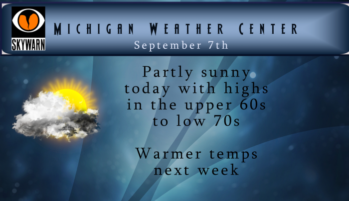
Once again not much rain at all up this way as just 0.01″ of rain fell here yesterday it was more like a heavy mist. Mostly sunny here at this time with a temperature of 67
Slim
Great post Slim – for further info on hurricanes or tropical depressions making it into Michigan here is an article from the NWS https://www.weather.gov/dtx/dtxcane
We had one peek of the sun yesterday – light rain moved in after 8pm giving us .11 of an inch….