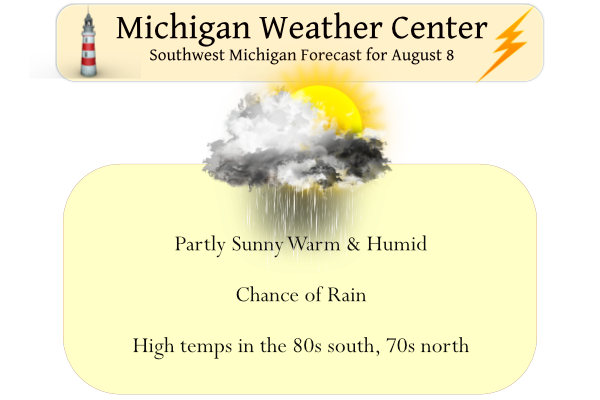
Yesterday in Otsego we had 1.25 inches of rainfall between noon and 12:30. Our total rainfall for yesterday was 1.58 inches. This brings us to 4.28 inches for August and 12.30 inches for the met summer. One last warm and humid day is in store before a cold front comes through this afternoon and brings in much cooler and drier air for the rest of the week. Meanwhile, there will be periods of showers and thunderstorms into this afternoon with locally heavy rainfall. Severe storms are not expected today.
We have a warm 73° at 6 am with a 73° dewpoint. Yesterday’s high was 84° and the low was 73°.
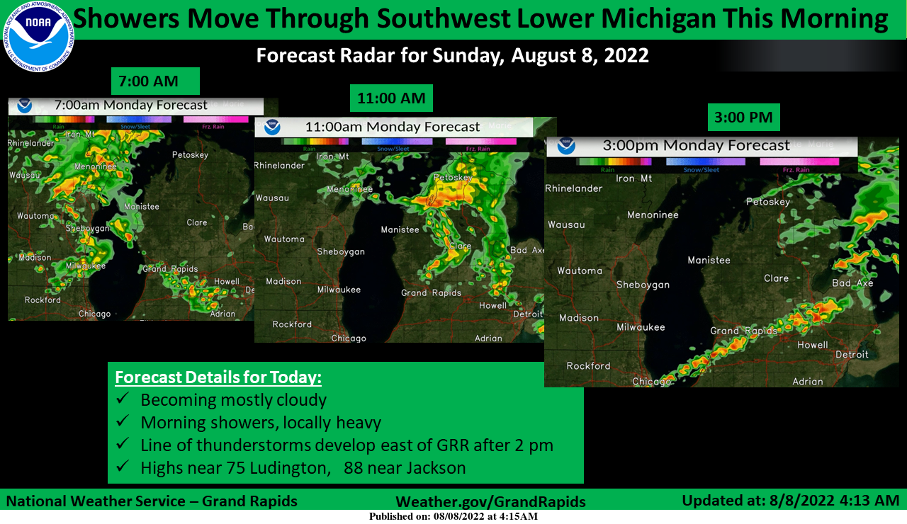
Showers and a few thunderstorms will move through parts of Southwest Michigan this morning. The storms will mostly not get east of a line from Alma to Battle Creek before noon. Additional storms are possible this afternoon.
Forecast Discussion
--Scattered showers and storms into Early Monday--

Southern lower Michigan remains in the warm sector with either
calm winds to southerly winds. This has allowed for rather stable
conditions with low clouds across the area. Weakening convection
will continue to bring scattered showers across the region with
most of the precipitation being fairly light. The sole exception
is where there is strong flow associated with an approaching low
level jet. A finger of the LLJ seen in the HREF 850 mb and 700mb
will only strengthen and move eastward through the morning and
afternoon hours. As there is a lack of vertical development into
Monday morning, severe weather is not a concern. However, flooding
from locally heavy rainfall is. Spots along I 94 have seen
between a half an inch to an inch of precipitation. So while the
passing showers are moving quickly, it will only add to the
conditions. PWATS continue to be in the 2 inch range, however as
stated one of the side effects of the LLJ is that these showers
and storms are moving quickly with little entrainment. Locally
rainfall will need to continually monitored through the day.


--Storms possible late Monday morning through the afternoon. --

The low level jet will move eastward as the cold front approaches.
Once that happens, the morning convection associated with it will
exit and new diurnal/sfc based development of convection along
the sfc cold front will percolate this afternoon. latest soundings
have the best profiles south of I 96 and especially along the I 94
corridor east of I 69.  While a locally heavy rain threat will
continue to exist, the storms during peak heating could have some
locally strong wind gusts as well. Due to these threats, WPC has
southern Michigan in a slight risk for excessive rainfall.

--Cooler and drier behind the cold front--

The elongated trough and associated cold front will swing through
the region Tuesday. A large upper level low situated over Hudson
bay will dominate the pattern this week. The region will between
that low and a semi-permanent high situated over the
intermountain west. The weather we will have to watch will be due
to the upper low tracking eastward and swinging an upper level
trough through the Great Lakes Wednesday into Thursday. this will
have a corresponding short wave that should bring a few showers
and storms. Behind that trough will be even cooler and drier air
that will settle over the region through the end of the work week.
I love the latest CPC! No hot air in sight! Incredible summer!
Get ready for a week of cooler temps and lower dew points! What a summer – no heat waves, near normal temps, plenty of sun, and I have hardly needed to water the lawn! Wow, just wow! Incredible summer and now a week of below normal temps!
The temperature here is just 60 with a mist and fog. Kind of wished we had some long pants to wear
Slim
We are at the docks in Manitowoc waiting for the Bagder
Slim
It has been nice to give my hose a break from watering the garden and flowers. Bonus I put some buckets out to catch the rain water to use the days it is dry!!!
Picked peaches last week and enjoying them and still picking blueberries locally!!! Support our local farms!!!
GR is a balmy +5.2 degrees above average through the first week of August. CPC says look for slightly above average temps to continue for at least the next 2 weeks.
I think some of these warm nights have really helped to bump up the average August temp this year
I did some digging with my PWS stats that are kept every day and here’s the rainfall totals we’ve had this Summer:
June – 1.68” (of that half an inch fell on June 8 and half inch on June 13)
July – 2.96” (1.8” fell on July 23/24)
August – 0.05”
Summer total so far of 4.96”, significantly less than many surrounding areas. Watching the rain come across the lake this morning and it is once again falling apart as it moves in. Keeps happening over and over this year.
My backyard and surrounding areas are the same. We were part of the first “drought zone” in Michigan, and never got out of it. Every storm goes south or north. It is starting to feel like a conspiracy. haha! What is strange is why isnt zeeland in the drought zone? https://droughtmonitor.unl.edu/CurrentMap/StateDroughtMonitor.aspx?fips_26057
We only picked up about 2 tenths in the last 24 hours at my house, just east of Hamilton. Just enough to allow the water hose to stay on the rack yesterday. Looking forward to the cooler and DRYER air-mass ahead 🙂
It rained overnight and it looks like there’s more coming across the lake. Not sure how much rain we received yesterday, but it was significant. On the other side of town at the airport, they recorded 1.78″ yesterday, with a total of 3.78″ during the first seven days of August. Needless to say, everything has returned to green here. After the front comes through, it looks like we will get back to normal-ish temps. The next week looks fantastic. The average low now is 61. After six consecutive humid nights with lows in the 70s, “normal” will feel great. I’m… Read more »