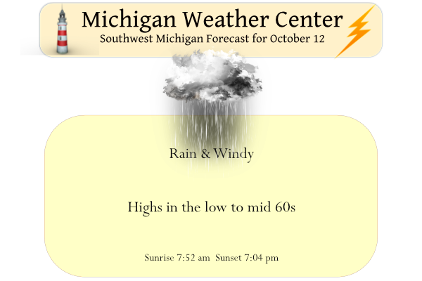
It has been quite some time since we have had decent rain in our forecast, way back on the 26th of September. We have had .63 of an inch so far from our current system. Yesterday’s high was 75° and the low was 40°. We expect rain today with gusty winds this afternoon with a chance of a thunderstorm.
Weather History for SW Michigan
October 9
1989: Record cold temperatures put the freeze on southwest Lower Michigan for the second day in a row. Records include 23 degrees at Grand Rapids and Lansing and 24 degrees at Muskegon. The record cold is accompanied by scattered snow flurries.
October 10
1879: Southwest Lower Michigan is in the midst of a long spell of warm weather. Lansing rises into the 80s for seven out of the eight days from October 5th through the 12th. This includes the record high of 84 degrees on October 10th, which was preceded by a record 83 degrees on the 9th and followed by 85 degrees on the 11th.
1906: An early season snowstorm drops 4 to 8 inches of snow from Ludington to South Haven. Temperatures plunge into the teens the next morning, killing thousands of fruit trees, enough to alter the agricultural economy of southwest Lower Michigan.
October 11
1912: A late evening tornado hit Gratiot County. Five farms sustained damage along a five-mile-long path. An elderly woman was killed and her son injured as their home was blown apart southwest of Alma.
October 12
2006: A record early-season snowstorm brings up to eight inches of snow to southwest Lower Michigan. Tree damage and power outages were extensive around Hastings in Barry County as the wet, heavy snow clings to the tree branches, which still had leaves on them. We lost a maple tree in our backyard during this event.
October 13
1874: A record cold snap struck Lower Michigan with Lansing plunging to 16 degrees.
1975: Record warmth occurred with highs in the 80s. The 87 degrees at Grand Rapids was a record for the date and the highest temperature for so late in the season.
October 14
1954: A tornado destroyed an empty schoolhouse at Ashley in Gratiot County. It also took the roof off one house and a porch off of another.
October 15
1899: Muskegon hits 86 degrees for its highest October temperature on record.
1944: Cold air is firmly entrenched in Lower Michigan with record lows of 23 degrees at Grand Rapids and 25 degrees at Muskegon.
Weather History for SE Michigan
October 9
On October 9, 1949, two days of record highs occurred in Detroit with temperatures at 86 degrees on the 9th and 84 degrees on the 10th.
October 10
On October 10, 1949, a three-day period of record highs in Flint ended. Temperatures ranged from 84 degrees on the 8th, 82 degrees on the 9th and 85 degrees on the 10th.
October 11
On October 11, 1949, record high precipitation occurred, with 3.27 inches of rainfall recorded in Detroit.
October 12
On October 12, 2006, the earliest measurable snowfall occurred in Detroit, Flint and Saginaw. Detroit recorded 0.2 inches of snow, Flint received 2.3 inches of snow, and Saginaw had 0.3 inches of snow.
Also in 1995, late-season heat gave record highs to all three sites, Detroit (84 degrees), Flint (82 degrees) and Saginaw (83 degrees).
October 13
On October 13, 1909, The second earliest measurable snowfall occurred in Detroit with an amount of 0.4 inches of snow. Also on this date in 1999, Detroit received 3/4-inch hail at 11:15 am.
October 14
On October 14, 1989, Detroit and Flint share record highs this date with 83 degrees and 82 degrees respectively.
October 15
On October 15, 1952, Saginaw reports 0.04″ rainfall. This is one of only three days where measurable rain is recorded this October, the driest on record with 0.18″ total. Also for this month, Flint had the 5th driest month on record.
Forecast Discussion
- Showers and Strong Winds Today Ahead of Cold Front -

On and off warm advection showers will persist this morning into the
early afternoon. Meanwhile, as the deepening surface system to our
west approaches, the increasing pressure gradient in conjunction
with a 50 to 60 knot LLJ just overhead will result in strong
surface winds. With afternoon mixing tapping into this reserve of
winds, gusts on the order of 35 to 45 mph will be possible ahead
of the arrival of the cold front.

By around 2pm the cold frontal showers should arrive in the
Ludington area, then down towards Jackson by 7pm. Instability still
appears to be limited so just a few embedded storms are expected.
While severe storms are not anticipated, these convective showers
may still contain locally damaging gusts due to enhanced downward
momentum transport of 50 mph winds.

Given that afternoon cloud cover may suppress vertical mixing
enough to limit winds a touch, we will hold off on a Wind Advisory
for today. However, there will be a narrow window of time during
the passage of the cold font when damaging winds up to 45mph or
greater will be attainable. Such hazards will be messaged through
short-fused SPS products.

- Cooler with Persistent Showers -

A secondary cold front is expected Thursday as a deeper upper low
takes root over the northern Great Lakes region. Meanwhile, 850mb
temps will drop below 0C and stay there through next week.
Several mid-level short wave lobes will support reinforcing pushes
of cold air over the warmer Lake Michigan waters. Thus,
persistent lake effect rain showers are expected to end the week.

Temperatures will be below average this weekend and even cooler into
the start of next week as 850mb temps plunge to -5C to -10C
Monday and Tuesday. Afternoon highs will be limited to the 40s
through the first half of next week.
73 here with a gusty south wind. Yes, I am enjoying while it lasts.
Once again Lansing was much warmer than GR as the high here was just 67 here at my house and is now down to 65 with rain just to the west.
Slim
I went outside and soaked it in. I have fallen one in the past hour to 69. Warmest it got at my house today was 71
We got some nice sunshine at my house shooting the temp up to 70 currently.
There is some sun here as well and the temperature here is now at 65. I have to wonder how much wind if any we will see with that area of rain to our west.
Slim
Interesting that there is currently a tornado warning west of Milwaukee. The warning includes the NWS office in Milwaukee.
I just saw that too…
Winds 45 to 50 mph today so long leafs .. Get the Winter coats out its going to get cold around here in west Michigan….INDY
Our normal summer temp pattern is about fall off a cliff! Fall has already started out with below normal temps and now we will be seeing some real cold! Bring on winter!
Get ready for November weather in October! Cold, cloudy and wet! Incredible!
Well, we finally got some rain and at times it was a heavy rain. Here in MBY I have recorded a total of 1.04” of rain fall. Up until midnight the official amount at Grand Rapids was 0.59” The official H/L at Grand Rapids yesterday was 75/42. That may have been the last high of 70 or better for 2022. We shall see. There was a reported 65% of possible sunshine. The overnight low so far today here in MBY has been 56. At the airport the low so far has been 57. For today the average H/L is now… Read more »