As I write this at 6 am, rain is moving into SW Michigan. The last time it rained was eleven days ago on the 13th. Low pressure will bring showers and thunderstorms today and Monday. Some small hail and gusty winds are possible with some of the storms this afternoon. Cooler air will follow on Monday and Tuesday. Below are the SPC outlook and predicted rainfall through 8 pm today.


U.S.A and Global Events for June 25th:
1957: Hurricane Audrey moved northward, slowly strengthening until the 26th. At that time, a strong upper-level trough led to its acceleration and the hurricane deepened rapidly on its final approach to the Texas/Louisiana border. Audrey became the strongest hurricane on record for June upon landfall, as it reached category four strength. Its acceleration was unanticipated, and despite hurricane warnings in place, 418 people perished in the storm, mainly across southwest Louisiana.
1967: Three, F3 tornadoes crossed the Netherlands on this day. The first tornado touched down at 4:17 PM in Oostmalle. This storm destroyed the church and the center of the village. More than half of the 900 homes in the community were damaged with 135 completely gone. The second tornado touched down near Ulicoten and tracked northward through the woodlands area. This storm killed two people at a camping site near Chaam, Netherlands. The third tornado destroyed 50 houses in Tricht, killing five and injuring 32 others.
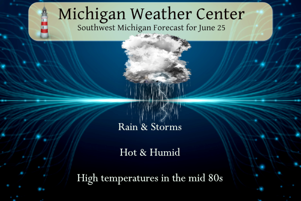
Grand Rapids Forecast
6 25 grrForecast Discussion
Remnant showers with a few embedded thunderstorms from the early
morning MCS exiting northern IL will likely impact areas near and
south of I-96 into the early to mid morning hours. No severe
weather is expected with this activity. Outflow boundaries from
this activity could possibly lead to additional scattered showers
and non-severe thunderstorms into the midday and early afternoon
period prior to the main timeframe of concern for severe weather
development later today.

Increasing confidence exists in strong to severe thunderstorms
across much of the region after 17z today. Damaging thunderstorm
wind gusts along with large hail are the primary concerns. The
environment is less supportive for tornado development here but
the threat is not zero.

The synoptic setup looks favorable for thunderstorm development
and potential severe weather after 17z. For late June standards,
the 500mb wave heading our way is anomalous and the timing is just
about perfect for afternoon storm development. The left exit
region of the upper level jet will provide upper level divergence
across Lower Michigan this afternoon. A 30-40 kt low level jet
around the southern periphery of the upper low will provide low
level convergence across southern and central Lower Michigan in
the 16z-21z time frame. Surface dew points will rise into the mid
to upper 60s, which will seem tropical to us given how dry our
weather pattern has been for many weeks.

The 00z HREF is showing SB CAPE values of 1000-2000 J/kg north of
I-96 after 16z and 2000-2500 J/kg south of I-96. NAM Nest 0-3km
shear values are around 25 kts and 0-6km is not much better at
30-35 kts, though LCL-EL shear values of 40-45 kts are projected,
which is sufficient for storm organization and potentially severe
cells. DCAPE values do look impressive with 1000-1300 J/kg noted
from various CAMs. Forecast hodographs today do show some
curvature in the 0-3km range, though with marginal wind speeds of
~20-25 kts this would probably limit the threat to an isolated
weak tornado if any could develop. Damaging wind gusts are the
main concern along with large hail, especially early on in the
life cycle of any storms.

HREF 24 hr max reflectivity is very robust for the entire CWA,
leading to increasing confidence that most areas will see some
rain today. Also of note is the HREF max surface wind gusts
(convective) are suggesting the greater likelihood for 60+ mph
gusts could occur during the 18z-20z window, during the earlier
portion of the event and further west than one would originally
suspect. Perhaps this is due to 1) a slight westward trend in
storm initiation according to the 00z guidance, and 2) the
possibility that a less than ideal low-level shear environment
would lead to storms containing the highest wind gusts early on
(shear/cold pool balance) and then transitioning to more outflow
dominant by the time they reach the US 127 corridor. The most
likely scenario shows storm initiation either over eastern Lake
Michigan in the 17z-19z time frame, or very close to the lake/land
interface. Scattered cells will probably congeal into a line
fairly quickly based on CAM simulated reflectivity trends. We
would not be surprised to see some pockets of significant wind
damage and/or hail damage along this line, along with scattered
power outages. The entire line will likely exit our CWA by 00z or
a bit sooner.

With the surface low overhead on Monday, expect periodic showers
and even some thunderstorms with instability remaining across the
region. Severe weather is not expected, however.


.LONG TERM...(Monday night through Saturday)
Issued at 332 AM EDT Sun Jun 25 2023

A few lingering showers and/or thunderstorms are likely Monday night
as a surface low remains close by over Lake Huron and upper
troughing continues over the Great Lakes. Any storms that develop
would be of the non-severe variety as instability is weak.

After a dry Tuesday/Wednesday, the next chance of rain will come
Thursday-Saturday as the next trough tries to move in. Within that
time frame, Friday looks like the best chance of rain. GFS shows a
northward moving warm front generating some showers/storms during
the day. While the ECMWF doesn`t quite buy into that, it does
somewhat resemble the GFS in moving a weak surface low over the
state. Those models also show a short wave rotating through the flow
over the cwa Sunday. Thus, precipitation chances may linger into
Sunday too.

Temperatures won`t be overly warm by late June standards. Thursday
and Friday will be the warmest days and see highs in the mid 80s.
Monday night through Wednesday night will see comfortable night time
temperatures in the 50s.
Get ready for more below normal temps! Incredible!
Now stay tuned for normal fun burning nights and cold sprites it has rained it has rained wow to the wow!! INDY
Some of you did not get much rain? I have picked up 1.2 inches of RAIN! Wow was it coming down on buckets! Incredible!
Nope. Under 0.05” and looking like it’s stopping soon. This drought continues and I will sell more livestock.
You were one of the lucky ones. The band of rain that came through here was nothing. Horrendous!
Wow that is unfortunate!
Total accumulation for the day for my house ended up at 0.12. Absolutely terrible. I can hope for more tomorrow, but it’s not looking good.
Getting heavy rain now. Couple of claps of thunder. Light winds. Looks like we’re right in the middle of the two significant cells. Temp has dropped 15 degrees.
I was about two miles away at a friend’s when I wrote that. Just got home. Completely dry here at our house. We got nada, zip, zilch, zero. 😞
That’s a nice sight from the Ring Camera…Ada is wet!
What a worthless band of rain for my area. Horrendous! Better than nothing but not going to help anything.
Only drizzling here. Worthless. It looks like it disintegrated and split around me. Maybe 0.05” so far today.
Actually I just checked the rain gauge. A whopping 0.02”. I am irrationally Angry.
Oh yeah it’s unreal. I’ve never seen a period this long with so few rain. Congrats to those that got lucky. Maybe we will get some more tomorrow but considering how today went I’m not betting on anything.
Praised the Lord we will have corn and INDY will have a fire again….let it rain let it rain ….INDY
Amen INDY!!! The Lord blessed us with a good soaking today too!
The National Weather Service in Grand Rapids has issued a
* Severe Thunderstorm Warning for…
Ionia County in south central Michigan…
Northeastern Barry County in southwestern Michigan…
Western Clinton County in south central Michigan…
Northwestern Eaton County in south central Michigan…
* Until 600 PM EDT.
…A SEVERE THUNDERSTORM WARNING REMAINS IN EFFECT UNTIL 515 PM EDT FOR EASTERN BARRY AND SOUTHWESTERN EATON COUNTIES… At 433 PM EDT, a severe thunderstorm was located near Bellevue, or 13 miles northeast of Battle Creek, moving northeast at 35 mph. HAZARD…60 mph wind gusts and penny size hail. SOURCE…Radar indicated. IMPACT…Expect damage to roofs, siding, and trees. Locations impacted include… Charlotte… Hastings… Nashville… Bellevue… Assyria… Kalamo… Olivet… Vermontville… Dowling… Banfield… Lacey…
Quite the storm over Battle Creek right now
It is raining so hard and blowing we can’t see across from us. It is pouring out of the eve troughs.
It’s been hot and sunny all day for me! I swear my property is cursed.
.
The sky has become pretty dark here now. Lightning and thunder , wind and it is pouring out.
Still not raining here. It seems like it is stalling in the middle of Kent county… just move a few more miles east please 😀
Raining here!
Hallelujah! Send it this way, please.
It looks like it is headed your way soon.
👍
Tornado Watch
MICHIGAN COUNTIES INCLUDED ARE
BERRIEN BRANCH CASS
HILLSDALE ST. JOSEPH
Severe Thunderstorm Watch until 7 Pm for the whole viewing area
added radar to bottom of post
.UPDATE… Issued at 1035 AM EDT Sun Jun 25 2023 We still expect convective initiation around 1-2 PM EDT and near or just east of our lakeshore. Current satellite presentation shows substantial clearing upstream over Lake Michigan and eastern Wisconsin. Thunderstorms are underway west and southwest of Green Bay in an area east-northeast of the surface low and downstream of an upper PV max. Farther south towards Milwaukee, clouds have a more laminar appearance suggesting that we can expect it to be another couple hours before boundary layer destabilization is sufficient to support thunderstorms. The driver for convective initiation will… Read more »
Scattered to numerous thunderstorms are forecast to develop in one or two organized arc or lines of lift related to: 1. The front impinging on a destabilizing boundary layer up and down western parts of the outlook area, and perhaps 2. A prefrontal/lake-breeze convergence zone over western Lower MI. Damaging to severe gusts and large hail are likely as activity organizes upscale following an early, discrete to semi-discrete stage. Supercellular tornado and large-hail threats will exist along nearly the entire corridor. That said, potential for strong tornado(es) and significant/damaging-hail should be relatively maximized across the eastern IN/western OH and perhaps… Read more »
Substantial rain? I will believe it when I see it! The estimates keep getting my lower and lower?
see new comments
SPC Update:

The farmer we know in Sand Lake says his crop is essentially a total loss and will be filing an insurance claim. I feel for the farmers that are not insured.
What is his crop?
Quite humid out right now (compared to the rest of the season so far). Pretty uncomfortable for working out right now. But looking forward to any rain or storms we get!
We are now in a slight risk area.
https://www.spc.noaa.gov/
with a moderate risk up to the Michigan border.
Slim
Supercellular tornado and large-hail threats will exist along nearly
the entire corridor. That said, potential for strong tornado(es)
and significant/damaging-hail should be relatively maximized across
the eastern IN/western OH and perhaps southern Lower MI sector,
where the supporting CAPE/shear parameter space will overlap best.
In that swath, large low-level hodographs will develop ahead of the
main convective band, leading to 150-300 J/kg effective SRH and
40-50-kt effective-shear magnitudes
Slim
Enhanced risk up to the border (that’s what you meant, just want to clarify for anyone else)
I am confused NOAA has is not in much a risk and just read on Michigan Storm Chasers site that our risk is increasing…. I guess we wait and see.
Happy 6 months to Christmas!!!
It has been a normal temp summer so far and no heat waves are in sight! Who would have thought?
The rain total forecast keeps getting lower and lower! Pathetic!
Rain has ended for now and we recorded an astonishing 0.08 inches of liquid gold. That raised our 7 week total here in northern Kazoo Cty. to 0.23 inches.
Pathetic lack of rain and little change in sight!
We received a bit of rain Friday afternoon. Just enough to make the concrete wet. We had about a dozen raindrops yesterday as a dark cloud moved overhead. Our local Mets aren’t very confident of legit severe weather this far north this afternoon/evening. But, the slow moving low will hopefully bring us an inch or maybe more of rain over the next few days. #fingerscrossed
We haven’t got a drop for a long time. I can’t even remember the last thunder we have had. It was probably thunder snow! Haha.
no a/c, no watering for a few days! Will be a nice break. Hopefully, the hail and high winds will not materialize.
Don’t count on it! I will believe it when I see it!
The official H/L at Grand Rapids yesterday was 90/67. There was once again no rain fall and the sun was out 74% of the possible time. There were 0 HDD’s and 14 CDD’s For today the average H/L is 82/61 the record high of 97 was set in 1988 and the record low of 41 was set in 1986. The record rain fall amount of 2.17” fell in 2021.
Slim
How many 90 degree days do we get in an average year? Seems we are at or close to it already. Yesterday was the 9th one at my house.
Officially Grand Rapids mean is 12, Holland 10 and Lansing is 6. The record for Grand Rapids is 37 in 1988, at Lansing it is 44 in 1895 at Holland it is 33 in 2012. So far this year officially at GR there have been 7, at Lansing 6 and at Holland 6.
Slim
There is a very good chance of rain fall today and some storms could be on the strong side. The rain that falls will be much welcomed. With highs forecasted in the upper 60’s for tomorrow that would be one of the coldest maximus for any June 26th there have been only 8 times that it has not reached 70 or better on any June 26th at Grand Rapids. At the current time there are a few sprinkles falling here just enough to get the pavement wet, the temperature is now at 69.
Slim