Today looks to the last day of this extreme dry spell. Since May 9th Grand Rapids has only had 0.24” of rain fall this is the longest dry spell of that magnitude 1988 Are we going to have a major drought? As a rule droughts are mostly short lived here in Michigan. Some of the longer lasting droughts in Michigan happened in 1930 to 1937, 1960 to 1967 and 1988 to 1990. These three droughts were long term and even in those years not every month was dry.
The drought that started in 1930 was of course part of the “dust bowl” era. 1930 is the driest year in recorded history across western Michigan with rain fall totals of 20.92” at Grand Rapids, 18.50” at Lansing, 16.57” at Muskegon and 19.36” at Holland. The June July total at GR was just 0.96” 0.68” at Lansing 1.09” at Muskegon. The high reached 99 at both Grand Rapids and Lansing. During the years 1930 to 1937 there were 12 days of 100 or better at Grand Rapids. During the 7 years of drought there were 158 days of 90 or better at Grand Rapids. The 1960 to 1967 drought was much less severe than the 1930/37 one and most of the really dry months were in the winter season. 1964 had the most days of 90 or better with 20 at GR and there was one day of 100 or better in 1964. The 1987 to 1990 drought had two summer months of less than 1” of rain fall at Grand Rapids. And 3 winter months of less than one inch. Both Grand Rapids and Lansing had a good amount of rain fall for the whole years in the 1987 to 1990 period. Grand Rapids. Lansing and Holland reached 100 in 1988 there were 21 days of 90 or better in 1987 at GR and 22 at Lansing. In 1988 there were 37 days of 90 or better at GR and Lansing.
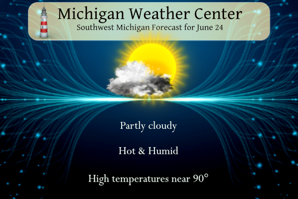
The official H/L yesterday at Grand Rapids was 83/63 there was no rain fall. Since May 1st Grand Rapids has only had 1.05” of rain fall. There was just 22% of possible sunshine for one of the cloudier days in a while. For today the average H/L is now up to 82/61 the record high of 96 was set in 1901 and 2009. The record low of 41 was set in 1961. The record rain fall amount of 2.85” fell in 1994.
There is a chance of some severe storms tomorrow and also a chance of some heavy rain fall. With how dry it has been any area that does get any heavy rain fall could see some flooding as the run off will be extreme. There will be a strong cold front late tomorrow and Monday and Tuesday will be much cooler.
SHORT TERM
(TODAY THROUGH SUNDAY)
ISSUED AT 244 AM EDT SAT JUN 24 2023

- RISK FOR STRONG/SEVERE STORMS WITH LOCALLY HEAVY RAIN FOR
  SUNDAY

SUNDAY AFTERNOON IS LOOKING LIKE THE MAIN WINDOW FOR POSSIBLE
SEVERE WEATHER. GUIDANCE IS IN RELATIVE AGREEMENT IN SHOWING THE
LEFT FRONT QUAD OF AN UPPER JET OVER THE CWA PROVIDING UPPER LEVEL
DIVERGENCE. THE CORE OF A STRONG 50 TO 70 KNOT MID LEVEL JET IS
SHOWN TO PIVOT JUST SOUTH OF THE CWA. AFTERNOON MU CAPE VALUES
VARIES FROM THE MODELS WITH LOW RES RUNS SHOWING 1000 TO 2000 J/KG
AND HIGH RES RUNS SHOWING VALUES TOPPING 2000 J/KG. THE 03Z RUN OF
THE SPC HREF SHOWS AFTERNOON ENSEMBLE MEAN MU CAPE VALUES TOPPING
1000 J/KG FOR MOST OF THE CWA AND 1500 J/KG ACROSS THE SOUTHERN
HALF. THIS RUN ALSO CAPTURES THE INCREASED POTENTIAL FOR A SWATH
OF 50 KNOT WINDS DURING THE AFTERNOON. BASED ON THIS AN INCREASED
RISK FOR A LINE OF STRONG TO SEVERE STORMS TO CROSS THE REGION,
ESPECIALLY THE SOUTHERN HALF OF THE CWA EXISTS SUNDAY AFTERNOON
WITH DAMAGING WINDS THE PRIMARY RISK.

PWAT VALUES CLIMB TO AROUND 1.75 INCHES WITH THE PASSAGE OF THE
STORMS ON SUNDAY. THE COMBINATION OF EARLY MORNING CONVECTION AND
AFTERNOON REDEVELOPMENT MAY LEAD TO LOCALLY EXCESSIVE RAINFALL
ESPECIALLY IN URBAN AREAS. THE SPC HREF 24 HR QPF ALSO CAPTURES
THE INCREASED POTENTIAL FOR SOME LOCATIONS TO SEE IN EXCESS OF 1.5
INCHES OF RAIN.

- WARMING UP AGAIN TODAY

STEADY 925 MB WARM AIR ADVECTION OCCURS TODAY AND INTO THIS
EVENING WITH MODELS SHOWING A RISE FROM 19 DEG C TO 25 DEG C 00Z
SAT TO 00Z SUN. MIXING TO THIS LEVEL SUPPORTS MAX TEMPERATURES
RISING BACK INTO THE UPPER 80'S TO NEAR NEAR 90 FOR MANY
LOCATIONS. LESS OF AN EASTERLY FLOW IS EXPECTED AND AN ONSHORE
WIND WILL LIKELY FORM TODAY AS A LAKE BREEZE DEVELOPS. THE WARMEST
TEMPERATURES WILL LIKELY END UP JUST AHEAD OF THIS LAKE BREEZE.
THIS WOULD INCLUDE THE GRAND RAPIDS AREA WHERE ENSEMBLE MAX T
GUIDANCE FROM THE ECMWF, GFS AND CANADIAN MODELS ARE SHOWING
VALUES AROUND 90 DEGREES TODAY.


LONG TERM
(SUNDAY NIGHT THROUGH FRIDAY)
ISSUED AT 244 AM EDT SAT JUN 24 2023

OUR PRIMARY LONG TERM FCST CHALLENGE IS TO EVALUATE CONVECTIVE AND
SVR WX POTENTIAL SUNDAY EVENING. STRONG TO MARGINALLY SEVERE
CONVECTION IS POSSIBLE SUNDAY EVENING MAINLY OVER OUR EASTERN
FCST AREA EARLY IN THE EVENING. THE LATEST MODELS RUNS SHOW THE
MAIN LINE OF CONVECTION PUSHING THROUGH THE EASTERN ZONES IN THE
22Z SUN TO 00Z MON WINDOW. THE OVERALL THREAT SUNDAY EVENING
LOOKS MARGINAL WITH MARGINALLY SEVERE WIND GUSTS BEING THE PRIMARY
CONCERN.

PRECIPITATION CHANCES REMAIN IN THE FORECAST THROUGH TUESDAY
AFTERNOON WITH THE UPPER LOW OVER OUR REGION. A FEW STORMS STILL
SEEM POSSIBLE MAINLY ON MONDAY AS A RESULT OF INSTABILITY GENERATED
FROM DAYTIME HEATING AND WITH THE POOL OF COLDER AIR ALOFT WITH THE
UPPER LOW OVER OUR AREA.

FAIR WX WILL RETURN WEDNESDAY AND THURSDAY ALONG WITH A MODERATING
TREND OF TEMPS. THE NEXT LOW PRESSURE SYSTEM APPROACHING FROM THE
WEST WILL BRING A CHANCE FOR SHOWERS AND STORMS THURSDAY
NIGHT AND FRIDAY.
Day 2 outlook:

This update features somewhat less of an eastward extent of thunderstorms into the area overnight and early Sunday. Some guidance would even suggest we will be completely dry until Sunday afternoon. Even if we end up seeing a good coverage of thunderstorms Sunday morning, however, my guess is that we will still experience sufficient destabilization for another round of thunderstorms Sunday afternoon. Sunday afternoon still looks like the main time for marginally severe storms with localized severe wind gusts possible. Most of the available CAMs develop a solid north to south oriented line of convection just east of US-131 starting… Read more »
Definitely feels hot with dew points in the 60s.
The corn in the nearby field is barely ankle high and looks stressed. I feel for the farmers this year.
Great pool day and then bring on the rain!!!! I love it!