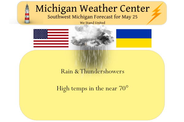
Yesterday’s high temp in Otsego was 68.5° and the low 45°. We have 54° at 5 am. Today we will see a return to an unsettled weather pattern with showers and a possible thunderstorm. We will see off and on rain through Friday.
Weather History for SW Michigan
May 22
1917: Cold rain mixes with snow and temperatures rise only to the lower 40s after morning lows in the lower 30s.
1963: Snowflakes fall at Lansing as morning low temperatures in the 30s only rise to the mid and upper 40s.
May 23
1966: A barn was destroyed by a tornado near Gobles in Van Buren County.
1973: A tornado destroyed three barns and damaged an industrial building in Winn in Isabella County.
May 24
1890: One person was injured as a tornado destroyed one home and a dozen barns northeast of Ithaca in Gratiot County.
May 25
1925: Lansing records its latest snow on record as snowflakes fall there with a low temperature of 32 and a high of 47 degrees.
1992: Widespread freezing temperatures do heavy damage to the fruit crop across southwest Lower Michigan. Record lows for today include the 29 degrees at Lansing, 31 at Grand Rapids and 32 at Muskegon.
2006: Two weak tornadoes caused no damage as they briefly spun up between Beebe and Breckenridge in Gratiot County.
May 26
1961: Snow flurries are observed across Lower Michigan as record cold air moves in. Temperatures fall well below freezing the next morning, wiping out much of the fruit crop.
May 27
1907: Wet snowflakes fall at Grand Rapids and Muskegon. It is the latest snow on record at Grand Rapids.
1912: A tornado destroys barns and kills livestock near East Leroy in Calhoun County.
1960: Several farm buildings were damaged or destroyed by a tornado four miles east of Ionia.
1973: A tornado destroyed a barn and silo near Saranac in Ionia County. Another tornado did minor damage near Gun Lake in Barry County.
May 28
1955: A series of tornadoes put down an intermittent damage path more than 60 miles long from near Schoolcraft in Kalamazoo County to the east of Grand Ledge in Eaton County. One person was injured northwest of Charlotte as a barn was destroyed. Two homes were unroofed and the total damage was estimated at 150,000 dollars.
1991: A tornado damaged homes and destroyed outbuildings near Hart in Oceana County.
Weather History for SE Michigan
May 22
On May 22, 1883, a very late-season snowstorm hit Detroit with five inches of snow accumulating during the overnight hours.
May 23
On May 23, 1963, the overnight temperature dropped to 28 degrees in Flint, which is the record low temperature for the day. Interestingly enough, the very next year, in 1964, the daytime temperature rose to 87 degrees, setting the record high temperature for the date. This high-temperature record was equaled and thus superseded in 2007
Also on May 23, 2004, severe thunderstorms rolled across all of Southeast Michigan. One storm produced a 70 mph wind gust at Detroit Metro Airport which caused damage to a building under construction and one injury. The storms dropped 1.69 inches of rain on Detroit, 1.39 inches on Flint and 1.41 inches on Saginaw. That was the last of the heavy rainfall that pushed May of 2004 to the wettest May on record (Detroit – 8.46 inches, Flint – 8.19, Saginaw – 8.14). As a result, widespread flooding across Southeast Michigan caused over 100 million dollars in damages.
May 24
On May 24, 1925, the temperature climbed to only 44 degrees in Detroit, setting the record for the record low maximum on this day.
Also on May 24, 1971, an F2 tornado moved through Tuscola County at 8:30 PM. This tornado is responsible for 1 injury and over $50,000 in damage. This was the strongest tornado ever to hit Tuscola County since 1950.
May 25
On May 25, 1896, an estimated F5 tornado touched down and moved northeast for about 30 miles, affecting portions of Oakland, Lapeer and Livingston Counties. Towns affected included Thomas, Ortonville and Oakwood just after 9:00 pm. With 47 deaths, this is the second deadliest tornado ever in Michigan trailing only the Flint-Beecher Tornado of 1953. Nine of the fatalities were in a single home in Ortonville and parts of some homes were found dozens of miles away. Twenty-two people were killed in Ortonville, ten in Oakwood, three in Thomas, four in North Oxford and three in Whigville with others in more rural areas. Other significant tornadoes occurred in Tuscola County with one fatality, and in Mt. Clemens where two people died when 30 homes were destroyed.
On May 25, 1994, Linden reported 3-inch hail at 6:30 pm which caused $5,000,000 in crop damage.
Also on May 25, 2011, thunderstorms produced heavy rain across much of Southeast Michigan. Flint received 1.28 inches, Detroit Metro Airport had 1.67 inches and Detroit City Airport recorded 3.03 inches. This rainfall added to the already very wet spring to produce numerous flooded roads and a few flooded homes. In fact, this rainfall helped to push Flint to its 2nd wettest May and wettest Spring on record. It was the 2nd wettest spring in Detroit records.
May 26
On May 26, 1968, 2.56 inches of rainfall fell in Detroit. This is the greatest daily rainfall total for the month of May in Detroit.
May 27
On May 27, 2012, Numerous trees were downed and the awning was torn off of an I-75 rest stop located near Exit 160 as thunderstorm winds of up to 75 mph swept across parts of Saginaw and Bay counties.
On May 27, 1987, a two-day streak of temperatures at 90 degrees occurred on the 27th and 28th in Flint. Also on this date in 1994, there was a two-day streak of record lows on the 27th with 31 degrees and the 28th with 36 degrees.
May 28
On May 28, 2013, numerous thunderstorms spawned six confirmed tornadoes in Shiawassee and Genesee Counties between the hours of 8:30 and 10:30 pm. Storm surveys revealed 2 EF0, 2 EF1, and 2 EF2 tornadoes had occurred in addition to sporadic wind damage. The damage included numerous snapped trees, lost roofs, and a destroyed barn. The most significant damage occurred a few miles east of Grand Blanc near the intersection of Hegel and Gale Roads, where a house was nearly destroyed in addition to a garage and external storage facilities.
Also on May 28, 2012, afternoon high temperatures soared to 95 in Detroit and 93 in Flint, both all-time records for the month of May.
Also on May 28, 1991, an F1 tornado spoiled dinner plans for the people of Huron County when it hit at 7:10 PM causing roughly $5000 in property damage.
Forecast Discussion
-- Showers/storms develop today with a small chance of severe South--

A few light sprinkles have already moved into the NW section of the
area early this morning. These sprinkles are mainly coming out of a
mid cloud deck based around 10k ft. The regional radar imagery shows
more showers down across Srn IN and IL, poised to move over the area
later this morning and this afternoon.

This rain is all being driven at this time by a 45 knot low level
jet nosing up into the area, advecting warm and moist air from the
Gulf region toward the area. The initial batch of rain this morning
and early afternoon is expected to be mainly rain, with no thunder,
as instability doesn`t really get here until later.

We have been talking about a small chance of severe weather for the
past couple of days, for the extreme SW portion of the area. The
models continue to indicate this is a marginal setup, but it can not
be ignored. First of all, the initial rain will limit heating some.
That said, a 45 knot low level jet will help to destabilize the
atmosphere a bit with the warm/moist air coming in. ML CAPEs are
forecast to increase to as high as about 1,000 J/kg down along the
CWFA border.

Deep layer effective shear will be favorable around 50 knots with
the upper jet nearby, and good directional shear in the lower
levels. This good low level directional shear will be the result of
the warm front moving toward the area, and a wave riding up along
the front. This wave is in the AR vicinity this morning, and will
ride up toward the area later today.

Forecast soundings show that all severe wx threats will be in play
today. The deep layer shear will help to support some marginal hail.
Limiting factor for this is that mid level lapse rates are fairly
weak, actually less than 6.0 C/km. DCAPEs are quite limited in the
400-500 range with a lack of drier air in the profile. Wind profiles
are not unidirectional, but a microburst could occur out of the
strongest storms. A weak tornado or two remains possible also. The
warm front and wave both will help with low level directional shear.
The low level jet overhead will help with the speed shear. Forecast
hodographs are of a favorable curved pattern with the shear present.
SRHs are in the 200s/300s 0-1 and 0-3km layers respectively. The
favored area for a weak tornado or two would be southern portions of
Kalamazoo and Van Buren counties where the best shear is, and
closest to the warm front as the wave comes up. This threat will
wane after 00-02z as the atmosphere stabilizes a bit.

-- Rain chances continue for Thursday and Friday --

Additional storms will be possible on Thursday. The favored area
will change a bit, being across the SE portion of the area. The
whole system shifts to the east a bit. We will see another low level
jet lift NNE, with it being aimed at the eastern portion of our area
near U.S.-127 and areas east. Instability and shear are both a bit
weaker on Thu compared to today. We actually have some ridging aloft
that will be over the area in response to the digging low to our SW.

Depending on the rotation and movement of the upper low, the SE
portion of the area will see additional rain on Friday. The
expectation right now is that the center of the low will be South of
the area and will move to the SE of the area. We will see the
deformation zone of the upper low clip the SE corner of the area.
This should be mostly just be rain there on Friday, with all of the
heat and instability out of the region.

-- Mainly Dry and warm for the holiday weekend into next week --

Once we can get the low to move out of the area on Friday, most
areas will stay dry through the remainder of the forecast period. We
will see a warm front develop to our West late Saturday and Saturday
night. The focus of this front and the associated low level jet will
be across Northern Lower, the U.P., and Northern WI. This is where
most of the showers and storms should be late Sat and Sat night. We
will likely just get into the warm sector, and under a gusty wind
regime.

A big ridge will build over the area and close off by Monday.
Temperatures will steadily increase, as 850 mb temps increase to the
upper teens on Sunday, and then low to mid 20s by Monday. These
types of temps aloft will support sfc temps well into the 80s on
Sunday, and 90 on Monday and Tuesday. The strong upper ridge will
squash just about any precipitation that would try to form.
Well that was crazy. We were at a dinner for the Zeeland township workers and firefighters and everyone’s phone went off at once for the tornado warning. Over 100 phones sounding an alarm. Everyone bolted out the door and left. Not sure that was the proper response in case there was a tornado coming but we made it home.
I have had my tv and I have not seen anything for Ottawa County. No sirens here either. I have been watching the sky. Stormy looking.
We were at the Drenthe Grove which is right on the border with Allegan county
Tornado warning now expired. The storm near Holland is strengthening… will be interesting to see what happens with that cell. But currently no warnings
There is one velocity scan where it was very impressive signature. I wouldn’t be shocked if there was a small touchdown for a brief moment, but we shall see.
Tornado warning for Allegan County. Extreme rotation near Pullman
That cell near South Haven is certainly showing signs of rotation.
Certainly a supercell type structure there near Pullman in Allegan County. Rotation continues. Not enough for a warning yet
I played in a golf outing all day. We got wet, but it was a great time. It beats working. 😁. My lawn was happy to finally get some needed rain.
The ground is wet, but we went and got a section of the flags dong. Makes getting the flags in and out of the ground a little easier. We will go back with the rest of the volunteers in a couple hours. Hopefully the rain will hold off. It sure is humbling to see all those flags of those men & women there. Also, it sure is a life lesson to talk to kiddos about all the different wars. There great grandfathers,grandfathers, uncles, cousins were (one still is right now) part of the military. They are also amazed at the… Read more »
👍
Todays weather = ridiculous. Cold, wind and wet! Horrendous!
The SPC has added a Slight Risk area for our Southwest counties of the state (Berrien, Cass, St. Joseph). 5% tornado probabilities added as well. Not the most impressive setup, but any more robust convection could acquire rotation.
As usual, WOOD shows a very cold long-term forecast initially but then keeps bumping temps. Now it’s incredibly warm: 72-88 everyday (except Friday) starting today!
The CPC’s guess for the summer is there is a 40% chance of above average temperatures. 33% chance of below average temperatures and a 27% chance of below average temperatures. So as you can see they are leaning toward above average but still have all of the bases covered however it plays out. As for rain fall it is 34% average 33% below and 33% above. Once again the bases are all covered.
Slim
A warm May leads to another long hot summer?
In looking at this weeks weather history there are a lot of tornadoes but also a lot of years with snow and cold.
The official H/L at Grand Rapids yesterday was 67/45 the overnight low here in MBY was 53 and the official overnight low at GRR was 51. At the current time it is cloudy and 54 here at my house. I see that the NWS is hinting of possible highs reaching near 90 next week.
Slim
More lousy weather on tap the next few days! Hopefully once the weather breaks we don’t see high humidities and temps near 90 degrees! Give me 70’s and sun!
The next several days look kind of wet. As for the warm up next week at this time it looks to be very warm to dare I say hot. Not sure how long that will last as we all know this is Michigan and we have ups and downs all year long that just goes with where we live.
Slim