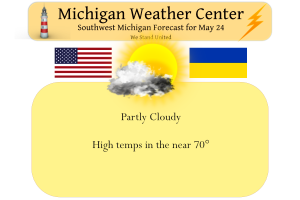
Yesterday was sunny with a high of 63.5° recovering from a low of 38°. Our slow warming trend will continue through Thursday. Skies will be partly cloudy today and tonight then a warm front will bring showers and thunderstorms by Wednesday afternoon. Those will continue into Thursday. Then a cold front will trigger showers and thunderstorms Thursday night. On Friday a developing storm system may bring rain into the area, areas south of I-96 have the greatest risk of rain on Friday. The warmer air tries to come back over the Memorial Day Weekend. High temperatures may be in the mid to upper 80s by Memorial Day.
Isolated severe thunderstorms are possible from parts of the southeast northward into the Ohio Valley and southern Great Lakes on Thursday.
Forecast Discussion
-- Unsettled weather Wednesday through Friday --

We will see another quiet and dry day today, before showers and
storms will move in and linger in some way through at least Friday.

High pressure over the area yesterday, will only slowly build to the
east through today. We will keep an east/northeast low level flow in
place around the high, which will continue to advect in drier and
cool air from Ontario and beyond. The air mass will moderate a
little bit with the strong angle of the sunshine for mid-May. It
will not be as sunny today as it was on Monday, as a mid cloud deck
will remain in place, especially for I-96 and North.

We will see the moisture increase even more on Wednesday, with
showers and a few storms likely beginning by Wednesday afternoon.

A sfc low will be lifting to the NE as a result of a long wave
trough situated to our west, and short wave energy lifting NNE out
of it. The moisture will really arrive in earnest by Wednesday
afternoon as the nose of 30-40 knot low level jet ahead of this
system will extend all of the way from the Gulf, and bring rich
moisture to the area.

There are expected to be some embedded storms in the shower
activity. Elevated instability is present on elevated LI progs, and
on forecast soundings. Looking at the plan view, the surface warm
sector is forecast to make it barely to SW Lower, before it gets
pinched off to our south as the system occludes. Sfc based
instability is rather meager at this time. We are not out of the
woods yet, as the warm front will be too close for comfort. If this
were to nudge just a little further north, our severe weather threat
would increase a bit with more favorable sfc based instability. We
will watch the trends of this.

We will see a relative lull in the more widespread shower and storm
activity later Wednesday night, before additional chances move in
earlier on Thursday. One low level jet moves out, and then another
tries to move in ahead of the main low rotating ENE through the
region. The focus of the Thursday showers and storms looks to be a
little further east, as the low level jet axis moves up over the
eastern half of the state. We will have some chances on Thursday,
just not as well as on Wednesday.

The final part of the period will then be when the upper low moves
out. This system is expected to linger here a bit with the low
closing off. Closed off upper lows are always tricky as it is tough
to forecast their movement. It does appear that there will
eventually be a deformation band of rain as the low lifts to the ENE
near the Ohio River valley. This part of the forecast is a bit
uncertain. The implications of it will be how much rain does the
area see.

-- Very warm to hot weather likely by Memorial Day --

The good news for most of the population that likes drier weather
for the holiday weekend, is that the upper low should move out, and
be replaced by a strong upper ridge that will bring increasingly
warmer/hot air to the area, along with mainly dry conditions.

Once the upper low moves out, a fairly high amplitude ridge builds
in over the area. This ridge has been shown by multiple models to
also close off, and warm temps aloft at 850 mb into the 20s C. This
moves in later Sunday as a warm front develops and moves north.
There could be a few showers/storm along this front as it moves
through. However, this does not look to be a big rain producer for
this area. Once the warm front moves through by next Monday, we
should be well capped aloft which will help to squash any
precipitation.
How does our chances of rain look for tomorrow in the afternoon /early evening time frame? We are supposed to help with replacing flags at the cemetery.
Thanks.
WednesdayShowers likely and possibly a thunderstorm after 2pm. Cloudy, with a high near 73. Breezy, with an east wind 13 to 20 mph, with gusts as high as 31 mph. Chance of precipitation is 70%. New rainfall amounts between a tenth and quarter of an inch, except higher amounts possible in thunderstorms.
Wednesday NightShowers and possibly a thunderstorm. Low around 65. Southeast wind 13 to 15 mph, with gusts as high as 28 mph. Chance of precipitation is 90%. New rainfall amounts between a tenth and quarter of an inch, except higher amounts possible in thunderstorms.
Slim
I just read this up there. Sorry. Geesh. I know it is hard to predict…
Thanks Slim!!!
That’s OK
Slim
Thank you for doing that. We’ve done the same at Fort Custer in years past.
Oh our family has done it for years. And it is our pleasure!!!
70 degrees Wednesday and then 75, 82, 84, 87 starting Friday! Looks like our warm May ends with another heat wave – along with lots of sun!
The official H/L yesterday at Grand Rapids was 62/40. The mean for the day at GR was 51 and that was a departure of -11. For the month the mean is now 59.8 and that is a departure of +2.0. There was no rain fall yesterday. Clouds moved in before sun set yesterday and that kept the temperatures up and the overnight low both here at my house and officially at GRR was 46. At the current time it is partly cloudy here and 49.
Slim
Looks like we will be catching up on our May rainfall deficit the rest of the work week. I know things are not “dry” in the area, but we definitely haven’t had a soaking rain event in quite a while.
My lawn is just now starting to dry up a bit. I’m hoping we get some rain this week.