Tornado warning sirens went off around 7 pm last night in Allegan county. Radar and visual indications in western Allegan county showed some rotation luckily nothing touched down. When this happens all the sirens in the county go off which I believe are controlled by the county dispatcher who has no control over individual city sirens, I think they are wired to all go off simultaneously. I am a spotter for the eastern side of the county so I had my Radarscope radar software going throughout the evening and was monitoring the cell. We will have similar circumstances today with some storms around the state – we are in the marginal risk area for severe weather in the southern half of the state.
Yesterday’s high temp came late in the evening at 72°, the low was 54°. We have 68° at 5 am. We had .35 of an inch of rain yesterday which brought our monthly total to 3.81 inches.
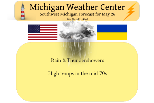
Forecast Discussion
-- Periods of showers and a few storms through Friday --

The more widespread showers and isolated storms from earlier have
moved off to the North and East, leaving just a few showers over the
area. It appears that the warm front has moved North of the area,
with pretty much all sites seeing winds become from the South.

The next round of showers and a few embedded storms will be moving
in over the next few hours from the SW as another wave in the broad
flow moves in. This wave will affect the wrn 2/3rds of the area for
a few hours this morning, before moving out.

Actually, a good portion of the day may be dry for most locations,
except for isolated showers around. This will be the result of the
low level jet focusing more toward the East, and short wave ridging
aloft moving through during the core of the day. This may actually
allow some sunny breaks and heating to take place.

Then later in the day, we will see a short wave in the flow move up
toward the area. This short wave will have the opportunity to act on
some decent instability if we can have some sunshine break out. The
degree of instability is uncertain at this time, but there is
potential that we could see 1500 J/kg of ML CAPE build. Forecast
soundings indicate that effective deep layer shear values of 35-40
knots would bring some potential stronger storms to the area as this
wave approaches. If it comes in late enough, the instability would
start to wane a bit as we start to lose the diurnal heating.

The severe threats in play look to be marginal at this time, as we
are in agreement with the Marginal risk from SPC at this time.
Forecast soundings/parameters indicate that mid level lapse rates
are not too bad in the mid 6 C/km range. DCAPE values are a bit
limited in the 400-500 J/kg range with not a lot of dry air to help
downburst potential. Low level shear/SRHs are quite limited with
weaker winds in the mid-mid levels.

Once the short wave moves in with the round of showers and storms,
we will see the upper low rotate just south of the area slowly
through Friday. We will see the deformation zone of the low move
slowly across the area during this period. This means we will see a
band of rain morph over the southern portion of the area, and bring
a soaking rain. Thunder looks possible until only about 00z tonight,
before it just becomes rain. We will see this rain then gradually
move out Friday night.

-- Chance for a few showers/storms centered around Saturday Night --

We will see a sunny and mild day for Saturday in the wake of the
upper low departing the area. 850 mb temps in the lower teens C will
support highs mostly in the 70s with plenty of sunshine.

The only chance of rain that looks possible for the holiday weekend
will come in centered around Saturday night, and mainly over the
Northern half of Lower Michigan. This chance will be the result of
the low level jet nosing over the area, and pushing the warm front
through the area. This looks like mostly elevated convection, with
some hail and locally heavy downpours possible.

-- Very warm and mainly dry for early next week --

We will then clear out quickly on Sunday, and remain mostly clear
right on through Tuesday. We will also see increasingly warmer
temperatures through Tuesday, to levels considered hot around 90
degrees.

Once the warm front moves through, we will see the upper ridge build
over the region and amplify a bit. This ridge will be holding steady
over the region as the upper pattern gets slowed down with the
amplified systems in the upper levels.

We will see temps at 850 mb eventually warm to around 22-24C.
Translating that down to the sfc would push max temps into the 90s.
Now we won`t mix efficiently those days with strong subsidence in
place under the ridge, but we should still approach if not barely
exceed 90F away from the lake.

The next chance of rain will come in on Wednesday, and this does not
look like a good chance. The upper ridge will be knocked down a bit
by some upper energy coming into the region. This will bring a weak
cold front into the region. The way the flow in the lower to mid
levels is, we will not have Gulf moisture available for this front.
Given we will have a quite dry atmosphere to start out, it looks
like we will not see much in the way of precipitation.
NWS says a big cooldown by mid weeks! Who would have thought after all the warm weather hype on here! Incredible!
The official H/L yesterday at Grand Rapids was 69/51 and at the airport 0.56″ of rain fell. The overnight low here at my house was 65 and at this time it is cloudy and 69. I recorded 0.69″ of rain fall up to 9:30 this morning.
Slim
NWS GR says hot temps coming!
This week hasn’t been nearly as cool as some had predicted either.
We got about a 1/2″ of rain yesterday, which was very welcome. It had been quite some time since we received some beneficial, soaking rain. My grass is green again this morning. 🙂
The weather for the holiday weekend looks to be fantastic to be outdoors. Heading to the lake Friday. Can’t wait.
90+ Monday through Wednesday? We shall see…
It will be interesting to see if we get any storms this afternoon. I’m actually considering fertilizing this morning while the rain holds off… seems like a pretty decent chance it will rain at some point today or tonight
I’d say there is a pretty good shot at rain today. Might even get some more tomorrow.
Michael, odd thing about the sirens going off yesterday, never had one notification on my phone and then saw nothing when I checked woodtv & wwmt.,com
We had just finished with the flags when they were going off. I heard them but didn’t know why. I checked the NOAA site…it was the only one with the warning info.