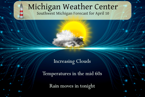
Yesterday we reached 69° with mostly sunny skies. Today will be mild and dry followed by a widespread soaking rain from Wednesday night through Friday. Friday will be the most unpleasant with cool temperatures, lingering showers, and northwest winds potentially gusting to 45 mph. Rainfall totals from this system will be well over an inch.
Sunny and dry weather returns Saturday with temperatures moderating over the weekend into early next week. Temperatures will tend to be above normal with above-normal rainfall over the next couple of weeks.
NWS Forecast
Weather History
1977: A three-day spell of 80-degree temperatures begins across Lower Michigan. Record highs included 81 degrees at Lansing, where temperatures would hit records of 82 degrees on the 11th and 83 on the 12th.
On April 10, 1977, the temperature rose from a pre-dawn low of 35 degrees to an afternoon high of 86, or a 51-degree rise, the greatest daily temperature rise ever recorded in Detroit.
1935: Severe dust storms across Iowa and Kansas closed schools and highways. Dodge City, Kansas experienced its worst dust storm of record, with dense dust reported from the morning of the 9th until after sunset on the 11th. The sky was almost as dark as night at times during the daylight hours. The thick dust suspended traffic on highways and railroads and also suspended most businesses in town.
1979: This day was known as “Terrible Tuesday” to the residents of Wichita Falls, Texas as a tornado rated F4 on the Fujita scale ripped through the city. A massive F4 tornado smashed into Wichita Falls killing 43 persons and causing 300 million dollars in damage. Another tornado struck Vernon, Texas killing eleven persons.
Forecast Discussion
- Strong System With Gusty Winds and Heavy Rain Late Thu to Fri

Skies start out mostly clear across West Michigan this morning, but
expect increasing cloud cover in advance of an incoming moisture
rich low pressure system originating out of Eastern Texas. Rain
showers will start to nose into far southern Michigan after midnight
Thursday becoming more widespread around daybreak as the low
tracks into central Indiana. Deformation precipitation on the
northwest flank of the low sets up over Lower Michigan Thursday
morning, with the heaviest precipitation expected to fall between
midnight to noon. The track of the surface low will obviously
dictate where the heaviest swath of rainfall occurs, but there is
increasing certainty that all of West Michigan will get at least 1
inch of rainfall. There is also growing confidence that amounts
up to 2 inches are not out of the realm of possibility,
especially for areas east of a line from Battle Creek to Saginaw.
Cannot rule out some storms Thursday afternoon, but persistent
cloud cover will limit instability development. If any storms do
develop, they would likely occur near and east of I-69.

Winds will gradually increase Thursday through Friday as the surface
low deepens while navigating into Eastern Lower Michigan. Winds
start off from the northeast Thursday afternoon, building and
shifting northwesterly in the evening as the center of the low
deepens to ~985mb while moving into the vicinity of Lake Huron.
Peak wind gusts are expected from midnight Friday to Friday
evening, with gusts to 35 to 45 mph likely.

Temperatures take a hit Thursday and Friday with deep northwesterly
flow on the backside of the low pressure system. Highs barely
breaking out of the 40s Friday combined with strong winds will
make temperatures "feel like" the 30s.

Lingering precipitation gradually diminishes Friday afternoon
with widespread dry conditions by Friday evening. Winds will also
gradually weaken Friday afternoon into Saturday morning as the low
progresses further northeast.

- Warmer weather returns this weekend into early next week

Dry weather/sunny skies are expected to kick off the weekend as
ridging and much drier air moves in behind the departing system.
High temperatures recovering to near 60 on Saturday before a more
substantial warm up arrives for Sunday into early next week thanks
to a building upper level ridge in advance of an upper trough/low
over the Rockies. Above normal temperatures with highs around 70 are
expected Sunday through Tuesday.

- Low risk of showers/storms Sat night and Sunday

On Saturday night and Sunday a push of warm advection and moisture
return from the southwest is shown to occur as a weak sfc low tracks
east from the nrn Plains. The warm front extending east/southeast
from the low will lift north into the area and could trigger a few
showers and storms.  Only 20-30 pct pops are warranted at this time
however since the models are struggling with the placement of the
sfc front and associated convective potential/coverage.

- Next good chance of showers/storms is next Tuesday

The sfc frontal zone looks to slip/settle back south of MI briefly
Sunday night/early Monday before lifting back north as a warm front
by Tuesday. Pops for showers and storms ramping up Tuesday into
Tuesday night as the wrn upper trough approaches and sends higher
PWATs northward with the warm front.
Forget any outdoor sports the next 2 days! Wow!
Golf anyone? Forget golf the next 2 1/2 days!
I’d like to highlight the wind chills that are coming! >>>>>Wind Chill ALERT>>>>>> wind chills in the 30’s all day Friday and wind chill around 30 degrees on Saturday morning! I guess winter temps are not done yet despite being the second week of April! WOW!
Really grasping for straws now LOL
Just the facts! Incredible cold is coming!
I’d like to highlight what slim said here:
The first 9 days of April are now in the record books and the mean so far is 45.7 that is +2.4.
How could that be?!?!! The way the cold weather nuts have been talking I thought we would sitting at about 10 degrees below average for temps and have a foot of snow on the ground!
Today, Saturday and Sunday look outstanding for golf!! Get prepared now and get your tee times!!
The warmth just won’t stop!
The weather has been absolutely perfect for early April. This weekend looks wonderful with highs in the 60’s and 70’s and tons of sun!
Anyone planning to golf on Thursday or Friday – forget about it and cancel your tee times! More horrendous Spring golf weather is on tap! Get ready!
The first 9 days of April are now in the record books and the mean so far is 45.7 the is +2.4 the high so far this month is 71 and the low so far is 31. There has been a trace of snowfall 0.81” of rainfall.
Slim
The overnight low here in MBY was 34 the current temperature is 36 with clear skies.
Slim
The official H/L yesterday at Grand Rapids was 66/43 there was no rainfall. The average wind speed was 12.3 MPH and the peak gust was 33 MPH out of the W. For today the average H/L is 55/35 the record high of 85 was set in 2011 and the record low of 15 was set in 1989. The most rainfall of 1.08” was in 2008 the most snowfall of 2.0” was in 1894. The most on the ground was 5” in 1973. Last year the H/L was 67/43.
Slim
Things are greening up nicely. We may get a couple of inches of rain in the next few days. Should be a good weekend to break out the lawn roller and perhaps the mower too.
When we were down in Ohio on Sunday and Monday many people were cutting the grass and the grass there was several inches tall where it was not cut. There were many flowering trees out in bloom and the dandelions were everywhere.
Slim
I’m thinking we will see a lot more blooming next week, after the late week storm and with the warmup next week
Enjoy today’s weather because the bottom drops out for Thursday and Friday! Cold, wind and rain is coming! Incredible storm system is on the way! Wow!