These sunny dry days are nice with the exception of all the pollen in the air they are tolerable if one doesn’t mind having puffy eyes and a leaky nose. The past few days have been terrible for allergy sufferers like myself. Antihistamines are the drug of choice pretty much all season long. It is also nearly impossible to keep a clean car. Tomorrow we should see some improvement with a chance of rain to wash everything down.

Yesterday we had a high of 73° and the low was 50°.
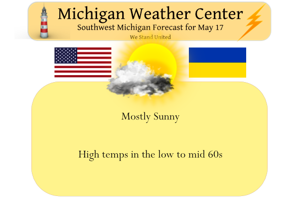
The dry weather today will give way to showers for Wednesday. After a mostly sunny day today, the clouds will increase tonight and we will see rain moving in from the west Wednesday morning. The daytime temperatures will also end up a few degrees below normal for this time of the year.
-- Today --

Northwest low-level flow is bringing 0 to 5 C 850 mb temperatures
through today. Mostly sunny skies amid upper level ridging and
surface high pressure will deepen boundary layer mixing during the
day up to the cap around 5,000 feet, where winds to about 20 mph
will be mixed down as gusts, less than yesterday. Highs in the 60s
are expected, cooler than yesterday also. Fire weather concerns
remain elevated given persistent dry conditions in quite a number
of locations, afternoon relative humidity percentage dropping into
the 30s, and the moderate breeze. Conifer forests in central /
west-central Lower Michigan and into northern Lower are most
susceptible to fire spread.

-- Wednesday --

Shortwave trough(s) moving through quasi-zonal flow and a right
entrance region of the upper level jet will make rain likely on
Wednesday. The shortwaves at 500 mb appear rather subdued and not
well phased, and the models differ in how well developed a surface
low becomes as it treks just south of Michigan. However, enough
moisture and mid-level frontogenesis should be present for light
to moderate rain over much of the area. The HREF, GFS, and ECMWF
ensemble members offer a wide range of potential rain amounts for
any given location depending on all these factors. Could be a
west to east swath of 0.5 to 1 inch of rain somewhere in the lower
two-thirds of Michigan, right now the most likely zone would be
between I-96 and M-20, but don`t feel very confident in this yet.
Dry air in the low levels preceding the arrival of this rain will
keep the areas that do receive steadier rain quite chilly, in the
upper 40s to mid 50s, while without the rain the temperatures
could climb into the 60s.

-- Thursday to Friday --

Not wanting to get too confident in the synoptic pattern yet for
Thursday to Friday as the 00Z GFS and some of its ensembles have
trended toward a less amplified ridge over the Northeast US and
Quebec, with the EML plume and greatest instability shifting a
little to the south of Michigan and the cold front arriving
sooner. Unsure if this is the start of a trend just yet.
Nonetheless, the mean solution among the ensembles of the GFS,
ECMWF, and Canadian has been for the advection of a high plains
elevated mixed layer over Michigan on Friday ahead of a
southwesterly upper level jet nudging in and a surface cold front
sagging through. Near the surface, Gulf moisture should advect in
and MLCAPE could build to 1500-3000 J/kg. The strength of the cap
would also be a significant factor that would modify the timing
and extent of convection. Can`t rule out some convection Thursday
night or Friday morning with the warm front. If we stay in the
warm sector through Friday afternoon, southwest winds would be
rather breezy regardless of convection, and any convective cells
or clusters that develop would create locally severe wind gusts
and large hail given the strong but fairly unidirectional 0-3 km
and 0-6 km shear. If convection develops above the cold front
instead, there may still be enough instability for elevated
parcels to keep hail as a threat.
Get ready for the cold, wind and clouds this weekend! The cool pattern persists!
Sunday night. = lows in the 30’s, wow just wow! So much the much hyped big warm up!
Get ready for a cold, wet day tomorrow and then major cold but the weekend! Incredible cold is coming!
Latest CPC looking very average the next two weeks. I’ll take it after a very warm start to May!
Wow big warm up coming after upper 50’s tomorrow. 75 Thursday and 84 Friday says WOOD!
Our cool cloudy wet Spring continues..61* degrees outside…InDY
Cloud free here and it’s down to 65 here currently. It’s been sunny all day.
The clouds have now moved in and it is mostly cloudy now with a temperature of 66. As I stated earlier after a brief one day warm up there looks to be a period of below average temperatures for the weekend and the start of next week. I have to wonder if the summer pattern will be one or two days of nice warm weather than 3 or 4 days of cool weather or will it be 3 or 4 days of good summer weather than 2 or 3 days of cool weather? We shall see.
Slim
It is still only mid-May so this up/down pattern isn’t too unexpected (still spring). We don’t usually see sustained warmth until around June 20 from what I’ve noticed. But we will see!
My goodness, what a pretty morning. 🙂
Our daughter and her friends went to Cedar Point yesterday for Senior Skip Day. She said the rides shut down 2x briefly for just a bit of rain. Other than that, the weather was fine and they had a great day.
This really is the perfect weather! We have a lot of memories at Cedar Point as we used to take the kids there every year. Haven’t been there in 5 years but think we might go this summer while I’m not working.
It’s gorgeous out again today! We’ve been getting really spoiled. No big droughts or tornadoes or wildfires or snow.
The US continues to be above average for tornadoes in 2022. It’s been a wild spring so far!
The official high low at Grand Rapids yesterday was 73/53 with 85% of possible sunshine. The overnight low here at my house was 44 and the official overnight low at GRR was 46. At this time it is sunny here and 52. In looking at Fridays forecast I have to wonder if there has been some back tracking on the storm potential. At this time it still looks like most areas will get rather warm on Friday.
Slim
GR has now had 8 warm days in a row. Looks like a short two day cool down before we approach 80 degrees again this weekend!
A little different take on this weeks weather. After nice long summer like 8 days (but dry)Grand Rapids will have a couple days of cooler weather and a chance of rain on Wednesday. In fact tomorrow could be very cool with rain and clouds. Then a day of near average highs and one day that could get warm it is back to a cool trend. Average highs are now in the 72 to 73° range and average lows are in the 50 to 51 range.
Slim
WOOD has 75 for Thursday and 79 Friday. Saturday may also prove to be above average given the warm overnight lows.