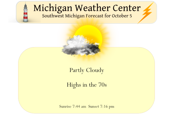
Yesterday we reached 71° for our high after a morning low of 35°. We can expect highs today in the low to mid-70s with a bit more in the way of cloud cover as the area of high pressure begins to move out of the state. Rain showers move in on Thursday then much cooler air arrives to end the work week.
Weather History for SW Michigan
October 2
1880: A tornado cut a 15-mile-long path of destruction from southern Barry and Eaton Counties into northern Calhoun County. Two children were killed and several other people injured near Bellevue, when the tornado picked up a house and carried it 200 feet before it disintegrated. The roar of the tornado could be heard six miles away.
October 3
1898: Lansing hits 90 degrees for its highest October temperature.
1954: Heavy rains cause some minor flooding across southwest Lower Michigan. Grand Rapids and Muskegon both have their wettest October days on record with rainfall totals of around 3.5 inches.
1974: Temperatures plummet into the 20s as very cold weather continues. Record lows included 22 degrees at Lansing, 23 at Grand Rapids, and 25 at Muskegon.
October 4
1935: Snowflakes are observed across Lower Michigan and Grand Rapids has a record cold high temperature of 42 degrees.
1951: Summer-like weather prevailed with lows in the mid-60s and highs in the 80s. Record highs include 87 degrees at Grand Rapids, 86 at Lansing and 83 at Muskegon.
October 5
2005: Balmy weather prevails across Lower Michigan, especially along the coast of Lake Michigan, where the low temperature for the day at Muskegon is a record warm 70 degrees, followed by a high of 80 degrees.
October 6
1998: A squall line moved across Lower Michigan producing tornadoes, downbursts, and some flooding. A tornado struck Ferris State University in Big Rapids, injuring seven students. Another tornado moved from northern Isabella County into southern Clare County, damaging several homes. Total damage from the storms was more than a million dollars.
October 7
1965: A tornado destroyed a trailer and several outbuildings southeast of Clare in Isabella County.
2007: Temperatures reach record highs as very warm weather prevails across Lower Michigan from the 5th to the 8th. Grand Rapids sets three record highs in a row with temperatures in the upper 80s from the 6th to the 8th.
October 8
1871: The worst wildfires in the history of the Great Lakes region occur as strong south winds combine with tinder dry conditions. The fires leveled several areas of Michigan and Wisconsin, including the cities of Peshtigo, Holland, Manistee, and Port Huron. At least 1200 people died, about half of them in the Peshtigo, Wisconsin fire. That same night, the Great Chicago Fire erupted, destroying much of the city.
Weather History for SE Michigan
October 2
On October 2, 1963, thunderstorms in Wayne county brought winds of 63mph in the evening.
October 3
On October 3, 1954, 4.58 inches of rainfall fell in Saginaw. This is the greatest amount of precipitation recorded for the month of October in Saginaw and is almost twice the amount of rainfall that normally falls during the entire month!
Also on October 3, 1935, snowflakes were falling across Southeast Michigan. Detroit reported a trace for the second earliest observed snow on record.
October 4
On October 4, 1990, Genesee county experienced an F2 tornado at 5:00 pm that injured one person and cost $2.5 million in damages.
October 5
On October 5, 1900, record highs were set three days in a row of 88 degrees on the 4th, 5th and 6th in Saginaw. It also ties with the highest temperature of the month.
October 6
On October 6, 1963, the temperature rose to 89 degrees in Flint. This ties with October 1, 2002, and October 3, 1953, for the record maximum temperature for the month of October in Flint.
October 7
On October 7, 2017, a cold front tracked across Southeast Michigan between 9 PM – 12 AM. Thunderstorms ahead of the cold front produced severe winds that resulted in numerous downed trees and power lines, especially in Monroe County.
Also on October 7, 2009, a strong low-pressure system tracked north of the Great Lakes region, with the associated cold front swinging through lower Michigan. Winds gusted between 45 to 55 mph with isolated gusts to 58 mph over a six to eight-hour time frame during the morning hours. With leaves still on the trees, tree branches and trees were reported down in and around the Detroit Metro Area. About 110,000 customers were without power from this wind event.
Also on October 7, 2007, the third day out of a four-day early October heat wave brought record highs to Southeast Michigan. Saginaw reached 91, and Flint was 88, both of which were records. Detroit reached 89 falling shy of the record temperature for the date.
Also on this date in 1963, the temperature rose to 92 degrees in Detroit. This is the record maximum temperature for the month of October in Detroit.
October 8
On October 8, 2007, the fourth day of early October heat brought record highs to Southeast Michigan. Detroit reached and Saginaw reached 90, and Flint was 88, all of which were records. It was the latest recorded 90-degree day in the history of both Detroit and Saginaw as well.
Also on October 8, 2001, Flint hit a record low of 25 degrees.
Also on October 8, 2000, an unusual early October cold blast brought one of the earliest snowfalls on record to southeast Michigan. Wet snowflakes fell in Flint on both the 7th and 8th, while snow was observed at Detroit Metro Airport on the 8th only. For Detroit, this was the third earliest snowfall on record. While the snow only fell in trace amounts in the major metropolitan areas, more substantial snow was observed in the Thumb area. One to two inches of slushy snow contributed to auto accidents in Huron County.
Forecast Discussion
The high pressure ridge will continue in control of the wx pattern
for one more day today and bring partly cloudy skies and
unseasonably warm conditions with high temps reaching well into
the 70s.

A strong cold front dropping down from the nnw will bring clouds
and showers Thursday. Moisture with this system is limited and
rainfall amounts will be rather light at mostly under a quarter of
an inch.

North flow lake effect clouds and scattered showers are expected
Thursday evening near Lake MI. As low level winds veer more to
the nne to ne the lake effect showers will develop/stay offshore
late Thursday night. H8 temps will fall to -3 to -5 C Friday and
high temps by then will only reach the mid 40s to lower 50s.

Concern continues about potential for widespread frost and
possibly a freeze Friday night. Skies will likely clear Friday
night in subsidence under the ridge. Excellent radiational
cooling conditions should develop overnight as that happens and
winds go calm.

Potential for frost remains Saturday night but freezing conditions
by then look less favorable. This is due to uncertainty about
cloud cover.  Some light boundary layer mixing may persist
overnight with the high pressure ridge well south of our area by
then.

Temps will then undergo a significant moderating trend late in
the weekend through early next week as sw return flow develops on
the backside of the departing ridge. In fact by next Tue high
temps could once again reach the 70 degree mark as strong south to
sw flow waa develops.
Slim did we have any 80’s in September?? Seems like forever aga it was 80 or better around here hmmmmmm… INDY
Yes definitely a near normal summer and a cool Fall so far! Heat, what heat! Incredible!
Bring on the snow Rocky bring on the snow…INDY
While we are still not at peak color, the colors are really starting to pop here in Ionia County. Farther along than last year at this time at least in my area. Driving I-96 though Ionia County there are some patches where the color looks very good, most prevalent in the maples.
The color has picked up here as well. Here is a picture from the UP
https://www.exploremunising.com/web-cams/
Stroll down towards the bottom of the page for the picture from MDOT at M 94
Slim
Wow the color there at M-94 looks very nice
My recollection was right about the early snowstorm out west last year:
https://www.woodtv.com/weather/bills-blog/11-9-of-the-contiguous-u-s-had-snow-on-the-ground-thursday-am/
Yep, there was snow in that area on the morning of October 14th 2021. But it did not last long and it was all gone in 2 to 3 days. Even at Devils Tower, WY where a total of 14.0″ fell it was all gone in 4 days. At Rapid City SD where 3.4″ fell in that October event the total for the whole winter season was just 29.0″ It did not snow in much of that area again until December of 2021.
Slim
Up to 27″ of snow fell from this early storm. Wow.
Wow… I think I remember Denver having a really crazy temperature swing from the 70s or 80s down to the teens within 24 hours. Must have been a significant fall storm
Kind of like a broken record in days of old, yesterday was yet another great fall day with once again 100% of possible sunshine the official H/L at Grand Rapids was 72/37 and there was no rain fall. The overnight low here in MBY was 43 and at this time it is 45 with sun and some clouds. For today the average H/L is 66/46 the record high of 85 was set in 1900, 1922 and 1946 the record low of 29 was set n 1965 and 2004. Last year on this date the H/L was 69/58. Today looks to… Read more »
Local TV met has the forecasted high for Friday at 49. If that comes to fruition, it will be the first day in a long time (163 days) that we did not reach 50.
We shall see. For October 7th at Grand Rapids the last time it did not reach 50 or better was in 2000. There have only been 8 times it has not reached 50 on that date. For Lansing the last time it stayed in the 40’s on October 7th was in 2012 and it has only been 10 years when it did not reach 50 of the date. Remember in the past Lansing was cooler than it is today (thus one of the reasons the departure from average is lower)
Slim