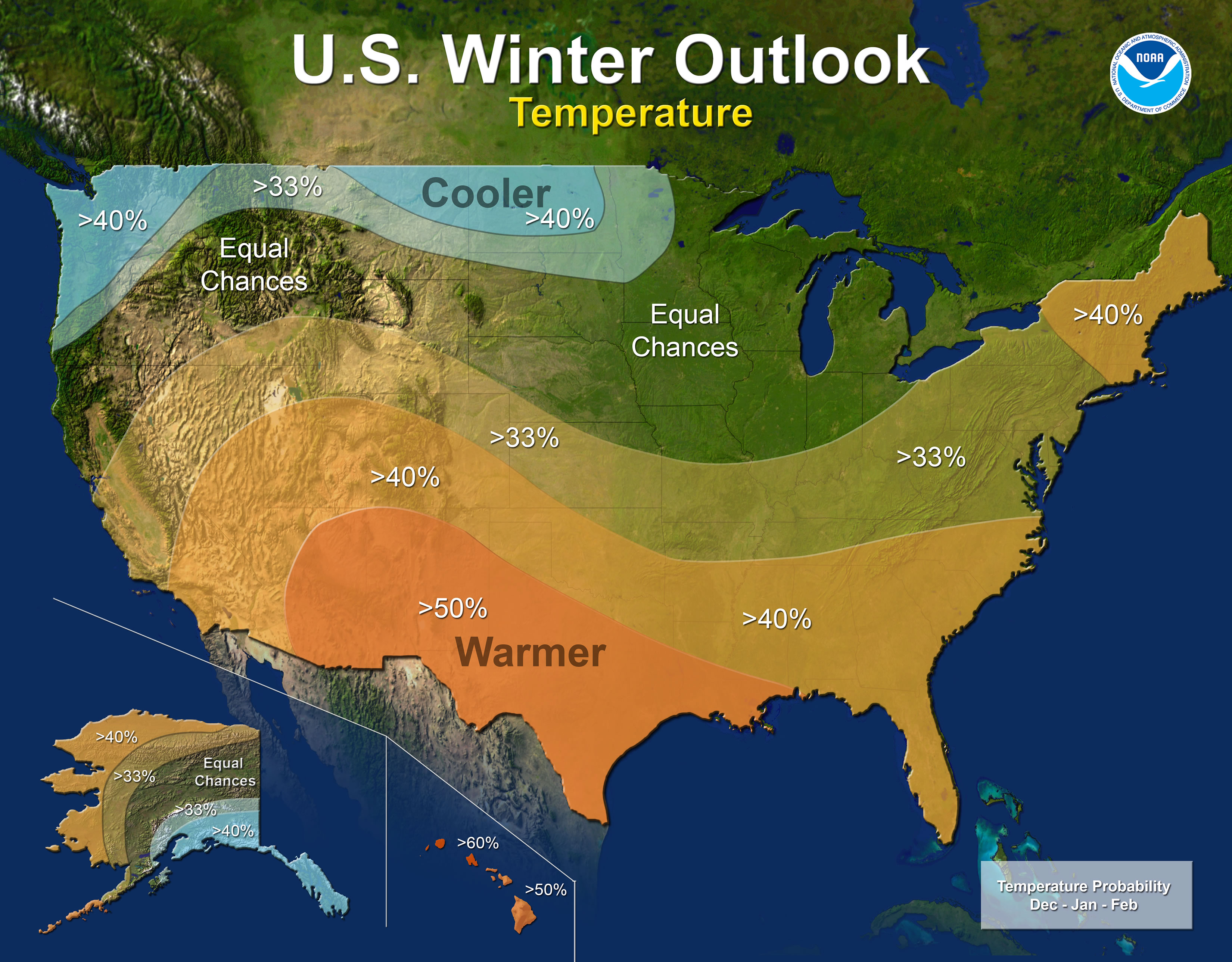
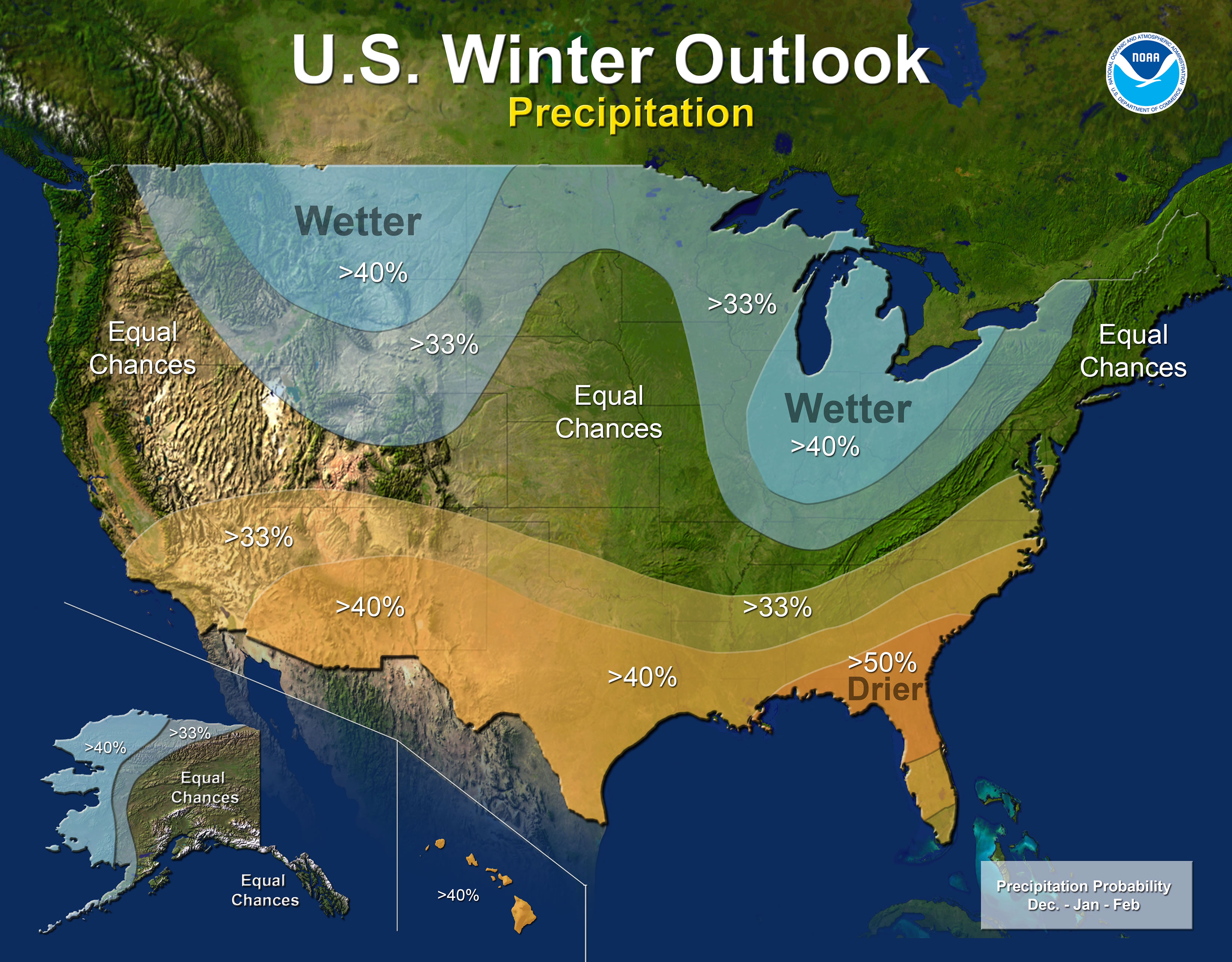
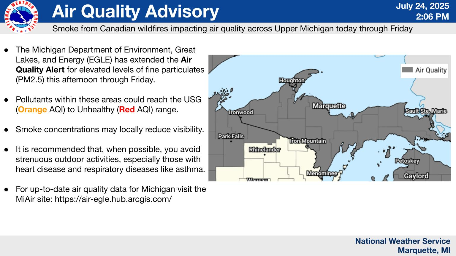
Many of the major players of winter forecasting are coming close together on predicting our forecast for this winter. NOAA has released their winter forecast. The graphics below (click to enlarge) show we have equal chances of above or below normal temperatures and a 40% chance of above normal precipitation.
[columns] [span6]
[/span6][span6]
[/span6][/columns]
“If La Nina conditions develop, we predict it will be weak and potentially short-lived, but it could still shape the character of the upcoming winter,” said Mike Halpert, deputy director of NOAA’s Climate Prediction Center. “Typical La Nina patterns during winter include above average precipitation and colder than average temperatures along the Northern Tier of the U.S. and below normal precipitation and drier conditions across the South.”
Other factors that influence winter weather include the Arctic Oscillation, which influences the number of arctic air masses that penetrate into the South and is difficult to predict more than one to two weeks in advance, and the Madden-Julian Oscillation, which can affect the number of heavy rain events along the West Coast.
NOAA’s seasonal outlooks give the likelihood that temperature and precipitation will be above-, near, or below-average, and also how drought is expected to change, but do not project seasonal snowfall accumulations. While the last two winters featured above-average temperatures over much of the nation, significant snowstorms still impacted different parts of the country. Snow forecasts are generally not predictable more than a week in advance because they depend upon the strength and track of winter storms. The U.S. Winter Outlook will be updated on November 16.
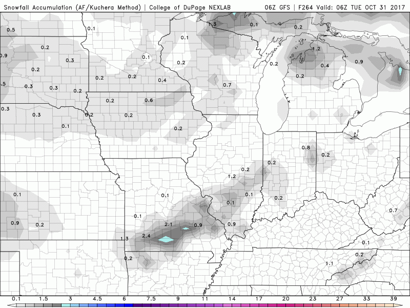
The GFS models are trying to bring snow into the Midwest the first week of November with 10 inches in Minnesota and Wisconsin and some lake effect into the western counties of Michigan. I added a new tab on the Forecast Page which includes the snow forecast for the Midwest and Great Lakes.
Below is the GFS model for October 31st through November 5th – if this holds true Minnesota and Wisconsin may see their first snowstorm of the season and areas south of Grand Rapids to Kalamazoo may see their first Lake effect snows with up to 6 inches. We will have to see if the snows from the west move further east as we wait for later model runs.
Added a new feature on the forecast page which puts all the NWS forecasts for their Michigan Offices in a tab format as seen below.
- Interactive Radar
- Planner
- Grand Rapids
- Marquette
- Gaylord
- Detroit
- National
- QPF


It was beautiful out today!! Went for a walk & it seemed like everyone was enjoying the warm weather. Sounds like a great weekend in the forecast too. 🙂
I just got back from a walk and boy it is very summer like out right now. 78° here at my house and 76° at the airport. Note the record high for the date is safe (83 in 1953)This will be the warmest October 20th since 2003 when the high at Grand Rapids reached 79°
Slim
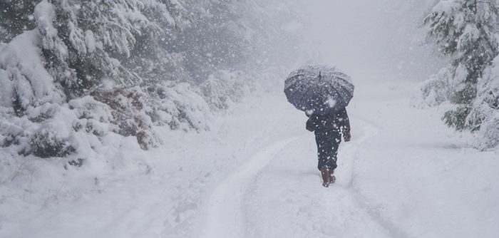
I just love that photo above!! So peaceful.
As we get into the cold weather season some things to remember (and keep an eye on) it the further off some event is scheduled to happen the more it will change. With snow fall maps watch the time line and remember snow fall maps seldom play out as advertised if they did we would end up with over 400” of snow a year. BTW I will come up with a snow fall guess later in the fall season (hint I will stay close to average)
Slim