A cut and paste forecast from last week continues into this week. It will be very warm and humid most of this week. Our high yesterday was 86.5° with a 76.7 dewpoint.
Occasional showers and thunderstorms will provide brief breaks in the heat from Tuesday onward. Showers and storms will not affect all places each day, but by Thursday, we think just about everyone will have received at least some rain. Right now we do not see a good set-up for severe weather, but we will keep assessing it each day.
It would be nice to see a brief respite with some rain to break the tediosity of the hot and humid air mass over our state. Otsego has seen only 1.43 inches this month the last being on the 12th. We do have a tolerable temp this morning at 60° with a 59° dewpoint which feels cool and comfortable, however, this will be short-lived.
I am sure you have noticed our daylight hours are decreasing rather quickly now – sunrise is 6:59, sunset is 8:31. This won’t have much of an effect on the heat though as our above normal temps are predicted to remain in the 80s through the first week of September.
Forecast Discussion
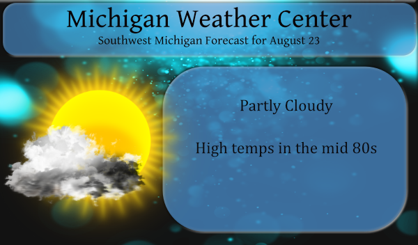
- Warm and humid into this coming weekend

The short story is warm and humid till at least Sunday the 29th.
This is the result of our subtropical high, currently centered in
Texas, continuing to expand toward Michigan through the week. The
ensemble 500 heights over our area, peak on Sunday the 29th. This
weather pattern and the associated heat and humidity is supported
by the ECMWF, GFS, Canadian, ECMWF ensembles, GFS ensembles and
the Canadian assembles, run after run, for several days now. Yes,
it does cool off toward Monday the 30th of August.

Actually in the Friday, Saturday into Sunday time frame we are in
the perfect place for our area to get has hot as it can typically
can get. That is, the upper high is centered just to our southeast.
We are on the northwest edge of the upper ridge. When we have
this sort of pattern, it is typically our hottest weather. I am
not saying record high temperature should be expected, but just
that we are in a place where we could see highs well up into the
90s by Saturday. True, our actual forecast does not have highs
forecast that warm, but we are being conservative for now since
this a 5 days away and convection may impact just how warm it
gets. The take away for you, from all this, is warm and humid
conditions will last into Sunday.

As for today, we have a surface high that moves across the area in
combination with the ridge axis of that expanding upper level
high, centered to our southwest. The result of that is a lot of
sinking air. That will mean not to much in the way of clouds and
as a result warm temperatures.

Tonight will start out mostly clear but a shortwave moving along
in the jet stream will touch off thunderstorms in the upper
Mississippi Valley and they will head southeast spreading mid and
high clouds into our area after midnight.

- Warm front/cold front convection Tue/Wed

We have two major frontal waves coming through this week. The
first such event is Tuesday into Wednesday. We get the warm front
convection on Tuesday during the day. The precipitable water on
both the GFS and NAM rise to 2.1 inches by midday Tuesday. The
1000/850 moisture transport is aimed near and south of I-96
Tuesday during the day. There is low level jet shown on both the
GFS and NAM Tuesday. We are in the speed convergence area of that
low level jet during the mid to late morning hours of Tuesday. So,
given the EL is near 200 mb and the model sounding nearly
saturated from the surface to 250 mb, I would say heavy rain would
be the greatest threat. Since the polar jet is in Canada, we have
very little deep layer shear so severe storms are not likely.

The warm front convection should move east of our CWA by late
afternoon. Then we have the cold front convection Wednesday
morning. These storms will develop farther north over MN/WS and
then head toward our area during the early morning hours of
Wednesday. There is a decent low level jet but this time the
moisture transport vectors are much stronger. Thus we get another
period of thunderstorms from that. As typical of these sorts of
events, trying to figure out where the strongest storms Tue or
Wed, will be, at this point is hard to do. Nonetheless, you
should know thunderstorms with locally heavy rainfall are possible
both times. It would seem the Wednesday morning event will impact
a larger part of area.

How the convection actually plays out may impact our forecast
high temperatures. Seems no matter what we should get to the mid
80s at least on both days, even with the storms.

- Another frontal wave toward end of week

Our upper high will continue to expand toward Michigan as we go
through the week. As always, more North Pacific shortwaves will
continue to track along the polar jet. So the next such event will
be in the Fri/Saturday time frame. This will be a similar thing to
the Tue/Wed event. Convection on the warm push and convection on
the cold front. It does seem through that on Saturday we could be
deep in the warm air, if so we could have highs well into the 90s
even through that is not currently in our actual forecast for
reasons noted above.
So much for the rain missing GR. Get ready GR to get hammered!
Still no heat waves in sight! I love summers with no heat waves and minimal days above 90 degrees! Fantastic!
Thank goodness it’s Summer…
Enjoy, because soon we will be getting hammered with cold and snow! I love winters!
More sustained warmth. GR has only had 7 below average temp days for the 23 days in August so far (including today).
Compared to most of the country Michigan has pleasant summers and most would say Michigan has cold and snowy winters. Remember Grand Rapids had 46.1″ of snow last winter and in many locations that would be considered a lot of snow. As close as Chicago a location that many consider a “cold and snowy place” in the last 30 years only 9 winters had more that that 46.1″ and in Indianapolis only 3 winters in the last 30 have had more that that 46.1″ with the most in that time there being just 55.7″. So I will rest my point… Read more »
West Michigan winters: Cold, snowy, and cloudy. It’s quite a difference from northern Indiana or even eastern Lower Michigan.
I have to say this August has had some great summer weather. And with it being late August now we only have a few weeks of warm weather before the cooler days of fall set in. In less than 4 weeks the average high will be in the upper 60’s and the lows in the upper 40’s While I do not mind fall weather I do not look forward to the snow and cold of winter. Even a “mild” winter will have cold and snow and I am not so sure this upcoming winter will be a “mild” one.
Slim
Looks like another brutal week ahead, and then by the weekend just ridiculously hot. Booo!