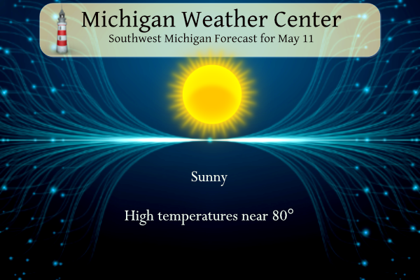
We will see some high clouds from time to time today, but the skies will mostly be sunny. A warm spring day is in store with highs up around 80 degrees. It will be cooler near Lake Michigan where a wind off the water will hold readings in the 60s. Expect light southwest winds of 5 to 10 mph. Warm and dry weather today will give way to a trend toward somewhat cooler but still fair spring temperatures. Showers or a thunderstorm are possible especially in southern Michigan Friday afternoon. The weekend is looking mostly dry.
U.S.A and Global Events for May 11th:
1865: A tornado touched down in Philadelphia around 6 PM ET, killing one person and injuring 15 others. There was considerable destruction of property, with 23 houses blown down, and damage to the Reading Railroad depot, with the water tank, carried 150 yards. Fairmont Park was damaged to the amount of $20,000.
1934: A tremendous dust storm affected the Plains as the Dust Bowl era was in full swing. According to The New York Times, dust “lodged itself in the eyes and throats of weeping and coughing New Yorkers,” and even on ships some 300 miles offshore saw dust collect on their decks. Click HERE for more information.
1953: A terrifying F5 tornado rips through downtown Waco, Texas, killing 114 people and injuring nearly 600 more. More than 850 homes, 600 businesses, and 2,000 cars are destroyed or severely damaged. Losses have been estimated at $41 million. The tornado is the deadliest in Texas history and the tenth deadliest in the US.
Grand Rapids Forecast
5 11 grrForecast Discussion
-- Warm and Dry Today --

With the upper level ridge just to the west, temperatures will
make a run at 80 today with scattered high clouds and a light
south-southwest wind. Dew points remain on the dry/comfortable
side and minimum relative humidity during the day will likely drop
below 30 percent. High temperatures along the Lake Michigan shore
will likely be held in the 60s, especially near/north of Holland.

-- Shower/Thunderstorm Potential Friday --

Moisture and lift associated with the mid-level vorticity/trough
out of Texas will initially bring in clouds around 10,000 feet
with virga Friday morning. Increasing sfc-850 troughing and
convergence by afternoon over southern MI along with late-arriving
low-level moisture should then promote surface-based convection
to about 15,000 feet according to CAM forecast soundings.
Convective updrafts like these that are warmer than -10 C would
usually struggle to produce significant rain or lightning
potential, though in this case, the shallow convective updrafts
would be seeded by ice from the stratiform clouds above 15,000
ft. Vertical wind shear is expected to be weak. The CAMs included
in the 00Z HREF do not appear as bullish about widespread heavy
rain in southern Michigan like some of the global model solutions
have been, but have maintained likely PoPs south of I-96 Friday
afternoon, though lowered the probability against NBM.

-- Mostly Dry Weekend Favored --

Once the wave from Texas passes, larger-scale ridging in the upper
levels will likely keep Saturday dry, and a vast majority of
ensembles support this. There remains a low chance of showers on
Sunday southwestern areas as enough moisture may be present while
a cold front and upper level shortwave trough arrive from the
north, embedded in the amplifying polar jet stream. Temperatures
on Sunday will likely end up in the low to mid 60s which is a
little below normal.

-- Pleasant Pattern Next Week --

Flow over Michigan will often be out of the north, with dry air,
sunshine, and temperatures near to slightly below normal being
common. The core of coldest air will likely stay over Quebec and
the NE US, and we should actually get alternating cold/warm
advection from the north as plumes of warmer air from the western
Canadian heat wave curl around the northern Plains high. Frost
potential Wed/Thu mornings remain to be seen but can`t be ruled
out depending on minor differences in how the large-scale wave
pattern evolves.
Hit 80 again here today!! The warmth just keeps ROCKIN!
Back in the near normal temp category on the 8-14 day outlook! Fantastic weather continues!!
We will have to see how it plays out but the JMA weeklies hint with the idea of a cooler/wetter pattern establishing itself smack dab in the Heartland to close out May and open June.
Slim
Nice part about this time of year is that even “below average” is still pleasant weather. One thing we need to watch is if we slip into a dry pattern. No worries about that now obviously but the current pattern overall is dry and something to watch in the long term.
That’s a good point. Even if the highs dip below the average, that’s still shorts weather.
Just mowed the lawn on my lunch hour before it gets too warm this afternoon. The grass is a tad drier than Sunday when I mowed. I may be needing to water the lawn before long.
It is the warm season from May-October. *Most* days are warm, even when below average.
November-April, *most* days are cold (even when “above average”). That’s how I look at it
Weather looks absolutely outstanding for the next couple weeks!!! Highs near 70 and cooler lows in the evening! Love this time of year and the great weather!
https://weather.com/weather/tenday/l/b523690bfd952b86fef3627c919dd9855281a8da16b83c10bdd381c64ae12cbc
As noted a few days ago, WOOD had only 58 degrees at the end of their forecast. That day is now forecasted to be near 70. Another bad troll job by WOOD.
Gotta be Kirkwood, still wishing for cold and snow in May!
Today should be our 7th warm day in a row. And some spots could go above average for May. What perfect weather!
Our local TV met’s only shows one day below average in their 10-day forecast
Last year starting on May 9th Grand Rapids had 7 days in a row of highs from the upper 70’s (2) mid 80’s (2) and upper 80’s (3) there was also one more day in the low 70’s. There was a similar string of days at Lansing. Now get this at Muskegon and Holland not only did they have that string they reached all the way up to 90 at Holland on May 11th and 91 at Muskegon on May 10th. It did reach 90 at Lansing last year in May but that did not happen until the 30th. The… Read more »
I hate to say it, but I would like some rain. Haha. And there isn’t any good chances in the forecasts for my area. This is very nice non-humid weather though.
Yes the chance of rain for tomorrow looks to be mainly along and south of 96. Beyond tomorrow there really is no rain in the forecast. Nice weather, but I just hope the dry pattern is not long term for the farmers. They were already late to plant this year.
Good morning! The official H/L yesterday was 75/45 there was no rain fall and 100% of possible sunshine. The overnight low here in MBY so far is 47 and that is the current temperature as well with clear skies. For today the average H/L is 68/47 the record high of 89 was set in 1896 and 1922 the record low of 28 was set in 1907 The record rain fall of 2.88” fell in 1981. Last year on this date the H/L was 87/66 for a very warm May day.
Slim
Last night was perfect for stargazing. Lots of blue sky this morning as the sun is breaching the horizon. It was pretty light out at 5:30 am when our pooch went outside. Today may be our 5th 80-degree day of spring. Can’t complain about the weather this week.
Happy Thursday, my friends. Have a fantastic day and make someone smile. 🙂