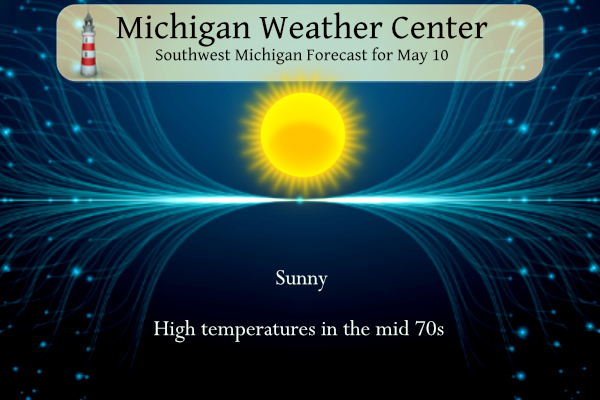
We have high pressure dominating our weather once again today with lots of sun and warm temperatures in the mid-70s in store. This pattern will continue through tomorrow before rain moves back into the picture on Friday. Temperatures will be 10° cooler along the lakeshore.
Grand Rapids Forecast
5 10 grrWeather History for SW Michigan
May 7
1947: Cold and snow prevail across Lower Michigan with lows in the upper 20s and highs only in the upper 30s to lower 40s.
1974: Temperatures tumble as cold high pressure builds into Lower Michigan. Record lows on this date include 22 degrees at Lansing, 25 at Grand Rapids, and 27 at Muskegon.
May 8
1976: A freeze hits Lower Michigan with Grand Rapids and Muskegon setting record lows of 27 degrees.
1880: A tornado destroyed two homes and a barn two miles east of Kalamazoo. No one was injured.
May 9
1923: A very late-season winter storm dropped up to a foot of snow across Lower Michigan. Records were set for May snowfall at many places including Lansing with 11.5 inches, Grand Rapids with 5.5 inches, and Detroit with 6 inches.
1927: About 40 farm buildings are damaged or destroyed as a tornado moved from near Loomis in Isabella County, across southeast Clare County, and into Gladwin County. Another tornado destroyed two barns and damaged two homes three miles west of Walker.
May 10
1902: A snowstorm drops from 1 to 6 inches of slushy snow across Lower Michigan. The four inches of snow at Muskegon is the latest measurable snow on record there
2006: A small weak tornado, determined to be a “landspout” moved through an open field near Schoolcraft in Kalamazoo County, doing no damage.
May 11
1956: A tornado hit the northeast edge of Kalamazoo, damaging 15 homes and destroying several barns.
May 12
1956: A severe weather outbreak produces tornadoes, high winds, and large hail across Lower Michigan. A deadly tornado hit near Flint for the second time in three years, killing three people on the southeast side of the city. One person was killed in Gratiot County as a tornado moved between Alma and Ithaca. Muskegon was pelted with baseball-sized hail that caused thousands of dollars in damage to homes and cars.
2000: Severe weather with flash flooding, tornadoes, and downburst winds hit Lower Michigan. A weak tornado moved through an open field near Gobles in Allegan County.
May 13
1930: Severe thunderstorms produced tornado and downburst damage across eastern Clinton County. Over 30 farms had wind damage and two dozen barns were destroyed. A tornado struck four miles south of St. Johns.
1980: Kalamazoo was hit by a tornado that killed five people and injured 79 others. Fifty million dollars in damage was done as the tornado damaged or destroyed nearly 300 homes and over 150 businesses.
Weather History for SE Michigan
May 7
On May 7, 1974, a two-day span of record lows occurred in Detroit on the 6th with 31 degrees and on the 7th with 27 degrees.
May 8
On May 8, 1964, an F4 tornado moved through Chesterfield Township in southern Macomb County, touching down at 4:59 pm. This tornado touched down north of Mt. Clemens and moved across Chesterfield Township near the Lake St. Clair shoreline before entering Lake St. Clair southwest of New Baltimore. This was the strongest tornado to ever hit Macomb County and was responsible for 13 fatalities.
May 9
On May 9, 1923, a late-season snowstorm pounded Southeast Michigan. Six inches of snow was recorded in Detroit, with areas around Flint and Saginaw receiving around a foot! Widespread damage was also reported with trees and power lines snapping under the heavy wet snow.
Also on May 9, 2000, Plymouth received 1.75-inch hail at 7:05 pm and then had winds at 69 mph at 7:33 pm, which resulted in $135,000 in property damage.
May 10
On May 10, 2003, 1-inch hail was reported in Wyandotte at 12:10 am. 3/4-inch hail was also reported in Redford and Wyandotte on this day.
May 11
On May 11, 1974, an F3 tornado moved through Livingston County at 5:31 PM, near the community of Hell. This tornado only traveled less than a mile, but was responsible for one fatality, 3 destroyed houses, and 15 damaged houses.
May 12
On May 12, 1956, an F4 tornado hit Genesee County killing 3 people and injuring 116. This tornado occurred just three years after the devastating Flint/Beecher tornado of June 8, 1953, and is the last killer tornado to hit Genesee County. On the same date, an F4 tornado hit southern Wayne County and was responsible for 22 injuries.
May 13
May 13, 2018, marked the end of a period of wet conditions across the area with the axis of heaviest rain stretching across the I-696 corridor. Locations saw anywhere between 1.5 to 3.5 inches of rainfall between May 11 and 13 and several roads were closed in Oakland and Wayne Counties due to localized flooding.
On May 13, 1912, Detroit reported a record for the latest snow accumulating an inch or more. The snow was measured at 1.5 inches.
U.S.A and Global Events for May 10th:
1880: A tornado estimated to be F4 intensity moved across 20 miles of Scott and Morgan Counties in central Illinois. The tornado touched down near Alsey and moved northeast, passing 8 miles south of Jacksonville. The tornado was strongest in the Pisgah area, where 30 buildings were destroyed. Seven people were killed.
1905: On Wednesday, May 10th, 1905, the Oklahoma Territory was struck by one of the worst natural disasters in early American history. Tornadoes pounded the southwest part of the Territory, one of which flattened the town of Snyder. The “official” death toll is listed today as 97, but the actual number of victims may never be known. One hundred years later, this single tornado remains the second most deadly in Oklahoma history.
1953: Four, F4 tornadoes touched down in parts of eastern Minnesota and western Wisconsin. One F4 tornado moved northeast from northeast of Fountain City, Wisconsin to Colburn, Wisconsin. The total damage from this storm was $1 million, and it caused ten injuries.
The second F4 tornado moved from 5 miles southwest of Chester, Iowa to 4 miles northeast of Chatfield, Minnesota. One man was killed as his barn was destroyed one-mile southeast of Wykoff. A rural school was leveled 3 miles south of Chatfield as well.
The third F4 tornado moved northeast and passed about 2 miles northwest of St. Charles, Minnesota. Farms were torn up all along the track. An infant was killed, and four other people were injured in a car that was thrown 100 feet. Overall this tornado killed one person and injured 11 people.
The final F4 tornado moved across Rusk, Price, and Taylor counties in Wisconsin. Over $150,000 worth of damage resulted. An F3 tornado moved northeast across Clayton County, Iowa. At least 60 head of cattle were killed. A farmer was carried 700 feet but suffered only minor injuries.
2010: On this day, Oklahoma experienced its largest tornado outbreak since May 3, 1999. Fifty-five twisters tore through the state, including two rated EF4. The EF4 storms took three lives and injured 81 people. Ironically, both EF4 tornadoes struck Norman, Oklahoma, home of the Storm Prediction Center and the National Severe Storms Laboratory. Fourteen additional tornadoes hit Oklahoma during May 11-13. The May 10 disaster racked up insured property losses of $2 billion.
Forecast Discussion
-- Warm and Dry Through Thursday --

Increasingly warm yet still rather dry air will be slowly flowing
in on the back side of high pressure today and Thursday. Other
than some patches of mid or high altitude clouds, plenty of
sunshine is expected. Seems like a day that would support small
and short-lived dust devils in the early afternoon given light
winds, strong surface heating, and modeled mixing heights to about
5,000 feet, at least east of the lake breeze front which will be
moving inland during the afternoon. Expecting mid 70s for highs
in most locations but temperatures along the immediate Lake
Michigan shore will likely stay in the 50s.

-- Chance of Showers or a Storm Friday --

Mid-level vorticity currently over Texas will be drawn
northeastward between the synoptic Great Lakes - Appalachian
ridge and the Western US trough. As it approaches Lower Michigan
Friday along with increasing low-level moisture transport, showers
will be possible, most likely in southern Michigan. Instability
does not appear to be substantial but could be enough to mention a
chance of a thunderstorm too.

-- Outlook for the Weekend to Next Week --

The midlatitude upper-level wave pattern early next week will
feature an anomalous high (with heat) centered over Alberta and
troughing (with cold) over Quebec, while a collection of lows in
the western US tend to retrograde. Michigan will increasingly be
under northwesterly flow in the upper levels, with surface ridging
extending from a high in the northern Plains. A couple cold
fronts may arrive from the north underneath shortwave troughs, one
during the weekend and another possibly mid next week.

The number of ensemble members of the ECMWF and GFS producing rain
showers Saturday or Sunday has decreased since yesterday, but
some chance still remains for now. Clouds will be more common
through the weekend at least, and Sunday`s highs will likely stay
in the low to mid 60s. Normal high temperatures by that day are
in the upper 60s.
I am not sure the CPC outlooks could look any better! Cool as far as the eye can see! Wow just wow!
Dry and cooler than average continues to show up in the CPC long range for most of the rest of May
https://www.cpc.ncep.noaa.gov/products/predictions/610day/
and
https://www.cpc.ncep.noaa.gov/products/predictions/814day/index.php
No so call “blowtorch” in the long range.
Slim
Anything but a blow torch! More like a locked in cool pattern! Bring it!
Only May 10th and it is looking like May will
be another cool month! You’ve gotta love the blue on all the CPC outlooks currently! No heat and humidity is in sight and this after an above normal snowfall winter and a cool Spring! What a pattern!
It’s only May 10th and we’ve already had 12-15 absolutely gorgeous summer-like days.
Highs in the 60’s next week for the middle of May I will take it below average and no heat waves in sight let the good cool times roll …INDY
Other than 2019 most of the recent Mays have had days in the upper 80’s and up to 90. We shall see if this year has a day in the upper 80’s or better.
Slim
Or you could just enjoy the long stretch of beautiful warm weather we’ve been having? LOL
Going for our 6th warm day in a row! We are getting spoiled.
Yep, we are now enjoying the “don’t have to” season. That is don’t have to have the air on and don’t have to have the heat on. Of course there are still some people that will have one or both on yet. I have a neighbor who does not open their windows and you can see them have the air and heat on in the same day.
Slim
The next week looks to be mostly mild with highs in the upper 70’s up to Saturday and then the upper 60’s to low 70’s there looks to be a good chance of showers on Friday and a chance of showers on Saturday and Sunday.
Slim
Good morning! Yesterday was a very nice early May day with the official H/L of 73/44. There was 94% of possible sunshine. There was no rain fall. For today the average H/L is 68/47 the record high of 89 was set in 1896 and the record low of 22 was set in 1966. The record snow fall amount of 5.5” was in 1902 that tied May 9, 1923 for the May record. There was 2.0” at Lansing on that 1902 date and 4” at Muskegon. The record rain fall amount is 3.53” set in 1981.
Slim
Yes, it is so nice to be able to get out and get those spring chores done with moderate temps and sun. Maybe make a little time for a bike ride…
The cool pattern is locked in and no change is in sight! Facts are facts people, so embrace the cool weather! Incredible!
I am a nerd. I enjoy history so I look forward to Wednesday so I can read the weather history here.
Another spectacular day is on tap. Love this time of year. Not cold and not too hot yet.
Have a great hump day everyone, and make someone smile. 😀
We are now in the heart of “don’t have to” season that is don’t have to have the heat on and don’t have to have the air on. As for weather history after today there has only been one other day in May with miserable snow fall. And while there are days in May and June with a reported trace of snow fall on many of the days the temperatures do NOT support there being snow fall. Hail would be the better outcome.
Slim