Yesterday we reached 83° here in Otsego at the Station which was pleasant warmth due to the low dew points. Light rain showers are possible mainly near and south of I-96 today, though an isolated heavier shower or thunderstorm near I-94 cannot be ruled out this afternoon or evening. Much of the weekend looks dry, however, some rain on Mother’s Day could be a possibility.
U.S.A and Global Events for March 12th:
1928: The St. Frances dam near Santa Paula, California, burst before midnight, sending 138,000 acres of water rushing down the San Francisquito Canyon, killing 450 people. The dam was designed and built between 1924 and 1926 by the Los Angeles Department of Water and Power, then named the Bureau of Water Works and Supply.
1976: A massive tornado outbreak spawned tornadoes in the Great Lakes and Midwest, including 9 in northern Indiana and extreme southern Michigan. A tornado missed President Ford’s motorcade by a quarter-mile near O’Hare. The next morning, he got out of his vehicle to view the damage.
1993: An incredible blizzard known as “The Superstorm” struck the eastern United States on this date through the 15th. The storm was described as the most costly non-tropical storm ever to hit the U.S., doing an estimated $6 billion in damage. The storm was as strong as a hurricane regarding winds and low pressure. The pressure dropped to an incredible 28.35 inches of mercury or 960 millibars when then the storm was located over the Chesapeake Bay. Boston, Massachusetts, recorded a wind gust of 81 mph, the most substantial wind they had recorded since Hurricane Edna in 1954. Also, as the storm was intensifying over the Gulf of Mexico, a wind gust of 99 mph was recorded by an offshore oil rig. It dumped incredible amounts of snow from Alabama to New England. The snow amounts were significant everywhere, but for places like Birmingham, Alabama, the 17 inches recorded brought the city to a standstill for three days. Mount Leconte, North Carolina, recorded 60 inches of snow. Practically every weather station in West Virginia established a new 24-hour snowfall record during the event. Syracuse, New York was buried under 43 inches of snow. The storm killed 220 people, and another 48 were lost at sea. The storm also brought a 12-foot storm surge and 15 tornadoes to Florida, where 51 people were killed. Air travel was brought to a halt as every major airport from Atlanta north was closed during the height of the storm. During the late evening into the early morning hours of the 13th, a vicious squall line swept through Florida and spawned 11 tornadoes resulting in five fatalities. Thunderstorm winds gusted to 110 mph at Alligator Point and 109 mph at Dry Tortugas. Exceptionally high tides occurred along the western Florida coast. A 13-foot storm surge occurred in Taylor County, Florida, resulting in 10 deaths with 57 residences destroyed. A 5 to 8-foot storm surge moved ashore in Dixie County. Over 500 homes were destroyed, with major damage to another 700 structures.
Grand Rapids Forecast
512grrLansing Forecast
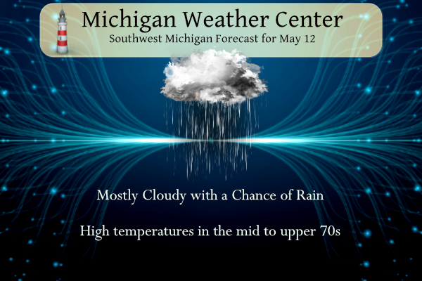
512lanKalamazoo Forecast
512kzoForecast Discussion
-- Chance of Showers Mainly In Southern Michigan Today --

Increasing mid-level clouds associated with the trough/vorticity
that originated over Texas a few days ago will result in a
cloudier day, though still warm and fairly dry, more so in central
Michigan and north of I-96. Virga or sprinkles from the mid-level
clouds will be possible, and any appreciable rain would form in
the afternoon/evening from isolated shallow convection underneath
the mid-level clouds, dependent on the degree of lower level
moisture advection which looks pretty weak. Areas near and south
of I-94 have the greatest potential for showers or an isolated
thunderstorm. Winds and vertical wind shear will be weak, though
the steep lapse rates / inverted V on the soundings beneath the
clouds to the surface late in the afternoon would support isolated
wind gusts over 20-30 mph with variable wind direction. In the
low probability case of robust convection, there has been the
signal in various models of bullseyes of 1+ inch of rain.

-- Mostly Dry Weekend Though Some Chance For Rain --

Though weak upper-level ridging and dry northeasterly low-level
flow will be present on Saturday, remnant mid-level moisture may
threaten to produce a few light rain showers on Saturday. This
is pretty low chance and low impact. Sunday`s rain potential is
lower-than-usual confidence for a Day 3 forecast, and depends a
lot on how much moisture is drawn in from the weakening Missouri
river valley low as it gets absorbed into the northern stream
shortwave diving in from the northwest. Solutions among the multi
model ensembles suggest Sunday is favored to be dry, though there
are a fair number of solutions with 0.10 to 0.20 inches of rain,
with outliers of 0.50 or more. The chance of rain is higher to the
southwest.

Early next week is favored to be dry with generally north flow,
though Mon-Tue won`t be all that cool relative to normal given
there will be a plume of warmer air flowing in from the northwest
originating from the western Canadian heat wave.
Just plenty of warmth and greatness on the way! Ignore the cold weather BS!!!
https://weather.com/weather/tenday/l/b523690bfd952b86fef3627c919dd9855281a8da16b83c10bdd381c64ae12cbc
Despite all of this warm weather hype the latest CPC shows below normal temps right into the last week of May! Incredible pattern!
Yep incredible WARM pattern!!
The highest I seen my weather station go yesterday was 83 at my place. It was a great day. As I’ve said 80-90 is my ideal range of temps.
Today will be our 8th warm day in a row! What another stretch of beautiful weather!
Let it warm, Let it Sun, Let it Spring!
Too funny and Mookie will get a kick out of this, check the blog archives and go to the comments for April 17. Terry DeBoer and Kirkwood both said cold temps all the way through May and no 80’s til sometime in June!! Ummmm…whoops!! LOL!!! Keep the warm temps ROCKIN and Chief Ellen needs to sit down and have a talk with those two, because their cold bias is making them look just silly!!
It’s crazy how wrong that prediction was! I just wish there was some accountability.
Just another warm, sunny, Spring day! Wow just wow, WOW! Let’s keep the warm weather rocking!
The warm spring just won’t stop. Now above average temps for May with more heat upcoming!
Today and tomorrow look pleasantly mild with highs mostly in the mid to upper 70’s It looks to cool down on Mothers day and most of next week look to be near average. There is a chance of showers today and Sunday more so to the south.
Slin
On a side note it looks like we are going to miss out on the 3 chilly saints this year. That is unless they come later in the month.
Slim
Next 10 days looks very normal for mid-May. We have 5 days with above average temps and 5 days with below average temps forecast. All in the 60s and 70s basically. This is one of the nicest times of the year
Yesterday was a spectacular day. The official H/L was 81/48 there was no rain fall and 87% of possible sunshine. There were no cooling or heating degree days so a great “don’t have to day” that is don’t have to have air or heat. For today the average H/L is now 69/47 the record high for today is 87 set last year and the record low of 27 was set in 1981 the most rain fall of 1.43” fell in 1912.
Slim