This week will certainly bring out a bout of spring fever with a need to get out and enjoy the great outdoors. I am sure this will lull us into a sense of false security thinking the cold temps have disappeared and winter has left us. As Slim said yesterday “beware of the Ides of March”.
We will have shots at 60° in some locations in southern Michigan through Thursday. Our next chance of rain comes Wednesday night into Thursday.
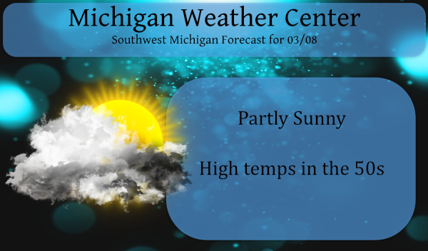
Forecast Discussion
-- Dry and warmer today and Tuesday --

Latest IR loop shows some mid cloud moving across Lake Michigan
in association with a short wave cross the Great Lakes. It`ll take
several hours for these clouds to move through, so we`re likely
looking at a partly sunny day. Southwest flow will increase today
and Tuesday bringing warmer air to much of the CWA. The exception
will be the lakeshore where flow off of the cold lake will hold
temperatures in the 40s. Elsewhere, the temperature will climb
into the lower to mid 50s north of I-96 and upper 50s to near 60
south of I-96 today.

-- Potential for fog/freezing fog tonight --

The southwest flow will bring an increase in low level moisture.
The upper ridge moving over the state tonight will result in light
winds. The combination of those two will likely result in and
increase in clouds and fog tonight. The ECMWF seems to have a
pretty good handle and is close to CONSShort and points toward
dewpoints remaining in the lower to mid 30s tonight and
temperatures fall close to the dewpoints. We`re likely to see fog
develop and perhaps freezing fog, especially north of I-96. If
this occurs, some roads could become slick Tuesday morning.

HREF indicates the clouds will decrease Tuesday afternoon and
that will help temperatures to climb into the lower 60s south of
I-96 and upper 50s north of there. Of course, the lake shore will
be colder.

-- Wet Wednesday night and Thursday --

Low pressure moving northeast along a cold front will push rain
through Wisconsin and the northwest CWA Wednesday. The rest of the
CWA will see rain Wednesday night and Thursday. The latest trend
of the models lingers the frontal boundary over southern Lower
Thursday which means we may see heavier rain along/south of I-94.
The GFS and ECMWF both show around a half inch of rain in that
area Thursday. High pressure will build into the CWA Thursday
night and Friday and we should dry out then.
U say u want to keep this blog about weather, but U let the bopsy twins go on and repeat themselves day after day,
Post after post, calling people warm weather nuts and trolling ur page like no other and do nothing!!!! I keep coming back here for the laughs, cause really it’s a joke!!!!
I may just crack open a sprite or two
I love skiing in March and more below normal temps on the horizon! bring it!
I’m seeing below normal temperatures now from the NWS March 16th through the 22nd March is such a transasion month crazzy INDY ….
Loving this so called “back loader” Winter with nothing but sun, temps 20 degrees above average, and no snow for the final month of the Winter season.
The skiing up in snow country this weekend was spectacular and near perfect! What a winter!
I’m glad you get out of you’re house and enjoy mother nature at its best more should do that ….I wore my winter toys out this Winter been a long time since that’s happen so close to home …INDY …
Absolute fantastic winter for outdoor sports! Incredible!
Wow 30’s with snow chances coming next week March is such a transasion month April is becoming one also like previous years ….INDY
What? You haven’t heard? The warm weather nuts have declared winter is over! Incredible!
At the current time it is 56 here at my house. With 60 looking like it is a good possibility I just checked and in the last 30 years the average date of the first 60 day at GR is March 7th so we are jus about average it that department. And while we are past the average last day of a 3” or more snow fall we are still well in the range of the latest date of April 14 (in the last 30 years) so now is the time to get out and enjoy the early spring weather… Read more »
I was just saying this yesterday.
So much sun the past couple of weeks. Vitamin D = good for the soul.
Ah.. for sure…
All the vitamin D is not so good for the snow… LOL!!!
According to the averages, roughly 95% of snow for the season will have fallen by now. With that said, GR still only has 45″ of snow on the season. We may not even get up to 50″ this year.
It feels like a Spring morning outside. With these warmer temps alot of my Spring flowers will be popping up.
Look at the forecast! It will be full-blown spring this week with still no snow in sight. Our last daily snowfall exceeding an inch was 3 weeks ago. I love it!