Well, here we are at the beginning of the end of 2020, the final week of a strange and fearful year. I have been around since the 1950s and this has been by far the worse year for the human race I have seen. This year has been a grim reminder that we only have so much control over our lives and it is only by faith and hope we get through each day. I don’t worry about tomorrow for today has enough concerns of its own. In other words, I deal with each day with the hope, strength and endurance the good Lord decides to give to me which is generally in abundance.
I have found that humor, patience and a positive attitude provide the tools needed to get through the day. There are unchangeable and immovable things in the world that are not worth worrying about as worry tends to fray the nerves and redirects our thoughts in negative patterns of destruction. Hope, faith and love go a long way to heal our hearts and minds and plow paths through the mess we have going on now. Things will get better, they generally do, we just have to weather the storm…
Well, I have broken my own rule of staying on weather topics, but hey this is my site and I can say anything I please 😈 I figured you could all use a few words of encouragement.
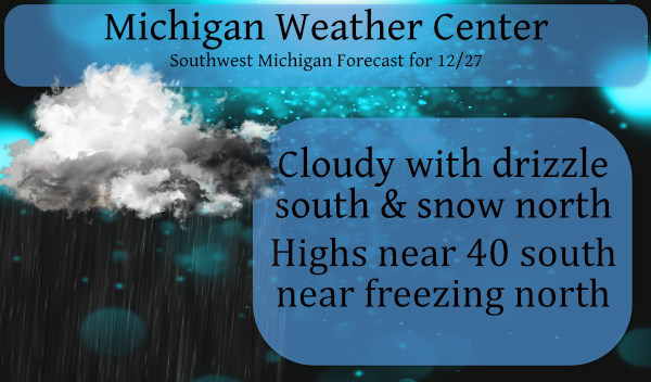
Weatherwise: An area of low pressure will move through the region Sunday evening bringing both rain and snow. Snow will be most prevalent up along U.S. 10 from Ludington to Clare. Rain will be the dominant precipitation type south of I-96. Accumulations of an inch or so of snow are possible across Central Lower Michigan. There is a small chance at some freezing drizzle or rain north of I-96, but we are not expecting significant impacts. Temperatures falling below freezing Sunday night may result in some slick spots for the Monday morning commute.
This week will be a continuation of our roller coaster ride of warm and cold temps along with rain and snow. Below is the NWS take on this weeks forecast:
- Stormy Period Later in the Week

At least one surface low tracks across Lower Michigan in the
Wednesday to Friday period, and possibly two. The first storm
passes north of the forecast area and we appear to be looking at
snow changing to rain at the onset of the precipitation late
Tuesday night into Wednesday morning. The rain should be ending
Wednesday afternoon or evening as drier air moves in from the
west.

Things get interesting on Thursday into Friday as there is
increasing model consensus on a second low moving north from the
Gulf Coast. This could bring a round of snow/rain or mixed
precipitation for at least the southern and eastern zones and
perhaps the entire forecast area, finally ending early on
Saturday.
MV I really like what you wrote today. I can relate to all of it. It all helps us to get thru this I always know that God won’t give me more then I can handle (even if I think I can’t). Thanks for the words of encouragement I am sure there are a few of us who could use them. 🙂
Wise words MV. We are better when we work together and not point fingers. I have heard when you point a finger 3 point back at you.
We have been out sledding…maybe today a dirty snowman build. Lol
👍
Thank you for those words of encouragement, Michael. I am in agreement that in these times we can all use as much encouragement and positivity as possible! I hate the slop forecast that we will be served this week, but I am grateful for the white Christmas that was not expected only a few short weeks ago : )
A quick update as to this season’s total snow fall so far at several locations around Michigan. Here at Grand Rapids 1.6” at Muskegon 5.5” Lansing 2.2” Detroit 12.2” Flint 4.3” Saginaw (Tri City airport) 2.5” in norther lower Michigan Alpena 20.3” Houghton Lake 18.2” Gaylord 29.1” West Branch 13.3” Petostey 19” in the UP Sault Ste Marie 24.6” and Marquette 48.3” (that Marquette total is some 18” below where they should be at this time) Except SE Michigan most areas are well below where we should be for this date.
Slim
Nah, nah, nah, we’re beating GR. 😁
Here is where we stand as we head into the last few days of December and the year. At Grand Rapids the mean for December is 33.0 and that is a departure of +3.2° There has been just 1.2” of snow fall in December and for the season just 1.6” that is just under 2 feet below average where GR should be for this date. Currently with a hazy sun thru clouds it is now up to 33 here at my house.
Slim